

Forecast for the Provo Area Mountains

Issued by Trent Meisenheimer on
Sunday morning, March 3, 2024
Sunday morning, March 3, 2024
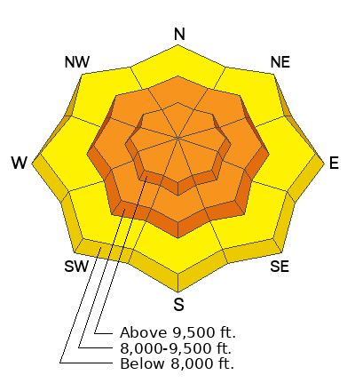
The avalanche danger is CONSIDERABLE across the mid and upper elevations for wind-drifted snow. Fresh hard or soft wind drifts (slabs) may be found on all aspects, including well down into drainage bottoms which are usually wind-protected. Avalanches could be 1-3 feet deep and large enough to bury a human. Conservative decision-making will be essential today.
Out of the wind-drifted snow, you will want to assess how the new snow is bonding to the old snow surface. Dry-loose or soft slab avalanches are possible within the new storm snow.
Low
Moderate
Considerable
High
Extreme
Learn how to read the forecast here
 Special Announcements
We are seeking a passionate individual to join us as Executive Director of the nonprofit Utah Avalanche Center.
 Weather and Snow
Yesterday's cold front was a powerful storm with strong pre-frontal southerly wind averaging 40-50 mph with gusts into the 80s and 90s. The cold front swept rapidly across the state, bringing booming thunder, strong wind, and a bust of heavy snowfall. From mountain peaks to the valley bottoms, we picked up roughly 5-10 inches of new snow across the board (0.53-0.78" swe).
This morning, under overcast skies, it’s snowing. Mountain temperatures are in the single digits °F. The wind is blowing from the southwest at speeds of 15-25 mph gusting into the 30s and 40s across the mid and upper elevations. The free air (11,000') moves faster from the southwest, blowing 30-50 mph and gusting into the 70s.
Today, we will see an additional 2-5 inches of snowfall. The best chance for the snow will be in the morning hours before it tapers off for the afternoon. Unfortunately, west and southwest wind will stay elevated, blowing 20-30 mph and gusting into the 40s across the mid and upper elevations throughout the day.
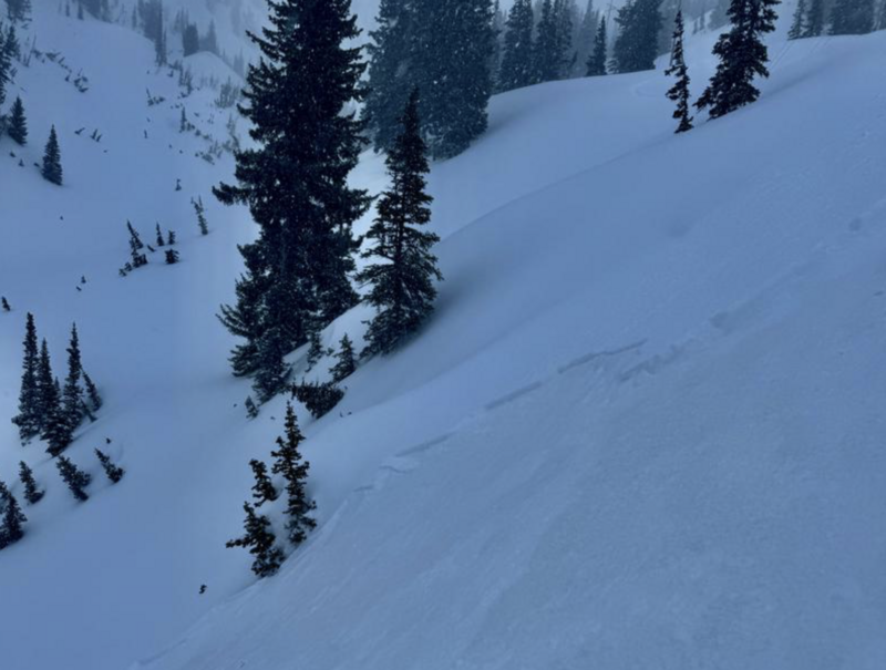
 Recent Avalanches
As yesterday's cold front came through, we saw snowfall rates easily reach 2-4 inches per hour snowfall. During this time, I imagine we saw a widespread natural avalanche cycle within the wind-drifted snow and the new snow. Dave Kelly was out late yesterday after the storm and has an observation HERE.
Photo: Dave Kelly, showing a small soft slab avalanche.

Avalanche Problem #1
Wind Drifted Snow
Type
Location
Likelihood
Size
Description
Strong southwest and northwest winds have been relentless for the past 24 to 48 hours. These strong winds have and will continue to change the landscape. Some slopes will become scoured, while others will have soft or hard slabs of wind-drifted snow.
Be on the lookout for wind-drifted snow across all aspects and elevations. This includes mid-slope-break-overs, cross-loaded gullies, drainage bottoms, and any other terrain feature on which the wind has drifted the snow. Wind-drifted snow (slab) avalanches could be 1-3 feet deep and large enough to bury a human.
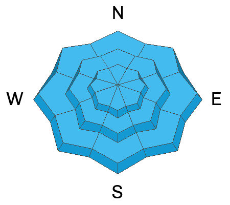
Avalanche Problem #2
New Snow
Type
Location

Likelihood
Size
Description
Out of the wind, you will want to assess how the new snow is bonding to the old snow surface. The good news is that we have a very easy marker in the snow in the form of a dust layer. Dig down 1-2 feet deep and see how the new snow is bonding. Shovel tilt tests, small test slopes, and quick hasty pits should give you an idea. Slope cuts will be effective today (as long as it's not a wind slab).
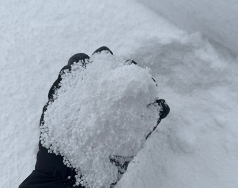
Yesterday's snowfall laid down a lot of graupel (round pelleted snow) that can easily sluff on steep terrain or become a weak layer within the new snow.
Photo: Pavlantos, showing graupel snow.
General Announcements
This information does not apply to developed ski areas or highways where avalanche control is normally done. This forecast is from the U.S.D.A. Forest Service, which is solely responsible for its content. This forecast describes general avalanche conditions and local variations always occur.