Donate to Our Spring Campaign or Bid on our Spring Auction to Support Forecasting

Forecast for the Provo Area Mountains

Dave Kelly
Issued by Dave Kelly on
Saturday morning, March 22, 2025
There is a MODERATE avalanche danger today, where it will be possible for humans to trigger new or wind-drifted snow avalanches failing in the most recent storm snow. This will be more likely during periods of increased snowfall.
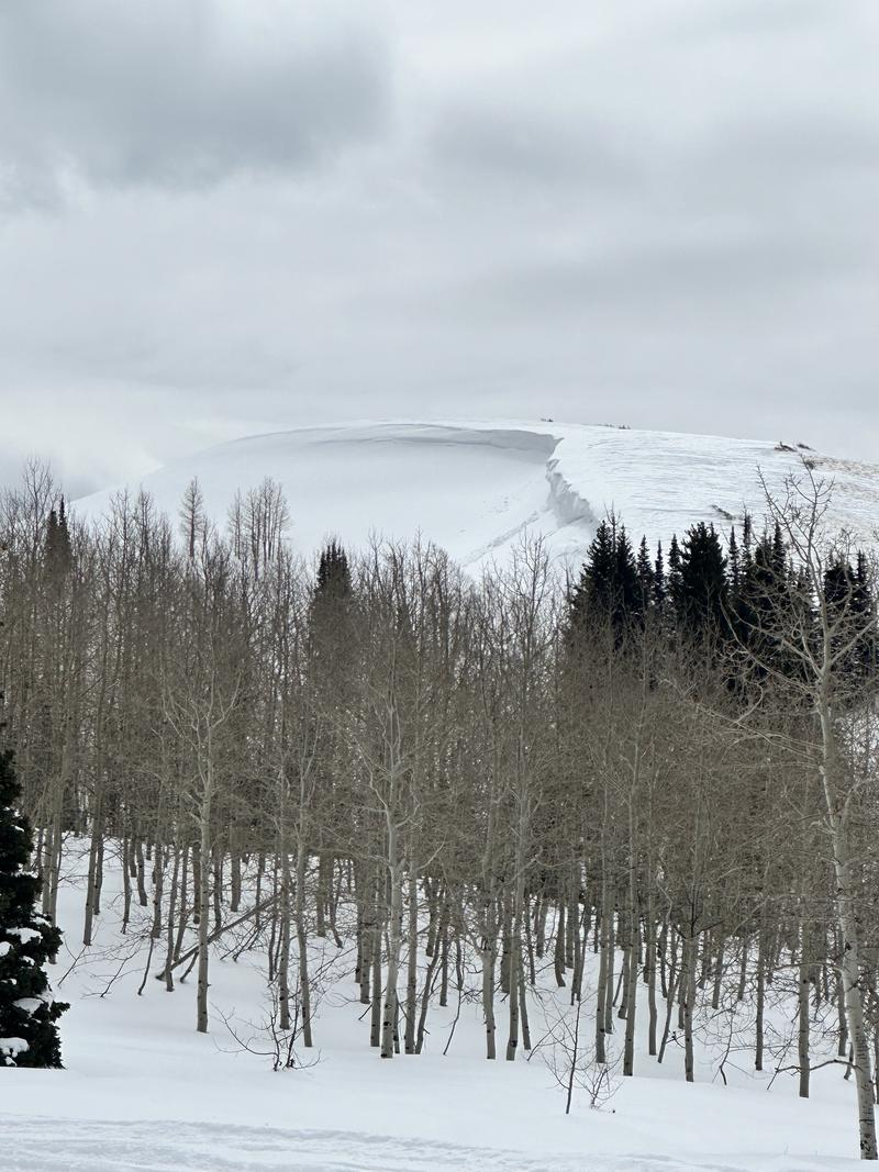
With any hint of March sun expect to see wet avalanches on solar aspects. These could be long running and may start as dry, turning to wet avalanches as they make their way downslope.
Low
Moderate
Considerable
High
Extreme
Learn how to read the forecast here
Special Announcements
Our Spring Campaign is in full swing, and there are two great ways to support forecasting, awareness, and education across Utah: Donate to our Spring Campaign, or Bid on items in our Spring Auction. Every dollar donated helps keep the backcountry community on top.
Weather and Snow
Currently, under overcast skies it is snowing lightly. We had 1"-2" of snow overnight. Temperatures are in the high 20's to low 30's °F. Winds are blowing from the south in the 20's gusting to the 30's MPH at the 8,000' ridgelines.
Today, look for overcast skies with decreasing clouds this afternoon. 2"-4" of snow is forecasted with .2"-.4" of water. There could be more snow at higher elevations in the northern Provo Region, which could see snowfall rates of up to 1" an hour. The storm should exit the area later this afternoon. Temperatures will be in the high 30's to low 40's °F and we may see rain on snow below 8,500' in elevation. Winds are forecast to blow from the southwest 15 gusting to 20 MPH at the 9,000' ridgelines and from the west-northwest 30 gusting to 40 MPH at the 11,000' ridgelines.
Recent Avalanches
Yesterday, we had no reports of avalanches from the Provo Region. Drew and Nikki both went out on field days in the Provo Mountains and found variable snow depths with some thinner areas that had depths just over 3'. These shallow snowpack areas still have weak faceted snow. While today may not be an issue, with more snow over the weekend, and warming next week these weak layers are something to keep an eye on.

Photo (Torrey) showing a thin snowpack with distinctive dirt layers

Check out all recent observations and avalanches HERE.
Ad
Avalanche Problem #1
New Snow
Type
Location
Likelihood
Size
Description
The snow that fell last night is slightly rimed and may not bond well to the old snow surface. Any avalanches may run fast and far on southerly aspects where the new snow fell on a slick surface. Expect to see snow pooling below cliff bands and in the bottom of gully features this morning. It will be possible for humans to trigger dry loose avalanches in steep terrain today. These will be 3"-6" deep and in areas where they have room to run could be powerful enough to push a human off their feet.

Any sun on new snow, even for an instant, will increase the likelihood of seeing wet snow avalanches. This is more likely to occur on the southerly and westerly facing slopes this afternoon. Rain on snow below 8,500' will also create wet loose avalanches in steep terrain. Any avalanches starting as dry snow in the Provo area mountains have the chance to turn to wet snow avalanches very quickly and could overrun the snow/dirt line.
Avalanche Problem #2
Wind Drifted Snow
Type
Location
Likelihood
Size
Description
The one consistent with this weather forecast is that the wind will blow. Expect to see drifts of wind-blown snow on the downwind side of ridgelines and terrain features. The wind-drifted snow will create soft and sensitives cornices on the ridgelines and these cornices may break further back than you expect and trigger soft slab avalanches below them.
Look for and avoid pillowy, wind loaded features and if you see cracking or collapsing than move to lower angle terrain.
Photo (Champion and Talty) of cornice buildup in Snake Creek
Additional Information
What happened to the persistent weak layer (PWL)? We encourage you to take the time to read this blog post discussing the PWL and how it may return.
General Announcements
This information does not apply to developed ski areas or highways where avalanche control is normally done. This forecast is from the U.S.D.A. Forest Service, which is solely responsible for its content. This forecast describes general avalanche conditions and local variations always occur.