Observation Date
3/21/2025
Observer Name
Champion & Talty
Region
Provo » Snake Creek » Ant Knolls
Location Name or Route
Snake Creek - Ant Knolls
Comments
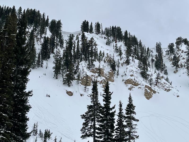
Traveled around the Ant Knolls area to get a better sense of how much new snow fell, overall snow depth, wind patterns, and the state of the repeater slopes. We took multiple Smart Probe readings across different aspects.
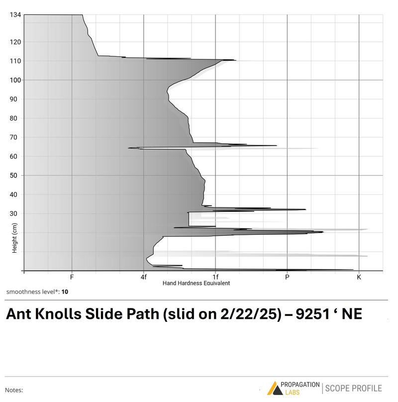
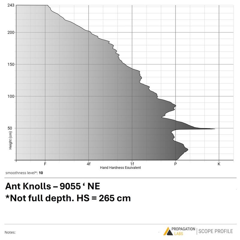
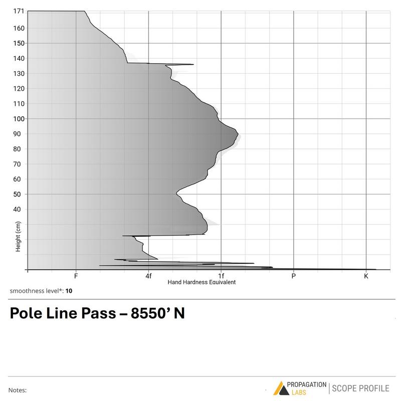
Overall, the snowpack structure looked similar to the central Wasatch. This area received less snowfall during the last storm, but snow depth is generally between 2–3 meters in most places that haven’t previously avalanched, melted out, or been stripped by the wind.
The primary concern remains the repeater slopes, like Ant Hill, which still hold a generally shallow and weak snowpack with facets near the base. While we saw poor snowpack structure, there was no sign of another recent slide. Given all the snow since March—and with plenty of tracks in there—those were solid testers on the weak snowpack. But it’s still a good reminder that weak layers persist, especially outside the core. These are the zones I’d be most concerned about waking up with additional load, warm temperatures, or heavy rainfall, as it wouldn’t take much for the shallow snowpack to become fully saturated and fail on the faceted grains.
Outside the repeater slopes, the main concerns are large cornices breaking off and some isolated wind slabs. The wind has already done most of its work, and we didn’t see much evidence of activity within the wind-drifted snow. That said, given the clear signs of transport, it’s likely that one could still find a wind slab on upper elevation, colder aspects.
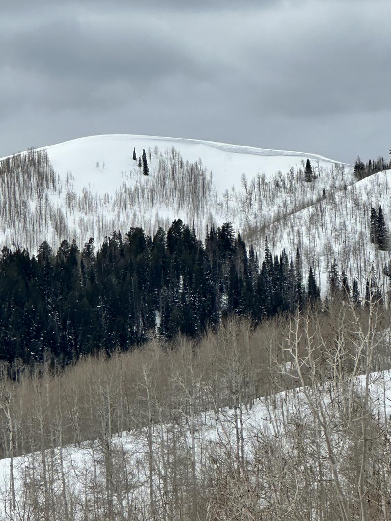
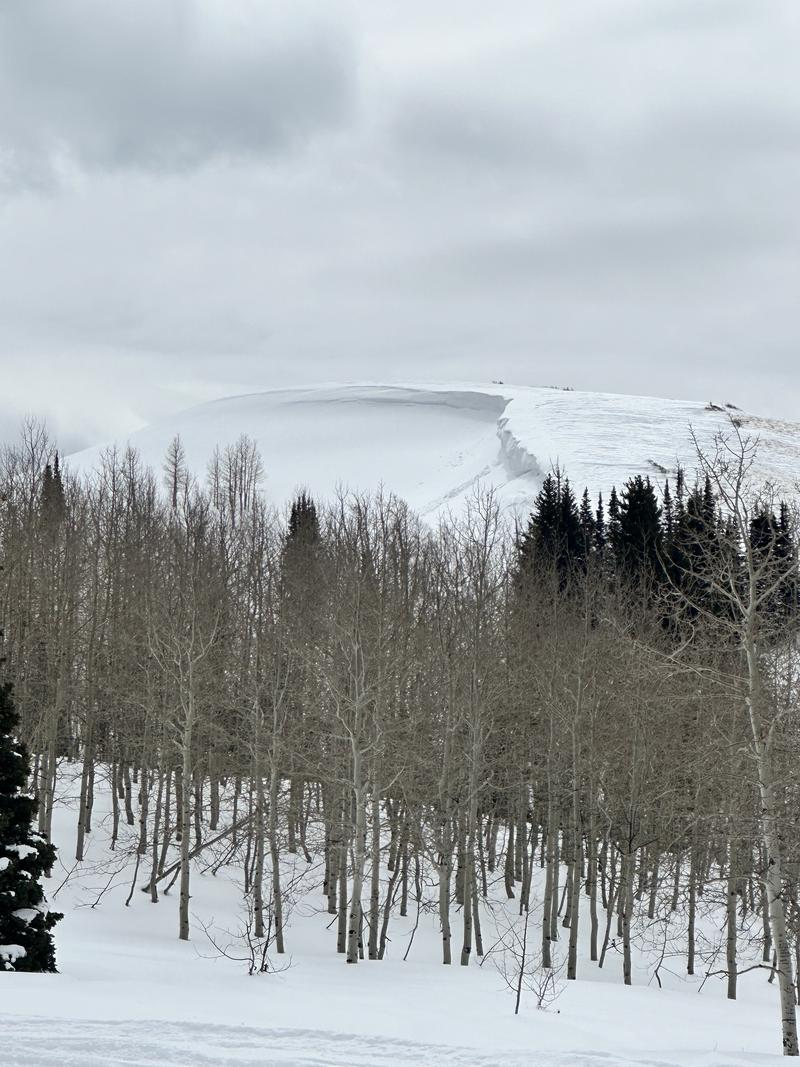
A few examples of the large cornices around Snake Creek
Today's Observed Danger Rating
Moderate
Tomorrows Estimated Danger Rating
None
Coordinates


