Donate to Our Spring Campaign or Bid on our Spring Auction to Support Forecasting

Forecast for the Provo Area Mountains

Greg Gagne
Issued by Greg Gagne on
Friday morning, March 21, 2025
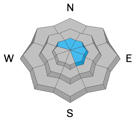
The avalanche danger is MODERATE on wind-loaded, upper elevation slopes facing northwest through east/southeast where it is possible to trigger a slab of wind-drifted snow 6-24" deep. All non wind-loaded slopes have a LOW danger.

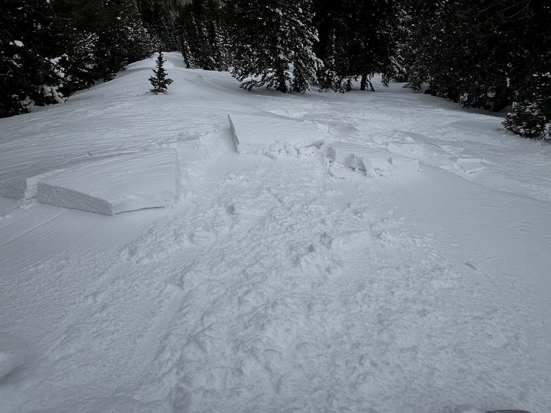
Winds, cool temperatures, and cloud cover should keep wet snow activity to a minimum, but pay attention for possible wet avalanches if the strong sun affects slopes you are on or below.
Low
Moderate
Considerable
High
Extreme
Learn how to read the forecast here
Special Announcements
Our Spring Campaign is in full swing, and there are two great ways to support forecasting, awareness, and education across Utah: Donate to our Spring Campaign, or Bid on items in our Spring Auction. Every dollar donated helps keep the backcountry community on top.
Weather and Snow
This Morning: Temperatures are in the 20's F and winds are from the west/northwest, averaging in the teens with gusts in the 20's mph at upper elevations. 11,000' winds are averaging in the 30's mph with gusts overnight near 50 mph.
Today: Partly sunny skies this morning will cloud over this afternoon with temperatures rising into the 30's F. Winds will back to the west/southwest and slowly decrease, gusting into the 20's mph - with stronger gusts at 11,000'.
Soft snow is still in abundance on wind-sheltered, northerly aspects at the mid and upper elevations with excellent riding and travel conditions.

Snowfall will begin overnight and into Saturday, with 4-6" of new snow expected.
Recent Avalanches
No recent avalanches have been reported from the Provo area mountains.
Ad
Avalanche Problem #1
Wind Drifted Snow
Type
Location
Likelihood
Size
Description
Moderate to strong winds blowing from westerly directions over the past 24 hours have created pockets of wind-drifted snow at the upper elevations, with drifts up to two feet thick. Cornices may also be sensitive.
I was able to intentionally crack out one of these wind drifts yesterday (photo below) and although they may be more stubborn today, these dense drifts may allow you to get well onto a slope before fracturing.
Additional Information
What happened to the Persistent Weak Layer (PWL) problem? We have listed PWL as an avalanche problem since late November, and have dropped the problem from our forecasts and now consider it dormant ("dormancy" refers to the layer being present but not being active). We encourage you to take the time to read through this blog posting where we describe our thought process for removing this problem, and how it may possibly return.
General Announcements
This information does not apply to developed ski areas or highways where avalanche control is normally done. This forecast is from the U.S.D.A. Forest Service, which is solely responsible for its content. This forecast describes general avalanche conditions and local variations always occur.