Forecast for the Provo Area Mountains

Drew Hardesty
Issued by Drew Hardesty on
Thursday morning, February 6, 2025
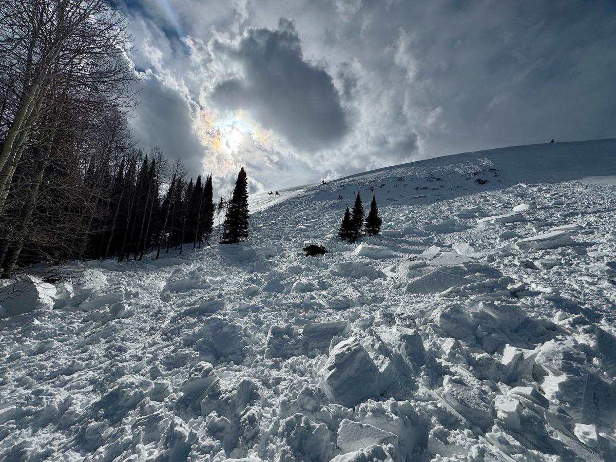
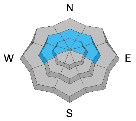
A MODERATE avalanche danger exists for lingering wind slabs at the mid and upper elevations and for possible gouging wet avalanches at the mid and low elevations. Cornices remain tender and are to be avoided.
Low
Moderate
Considerable
High
Extreme
Learn how to read the forecast here
Special Announcements
The Preliminary Report for Monday's Monte Cristo avalanche fatality is HERE.
Our condolences go out to the victim's friends and family and all those affected by this tragic accident. UAC staff visited the site on Tuesday and a full report is forthcoming.
Weather and Snow
Yesterday afternoon's frontal passage offered gusty winds and just a touch of rain or flurries, depending on elevation.
But now the term whiplash comes to mind: we have a storm on tap for tomorrow and - in-lockstep - temperatures have rebounded back into the upper-20s to mid-30s and winds are again moderate to strong from the southwest. Skies have scattered clouds but I bet we'll see a few flurries by the afternoon. Tomorrow's storm will probably have an initial rain/snow line of up to 7500' (possibly as high as 8000') and it looks as if most of the precipitation will arrive warm and dense ahead of a suppertime cold front. 3-6" is a fair bet; maybe more. Winds are to remain moderate to strong from the west-southwest for most the day. By evening, we'll see some light snow in the valley and mountain temps plummet to the low single digits by late weekend. The long term looks somewhat active.
Recent Avalanches
None reported. On Tuesday, the ski area reported triggering wet loose avalanches which would in turn gouge out wet slab avalanches 1-2.5 feet deep, running on wet basal faceted grains. I could picture more of this today.
Ad
Avalanche Problem #1
Wind Drifted Snow
Type
Location
Likelihood
Size
Description
The winds remain merciless. Hard and soft slabs of wind drifted snow litter the steep terrain, although they are more stubborn and sluggish than late weekend into Monday. I would chalk them up as stable, but many of these wind slabs, however, do rest upon a layer of weak snow (last week's snow surface) and remain prone to triggering.

Cornices are becoming unruly along the ridgelines - remember to give these growing monsters a wide berth.
Avalanche Problem #2
Persistent Weak Layer
Type
Location
Likelihood
Size
Description
There are two buried persistent weak layers (PWL) in the snowpack:
  • The upper layer formed during last week’s cold, clear weather and many wind slabs are failing at this layer.
  • The lower layer, near the ground, formed in December and has caused large avalanches, including two fatalities during the Holiday Avalanche Cycle. This layer is most likely to be triggered on steep, thin snowpack areas, rocky gullies, and repeater slopes (areas that have previously avalanched). Avalanches up to 1–3+ feet deep possible.
Avalanche Problem #3
Wet Snow
Type
Location
Likelihood
Size
Description
I do think that last night's window of clearing skies and drop in temps will have reduced the likelihood of triggering wet avalanches, but the isothermal wet snow at the mid and low elevations has not had time to completely lock up. I could picture any avalanche from above still gouging down into unconsolidated grains. By tomorrow into the weekend, however, things should be locked up tight as a drum and it'll be nice to take wet avalanches off the menu in early February.
General Announcements
This information does not apply to developed ski areas or highways where avalanche control is normally done. This forecast is from the U.S.D.A. Forest Service, which is solely responsible for its content. This forecast describes general avalanche conditions and local variations always occur.