UDOT PLANNED AVALANCHE CLOSURES!!

Forecast for the Provo Area Mountains

Trent Meisenheimer
Issued by Trent Meisenheimer for
Saturday, February 4, 2023
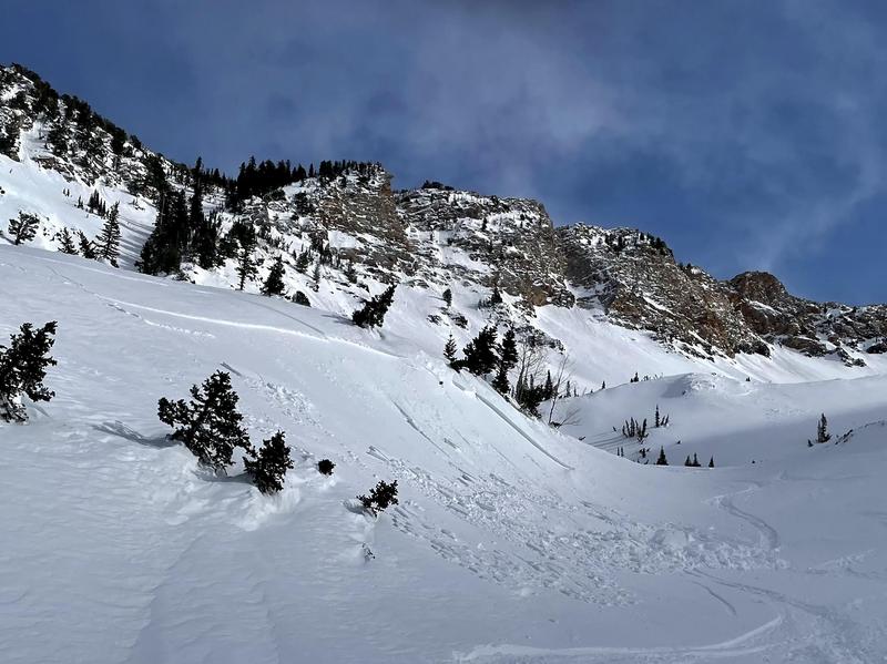
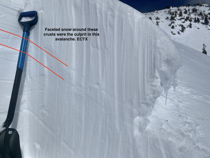
Today there is MODERATE avalanche danger on all upper elevation slopes and on slopes facing west through north through east at the mid elevations for triggering either a soft or hard slab of wind-drifted snow. Southerly winds have created sensitive slabs of wind-blown snow that are likely to be 6-12 inches deep and up to 100 feet wide.

Lose the wind and lose the problem. On slopes where you find soft powder snow unaffected by the wind, you will find better riding conditions and LOW avalanche danger.
Low
Moderate
Considerable
High
Extreme
Learn how to read the forecast here
Weather and Snow
Under clear skies, the current mountain temperatures range from 18-26 °F. Winds are from the westerly direction blowing 5-15 mph and gusting into the low 20s across much of the upper-elevation terrain. Above 10,000', winds are blowing west-northwest at 25-30 mph.
Mountain temperatures will climb into the upper 30s and low 40s °F at 8000'. Winds will be west and southwest and blow at speeds of 10-20 mph throughout the day. Sunny skies will eventually give way to high clouds as another storm approaches northern Utah. This storm will arrive Sunday mid-morning and last into Monday with perhaps 6-12 inches of new snow.
Recent Avalanches
One avalanche was reported from Aspen Grove yesterday. It was a wet loose avalanche and you can find the observation HERE. Yesterday in the Wasatch range backcountry riders reported sensitive hard and soft wind slabs. Most of these avalanches were 4-7 inches deep and up to 100 feet wide.
See the full list of avalanche activity where you can filter avalanches by region and date.
Ad
Avalanche Problem #1
Wind Drifted Snow
Type
Location
Likelihood
Size
Description
Yesterday's west and southwest winds peaked at 5:00 pm with speeds of 20-30 mph, gusting 40 across the upper elevation ridges. I saw massive plumes coming off the American Fork Twins and the east face of Hogum Hogback (LCC) in a complete whiteout with lots of blowing snow that cross-loaded many terrain features. Yesterday's reports of both hard and soft wind slabs triggered by backcountry riders tell us that avalanches are still possible today.
Avalanche Problem #2
Persistent Weak Layer
Type
Location
Likelihood
Size
Description
A thin layer of faceted snow sits above an ice crust and is buried 1-2' deep on slopes facing west to south to the southeast (see photo below). The most recent avalanche failing on this layer is from Reynolds Peak, reported yesterday. It was likely triggered on the 2nd.
Yesterday, I looked at the avalanche triggered on the 29th (photo below) and found this layering unreactive in stability tests. We are likely to drop this problem in the next few days as it becomes more and more unlikely to trigger an avalanche on this layer.
For those interested in the snow metamorphism, watch Mark Staples describing the process that created this PWL on a sunny aspect. During his outing yesterday, Drew Hardesty also found this metamorphism on the snow surface.
General Announcements
This information does not apply to developed ski areas or highways where avalanche control is normally done. This forecast is from the U.S.D.A. Forest Service, which is solely responsible for its content. This forecast describes general avalanche conditions and local variations always occur.