Forecast for the Provo Area Mountains

Dave Kelly
Issued by Dave Kelly for
Monday, February 27, 2023
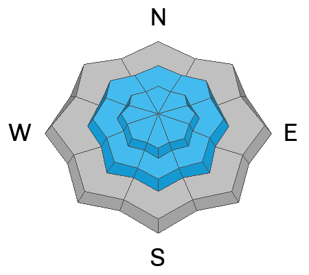
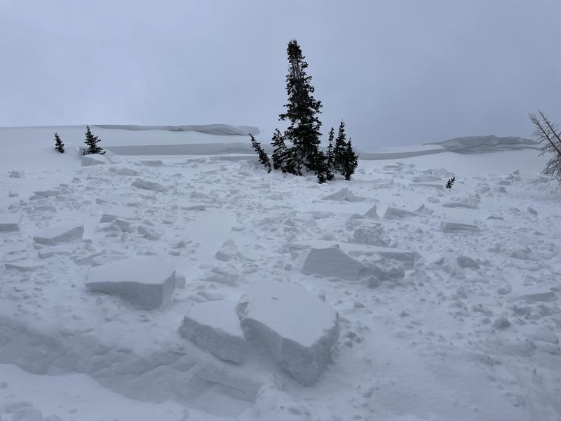
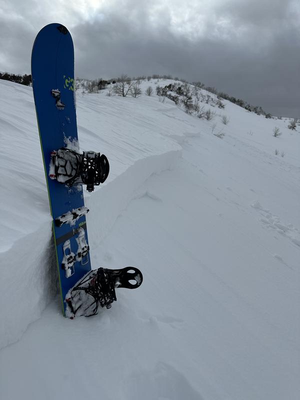
The avalanche danger is CONSIDERABLE on mid and upper-elevation slopes for wind-drifted snow avalanches. Humans are likely to trigger an avalanche that could be 1-3' deep and up to 150' wide. The avalanche danger is MODERATE on lower elevation slopes where human triggered avalanches are possible on density changes within the new snow or on last week's old/new snow interface now buried 2-3' deep.
The potential depth of these avalanches is not something I would mess around with. Today, I would be enjoying the start of a long run of snow storms and traveling and riding on slopes under 30 degrees out of the wind zone.
Low
Moderate
Considerable
High
Extreme
Learn how to read the forecast here
Weather and Snow
Currently it is snowing in the mountains. Temperatures are in the low 20's °F. Winds are blowing from the southwest 25 gusting to the 40's MPH. The Provo area weather stations are reporting 6-13" of snow and .60-1.10" of water

Today, temperatures will be 28-32 ˚F. Under overcast skies we can expect 6-10" of new snow, and southwest winds increasing this afternoon 30 gusting to 40 MPH at the 9,000' ridgelines and 40 gusting to 65 MPH at the 11,000' ridgelines.

A series of storms has arrived in Northern Utah. The National Weather Service has issued a Winter Storm Warning effective until 5:00 pm on Wednesday. These storms will bring 30-40" of new snow and up to 3" of water to the mountains.
Recent Avalanches
Yesterday we had reports of wind-drifted snow avalanches. Check out the updated observation and avalanche page.
Ad
Avalanche Problem #1
New Snow
Type
Location
Likelihood
Size
Description
I would expect to see dry loose avalanches on a density change within the new snow. Shovel tilt tests are a great tool for finding weaknesses within the storm snow.

There are tricky avalanche conditions out there right now. The old/new snow interface from February 21 is still producing propagation with extended column tests and I will be digging down at least 3' to the old/new snow interface from last week's storm to see how this layer is reacting before traveling on terrain over 30 degrees. A snow pit from when Mark and I went to the South Fork of the Provo River on Saturday shows the weak layer 28" from the surface.

It is a good time to back off and seek soft turns on slopes less than 30 degrees until these interfaces show us they are no longer capable of avalanching.
Avalanche Problem #2
Wind Drifted Snow
Type
Location
Likelihood
Size
Description
We continue to get reports of wind-drifted snow avalanches, and the cornices on ridgelines are enough to rival the sort that you would expect to find in the Pacific Northwest. This observation from Mount Raymond yesterday highlights the sensitivity of these areas of wind-drifted snow and is similar to something you might find near ridgetops in the Provo Area Mountains. This particular avalanche was 3' deep and 70' wide running on a 32-degree slope.
Avoid the wind and avoid the problem.
Photo (Brackelsberg / T. Diegel)
Additional Information
We had a great avalanche observation from the Lake Mountains which are low elevation terrain outside the Provo Forecast area. With more than enough snow to travel on in low elevation terrain it is a reminder that any slope that is over 30 degrees has the potential to avalanche.
Photo ( B. Coburn)
General Announcements
This information does not apply to developed ski areas or highways where avalanche control is normally done. This forecast is from the U.S.D.A. Forest Service, which is solely responsible for its content. This forecast describes general avalanche conditions and local variations always occur.