UDOT PLANNED AVALANCHE CLOSURES!!

Forecast for the Provo Area Mountains

Drew Hardesty
Issued by Drew Hardesty on
Friday morning, December 28, 2018
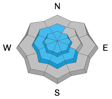
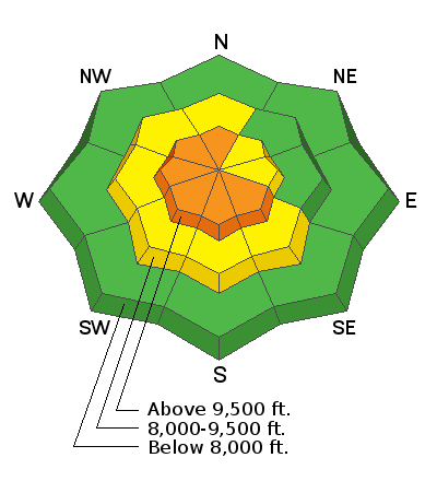
Areas of CONSIDERABLE danger exist for steep wind drifted slopes. Human triggered avalanches are likely. These drifts will be more pronounced on steep north to west to south facing slopes in the upper elevations. An isolated chance exists for avalanches stepping down into the old weak snow at or near the ground in shallow, rocky terrain (generally northwest to east facing slopes).

Safe travel protocol is key today: Travel one at a time in steep terrain, keep your partner in sight and be in position to get to them quickly should there be an avalanche.
Low
Moderate
Considerable
High
Extreme
Learn how to read the forecast here
Special Announcements
The new UAC IOS mobile app is now available on the app store. Check out the new "My Weather" feature.
Weather and Snow
And not unlike staying late at the end of a show or after last call at your favorite watering hole, the bouncer or security guard will say, "You don't have to go home, but you can't stay here." And so it is with the northeast winds, ushering us now out of the high alpine areas to take refuge in the shelter of the glades and mid-elevations.

Skies are mostly cloudy with a few flakes floating hither and yon this morning. Temperatures have fallen to just this side of zero with most stations in the low single digits.
But it is the winds I don't like. Over the last few hours, they've continued to veer to the northeast and east-northeast, blowing 20-25mph with gusts to 35. The highest, most exposed anemometers are gusting into the 40s and 50s. Current wind chill to minus 30F in many areas is brutal. Consider this if things don't go well in your backcountry outing today (extra puffy anyone?).
Still, out of the wind, skiing and riding conditions are really quite good these days with snow depths now at 35-45" of snow on the ground.

You'll see that the low pressure system has become a closed Low around the 4-corners area, with resulting cyclonic (counter clockwise) winds blowing east-northeast over the Uintas and Wasatch Ranges. For today, we should see clearing skies with slowly diminishing winds by the afternoon. Mountain temps will be in the single digits, though potentially the coldest temps of the winter are due to arrive New Year's Eve.
Recent Avalanches
Greg's excellent Week in Review can be found here.

The only activity of note yesterday was high on Box Elder Peak with a skier triggered shallow hard slab a couple feet below the ridgeline on the southwest face at 11,000'. It was described as a "D1" on the destructive scale, "relatively harmless to people". This makes two wind slab avalanches in two days in the high country at or above 10,500' on wind drifted southerly aspects (SE & SW). There'll be more today.
Ad
Avalanche Problem #1
Wind Drifted Snow
Type
Location
Likelihood
Size
Description
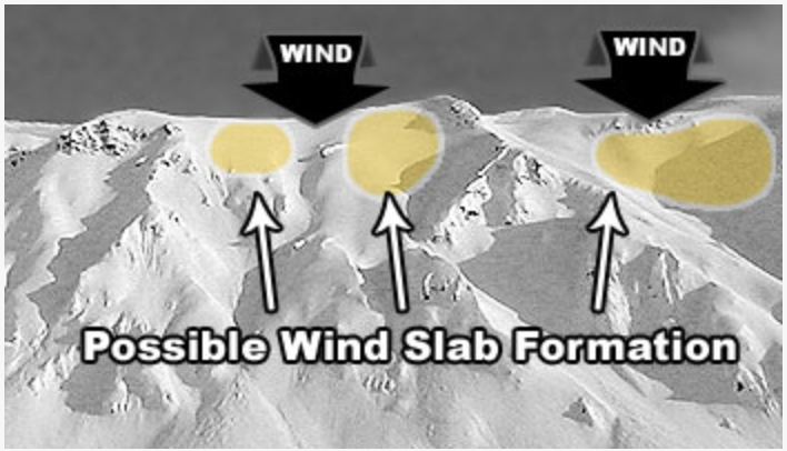
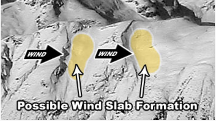
It should be a game changer. Watch for new and developing wind drifts in unusual locations today. The dastardly east to northeast winds have plenty of low density snow to blow around and these drifts will be very sensitive to human weight but again found in unusual locations. These soft drifts will be more prominent - but not limited to - the upper elevation north to west to southerly facing slopes. They'll also be cross-loaded beyond sub-ridges and around other terrain features and reactive to ski cuts and cornice drops.

Wind drifts can look rounded and smooth and certainly feel more thick or punchy when you move through them. Shooting cracks or audible collapsing of a drift on lower density snow below are red flags to turn around.
Avalanche Problem #2
Persistent Weak Layer
Type
Location
Likelihood
Size
Description
In isolated areas (thinner snowpack areas or terrain that has previously avalanched this season), human triggered avalanches 1-3' deep may again run on weak sugary faceted snow. These areas are generally on northwest to east facing terrain above about 9000'.
Additional Information
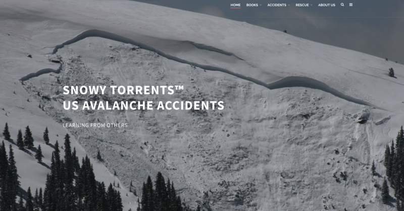
An avalanche-related close call occurred a couple days ago while two climbers were ascending an ice route in Little Cottonwood Canyon. Thanks to their write-up, their harrowing experience can be found here. Roughly twenty years ago, a well known climber was killed in an avalanche on The Fang in Provo Canyon. The write-up can be found in the Snowy Torrents here. The authors in the accident report point out that on ice routes most of the time, "There is literally nowhere to hide when avalanches run". The home page for the Snow Torrents here.
General Announcements
This information does not apply to developed ski areas or highways where avalanche control is normally done. This forecast is from the U.S.D.A. Forest Service, which is solely responsible for its content. This forecast describes general avalanche conditions and local variations always occur.