UDOT PLANNED AVALANCHE CLOSURES!!

Forecast for the Provo Area Mountains

Evelyn Lees
Issued by Evelyn Lees on
Wednesday morning, December 26, 2018
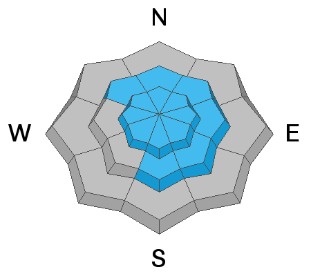
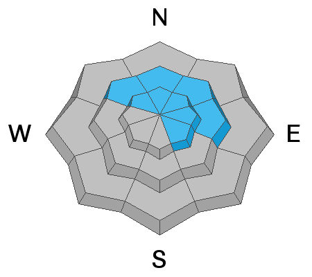
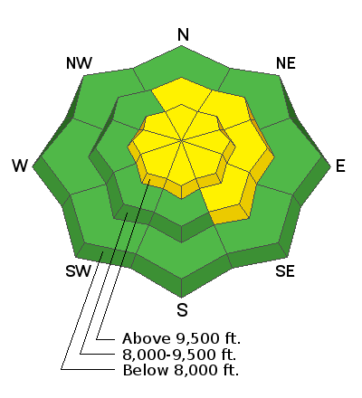
The avalanche danger is MODERATE on most steep mid and upper elevation slopes, where sensitive drifts of wind blown snow can be triggered on steep slopes.
There is also a MODERATE danger for triggering a deeper slide failing on facets near the ground. These deeper slides are becoming easier to trigger, and the most likely slopes would be a mid or upper elevation slope facing northwest through north through easterly, where there are weak, sugary snow layers.
Travel one at a time in steep terrain, keep your partner in sight and be in position to get to them quickly should there be an avalanche.
Low
Moderate
Considerable
High
Extreme
Learn how to read the forecast here
Special Announcements
The new UAC IOS mobile app is now available on the app store. Check out the new "My Weather" feature.
Weather and Snow
An additional 2 to 3” of snow fell overnight, capping off a great week of small storms. Seven day snow totals are now about a foot in the Provo area mountains. It's imporved the turning and riding conditions on all aspects, though total snow depth are still shallow - 2 to 3 feet at the mid elevations.
Snowfall is about over and skies will become partly cloudy by afternoon. Temperatures are currently in the teens and twenties, and will warm into the low to mid 20s by afternoon. Winds have shifted to a northerly direction, averaging 15 to 20 mph along the higher ridge lines, gusting to 30 mph. Speeds average 5 to 10 mph at the mid elevations.
Recent Avalanches
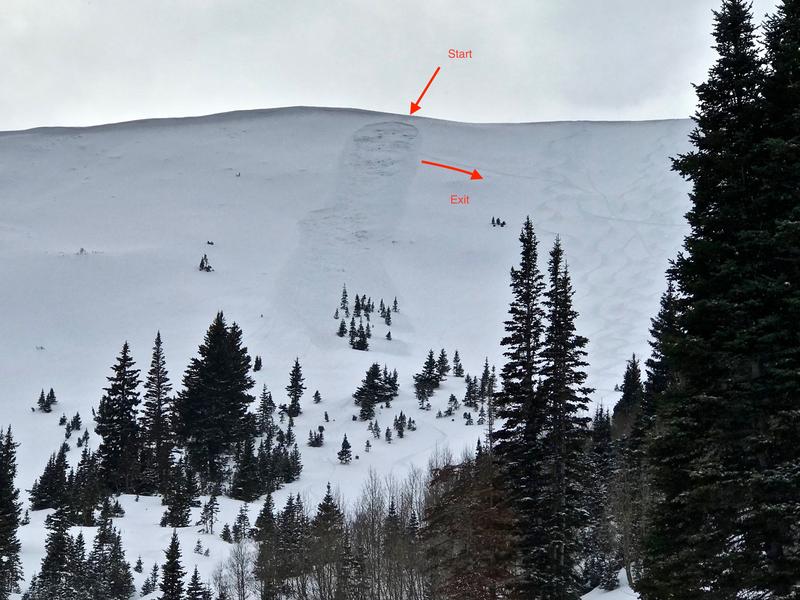
No new avalanche reported from the Provo area mountains. However, the Provo snowpack is similar to the central Wasatch, or even weaker. So yesterday's avalanche activity is important. On South Monitor, a skier triggered slide failed on facets near the ground yesterday. It broke a couple turns above the skier, but they were able to get out to the side avoiding a long ride. It was about 15 inches deep by 60 feet wide, on an easterly facing slope, at about 9990'. Photos below, and a great observation here.
In addition, a few natural new snow sluffs ran early this morning on the steep south facing slide paths in Little Cottonwood during the heaviest snowfall. Yesterday, small new snow sluffs, shallow wind drifts and sensitive cornices were triggered by people.
Ad
Avalanche Problem #1
Wind Drifted Snow
Type
Location
Likelihood
Size
Description
Steady ridgeline winds are forecast for the day, which will blow the low density snow into sensitive drifts or wind slabs. With faster wind speeds, these drifts will be more widespread than yesterday. Mountain terrain channels the wind in odd ways, so look for these soft to medium, rounded wind slabs or drifts on a variety of aspects and elevations. They will be on the lee sides of ridge crests and around terrain features, like gully walls, sub ridges and down into open bowls at both the mid and upper elevations. Lingering drifts from yesterday’s strange southeasterly winds hidden beneath the snow.
Out of the wind affected terrain, new snow sluffs and a few cracky soft slabs can be triggered on steep slopes of all aspects. Consequences are important - even a small sluff can be serious if it takes you into trees, off a cliff or for a long ride.
Avalanche Problem #2
Persistent Weak Layer
Type
Location
Likelihood
Size
Description
The small storms are sneaking up on us - in the last week, mid elevations in the Provo area mountains have had up to a foot of snow. In the central Wasatch mountains, there have been 2 skier triggered slides in the last 4 days breaking near ground on the weak, sugary faceted snow. Both were on slopes with old faceted October snow near the ground and that had a shallow snowpack because they avalanched already this winter (know as “repeaters”.
The old faceted, sugary October snow layer is most widespread on upper elevations northwest, north, northeast and easterly facing terrain. Here is an excellent observation from the Provo area mountains.
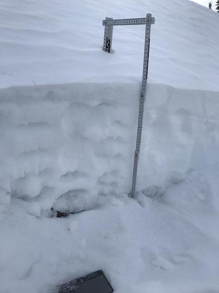
Here is what the shallow, Provo area snowpack looked like on Dec 23rd, mostly weak and sugary, with a thin wind slab on top. There is now another 7" of new snow on top.
General Announcements
This information does not apply to developed ski areas or highways where avalanche control is normally done. This forecast is from the U.S.D.A. Forest Service, which is solely responsible for its content. This forecast describes general avalanche conditions and local variations always occur.