Forecast for the Provo Area Mountains

Trent Meisenheimer
Issued by Trent Meisenheimer for
Sunday, November 25, 2018
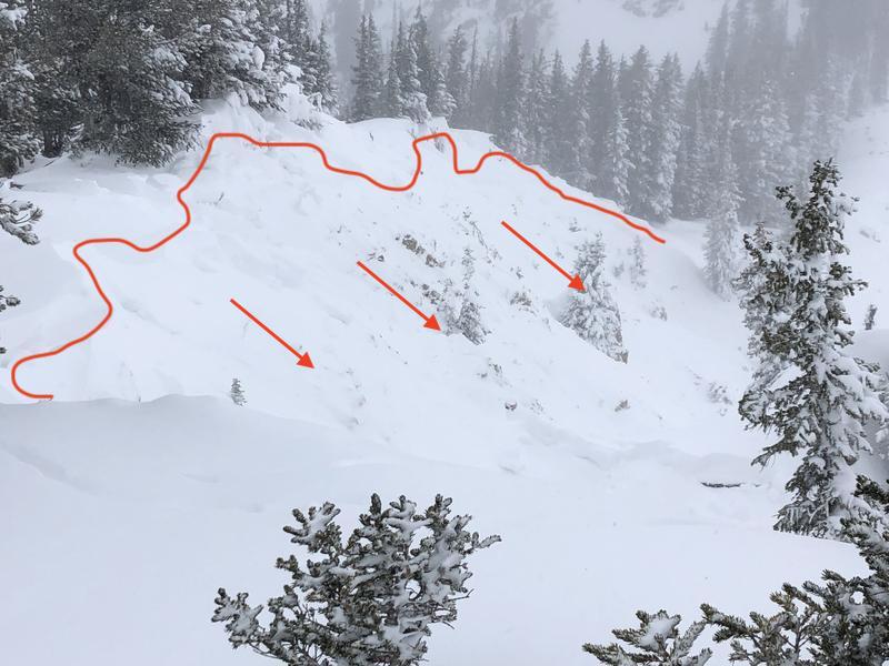
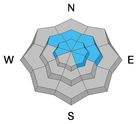
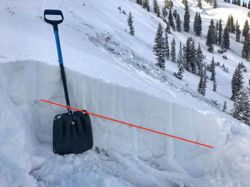
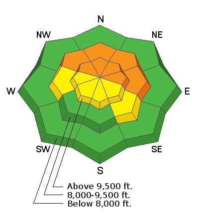
There is a CONSIDERABLE danger for slab avalanches failing on weak, sugary, snow 2-3' feet deep. This problem is found on mid & upper elevation slopes that face northwest, north, northeast and east. Don't be fooled by the sunshine and beautiful powder snow, these are the exact conditions that lead to avalanche accidents and fatalities. Dangerous avalanche conditions do exist, careful snowpack evaluation, cautious route-finding and conservative decision making is essential today.
Low
Moderate
Considerable
High
Extreme
Learn how to read the forecast here
Weather and Snow
For today we should see party cloudy skies and cold temperatures. Winds have backed off considerably and are currently blowing 5-10 mph across the highest terrain. Temperatures have plummeted into the single digits at upper elevations and are in the mid teens at many of the mid canyon trailheads. The Thanksgiving storm was just what we needed and storm totals are as follows:
  • Upper LCC: 20-24" of snow (1.50"-2.05" H20)
  • Upper BCC: 25-30" of snow (1.50"-3.21" H20)
  • Provo area: 17.5-24" of snow (2.7"-3.23"H20)
  • Ogden area: 20-24" of snow (1.50-2.93" H20)
  • Park City: 16-20" of snow (1.50"-2.0" H20) )
Recent Avalanches
Strong winds and heavy snowfall have overloaded our snowpack, leading to a natural and human triggered avalanche cycle yesterday. Numerous avalanches were reported in the SLC area from both backcountry travelers as well as snow safety teams. The avalanches were up to size 3 on the destructive scale (meaning it could bury and destroy a car, damage a truck, destroy small buildings or break trees.) Many size 2 avalanches were also reported and these are large enough to bury and kill a person.
These avalanches failed on a layer of very weak faceted snow that formed over the month of November due to cold clear nights. These avalanches were up to 2-3' deep, 100'-250' wide, running into the flats. While there were no reports from the Provo area, I would assume the same for this terrain as SLC is a good representation of the current snowpack.
Photo: Greg Gagne, Slab avalanche on Rocky Point in upper Little Cottonwood Canyon.
Ad
Avalanche Problem #1
Persistent Weak Layer
Type
Location
Likelihood
Size
Description
We have a CONSIDERABLE danger for slab avalanches. Very weak faceted snow has become overloaded by the strong winds and heavy snowfall. This weak, sugary, faceted snow is found on mid elevation, northwest, north, northeast, and east facing terrain. As well as the upper elevation west through southeast facing terrain. These are the slopes I would avoid for the next couple of days. Don't be fooled by the sunshine and beautiful powder snow, these are the exact conditions that lead to avalanche accidents and fatalities. The slab avalanche you trigger has the potential to be 2-3' deep and several hundred feet wide. This is the type of avalanche that will kill you! Any steep slope with old faceted snow should be off limits.
Avalanches can be triggered from a distance today and from adjacent terrain. Avoid walking in runout zones and being underneath anything steep in the terrain described by the locator rose above. Be mindful of anyone below you if you're walking on ridgelines.
Photo: Trent Meisenheimer. Snowpit from a NE facing slope in upper Little Cottonwood, highlighting the dangerous layer of faceted snow. This photo was taken Friday 23rd before we added another 1-2' feet of heavy snow.
Avalanche Problem #2
Wind Drifted Snow
Type
Location
Likelihood
Size
Description
Yesterday there was a wind gust reported at 102 mph at upper elevations. Wind along with 17.5-24" of new snow has created many drifts of wind blown snow scattered across the terrain. The good news: wind drifts are easy to spot by their rounded appearance and they tend to stabilize quickly. The bad news: is that with such strong winds you can expect cross loading at all mid and upper elevations and drifts that have formed in odd places as well, like gullies and mid slope break overs. Avoid being on any steep slopes that's been wind loaded.
Snow safety crews reported that the new snow was inverted and noted collapsing within the new snow on all mid and upper elevation aspects. We need to let the new snow settle out before committing to any steep terrain.
Photo: UDOT Provo Canyon - strong winds blowing snow off the high peaks.
Additional Information
High pressure will take hold for the next few days leading to clear skies and a warming trend. There does look like another storm on the horizon for late Wednesday into Thursday as the polar jet sets up on a westerly flow overhead. Stay tuned.