Forecast for the Provo Area Mountains

Evelyn Lees
Issued by Evelyn Lees for
Monday, November 26, 2018
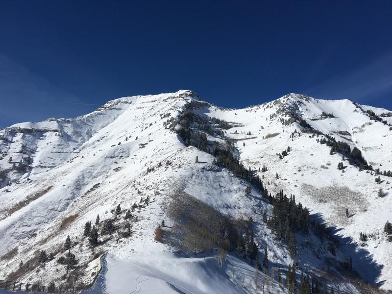
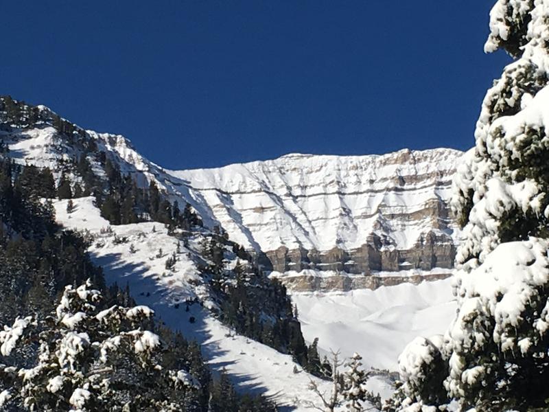
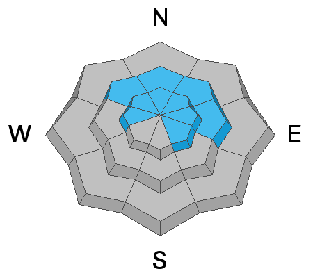
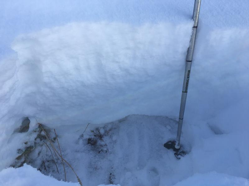
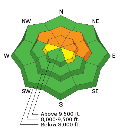
Any slope with old sugary, faceted snow near the ground is dangerous. Stay off mid and upper elevation slopes facing northwest through easterly, where the avalanche danger is CONSIDERABLE and you can easily trigger avalanches breaking 1 to 3 feet deep. Avalanches can be triggered from a distance and from below. Upper elevation west and southeasterly facing slopes have patchier old snow, but can still produce avalanches.
The danger is LOW on south and southwesterly facing slopes where the new snow landed on bare ground.
Low
Moderate
Considerable
High
Extreme
Learn how to read the forecast here
Weather and Snow
The Thanksgiving weekend storm has settled, and the Provo area mountains have one to two feet of snow on the ground at the 7,500 to 8800' elevations. Access is still tough, with less than a foot of snow at the lower elevations. Hitting rocks and logs is common with the overall shallow snow pack.
Temperatures are in the teens and twenties this morning, with a few single digits in the canyon bottoms where the cold air has pooled. Skies will be sunny and warm temps today, with highs reaching mid 30s at 10,000’. The northwesterly winds are less than 5 mph this morning, with the highest peaks clocking in at 15 mph, and speeds should remain light through the day. Increasing clouds tomorrow, with a trace to a few inches of snow on Tuesday night, followed by a couple of stronger storms adding snow into the weekend.
Drew was in the Provo area mountains yesterday, and here are some photos showing snow coverage. Here's his full observation.
Recent Avalanches
No avalanches reported from the Provo area mountains. However, conditions at the mid and upper elevations are probably similar the the Salt Lake area mountains to the north, where there is easier access to the higher elevations and numerous avalanches being triggered. Check the Salt Lake forecast and the avalanche list for an idea of what the mid and upper elevations in the Provo area mountains may be like.
Ad
Avalanche Problem #1
Persistent Weak Layer
Type
Location
Likelihood
Size
Description
It is very simple – steep slopes with old snow are dangerous. Any slope that was white with snow before Thanksgiving has weak, sugary facets near the ground. And now these slopes are loaded with new snow, they are continuing to produce avalanches 1 to 3 feet deep. Slides are being triggered from a distance and from on slope. Unfortunately, most slides are running in the upper layer of the facets, above the October rain crust, and not cleaning out lower facets or crusts.
These old faceted snow layers will remain a dangerous weak layer all week and will become even more reactive the next time it snows.
Here's a look Drew took of the snowpack at 8,500' on a north facing slope in the Provo area mountains, with the facets at the bottom. The weak facet layer depth will increase with elevation.
Avalanche Problem #2
Normal Caution
Type
Location
Likelihood
Size
Description
The lower elevations and sunny slopes that were bare ground before Thanksgiving have one to two feet of new snow sitting on dirt and rocks, and a low avalanche danger. Use normal caution - you may be able to trigger a few wet sluffs on the steepest sunny slopes as the snow heats up today, or there could be a small old wind drift that may crack out. Hitting rocks and stumps remains the greatest hazard.