Holiday Auction is Live!

Forecast for the Provo Area Mountains

Nikki Champion
Issued by Nikki Champion on
Saturday morning, November 14, 2026

Winter is finally showing up, and it’s time to shift your mindset. Conditions are still thin, and the biggest hazards right now are rocks, stumps, and deadfall hiding just beneath the surface, but that’s starting to change. A storm moved in last night and is expected to peak midday, and avalanche danger will continue to rise as the snow falls.

With fresh snow and rising winds, expect shallow slabs of new or wind-drifted snow at the upper elevations, especially where dense snow has landed on a weak, faceted base. Conditions could change quickly through the day, so pay close attention to what’s happening around you.

More storms next week will add to the load and make avalanches more likely. In the early season, even a small slide can drag you through rocks and stumps, so the consequences are high. If you’re heading into the backcountry, carry a beacon, shovel, and probe, know how to use them, and start choosing your terrain carefully now.
Low
Moderate
Considerable
High
Extreme
Learn how to read the forecast here
Special Announcements

SAVE THE DATE!

Weather and Snow

This morning, snow is falling in the mountains and rain is falling at the trailheads. Temperatures are in the low 30s °F along the highest ridgelines and the mid-30s °F at trailheads. Winds over the past 24 hours have been mostly from the east, peaking last night with gusts up to 30 mph along the highest ridgelines. They have since shifted to the west and southwest and calmed considerably. As of 7 a.m., Aspen Grove had about 1 inch of new snow and 0.21 inches of water, much of it falling as rain, while mid-mountain stations are reporting no new snow.

Today, temperatures will climb into the upper 30s and low 40s °F. Winds will be mostly from the south and will pick up at upper elevations, with gusts up to 50 mph along the highest ridgelines. Periods of snow will continue through the morning, peak around midday, then taper to showers in the afternoon and evening. The Provo area mountains could see another trace to 3 inches of snow, with up to 0.45 inches of water.

A colder storm will roll in Monday evening and last until Wednesday morning. Snow could fall as low as 4,800 feet, reaching the foothills and higher benches. The mountains will get more snow this time, with 4 to 8 inches becoming more likely in the Provo area mountains.

An even colder storm will follow Thursday through Saturday. This one has the best chance of bringing snow all the way to the valleys, with about a 60% chance of snow reaching the valley floor by Saturday morning. For now, the valleys could see up to an inch.

Recent Avalanches

No recent avalanche activity; observations have been generally thin from the Provo-area mountains.

If you’re getting out into the field, please submit your observations here.

Avalanche Problem #1
Normal Caution
Type
Location
Likelihood
Size
Description

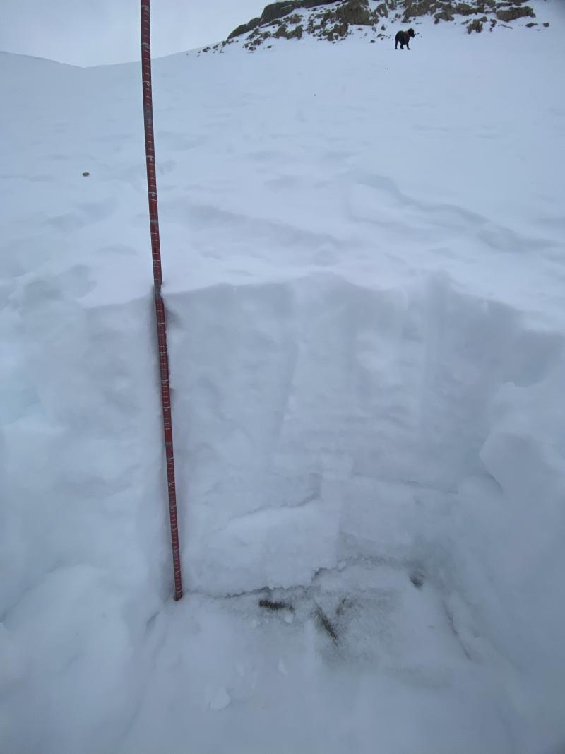
Jess Shade got out in the Provo area mountains yesterday and sent in a great observation. She found thin, highly variable coverage, with snow starting around 9,000 feet and depths from 40 cm in the meadows to over 1 m on the Timp Snowfield. Wind effect was visible on most aspects, and she saw wind moving snow and small spindrift avalanches on east-facing cliffs before the storm moved in. In her pit, soft snow sat on a hard, icy layer about 40 cm above the ground. That firm, slick surface could make a poor base for the new snow on the way. See photo below.

So what does this mean for avalanches? Before this storm, the little snow we had was mostly on north-facing upper elevation slopes, and it was weak: a mix of crusts and loose, faceted snow. The only missing ingredient has been a slab on top. This storm could provide one, and next week’s storms almost certainly will if the forecasts hold.

As new snow and stronger winds build at the upper elevations, the danger could rise quickly through the day. Expect shallow, likely sensitive slabs of new and wind-drifted snow, especially on upper-elevation slopes that already held weak, faceted snow.

These slides may be small, but early-season consequences are serious. With so little snow covering the ground, even a short ride can drag you through rocks, stumps, and deadfall.

If you’re heading into the backcountry, practice safe travel techniques, like exposing only one person at a time. Everyone in your group should carry a beacon, shovel, and probe and know how to use them. It’s time to start treating steep terrain with caution.

Additional Information

It's never too early to start thinking about avalanches. Here are a few things to consider doing:

  • Learn online. We have over 5 hours of free online learning at the Know Before You Go website
  • Check out the upcoming in-person Know Before You Go events HERE
  • Sign up for an on-snow class
  • Check out the UAC's education progression HERE
  • Get your avalanche rescue gear ready for winter. Put fresh batteries in your transceiver and update the firmware. Inspect your shovel and probe. Get your airbag backpack ready by possibly doing a test deployment and updating the firmware if it is an electric version or getting your canister refilled if it's not electronic.