Join us for the 33rd Backcountry Benefit - Get Your Tickets Now!

Forecast for the Provo Area Mountains

Greg Gagne
Issued by Greg Gagne on
Monday morning, January 5, 2026

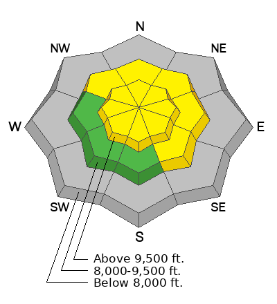
The avalanche danger is MODERATE at the upper elevations and on northerly through south-east facing slopes at the mid elevations where a soft slab of wind-drifted or new snow may be reactive. On isolated, northerly-facing slopes at the upper elevations, avalanches failing on the persistent weak layer of faceted snow down near the ground are possible. With periods of heavy snowfall possible this morning, the avalanche danger may rise to CONSIDERABLE.

Low
Moderate
Considerable
High
Extreme
Learn how to read the forecast here
Weather and Snow

As of 5 am, 24-hour snow/water totals are 2-4 inches of snow with nearly an inch of water, although I suspect water numbers are higher than what instrumentation is reporting.

Winds are from the west/southwest and sustained, averaging in the teens and 20's mph (perfect wind speeds for creating fresh wind drifts) with overnight gusts in the 30's mph along exposed mid and upper-elevation ridgelines. 11,000 foot gusts are in the 50's mph. Temperatures range through the 20's °F.

For today, expect periods of heavy snowfall this morning and moderate to strong winds, with another 4-8 inches of snow expected. Snowfall rates will be the highest this morning, before tapering to snow showers this afternoon. Temperatures will rise into the upper 20's °F.

After a short break, another storm is expected later Wednesday. This will be a more traditional storm featuring colder temperatures and lower-density snowfall.

Recent Avalanches

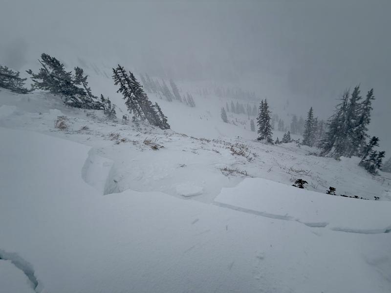
We've received no reports from the Provo mountains for several days, but on Sunday afternoon to our north in the Salt Lake mountains, a party on the ridgeline above Two Dogs in Days Fork unintentionally released a cornice onto the slope below which triggered an avalanche that initially failed above the Christmas rain crust (CERC) layer, but stepped down to facets and depth hoar at the ground. The slide was on a northeast-facing slope at 10,100 feet and was 4.5 feet deep, 250 feet wide, and ran 700 feet, snapping trees along the way. With a similar snowpack structure in the upper elevations of the Provo mountains, avalanches failing on the persistent weak layer down near the ground are possible.
Read all backcountry observations here.


Avalanche Problem #1
Wind Drifted Snow
Type
Location
Likelihood
Size
Description

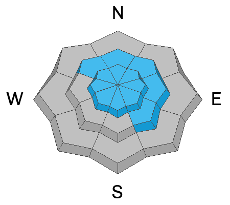
Moderate to strong winds from the west/southwest will continue to drift snow onto leeward north and east aspects, although cross-loading (which will drift snow onto south and west-facing slopes) is also possible. Watch for cracking as an indication of sensitive fresh wind drifts.

Avalanches involving recent slabs of wind-drifted snow may step down 2-3 feet deep to the Christmas rain crust (CERC layer) or to the more deeply-buried faceted snow down near the ground, with avalanches over four feet deep possible.

Avalanche Problem #2
Persistent Weak Layer
Type
Location
Likelihood
Size
Description

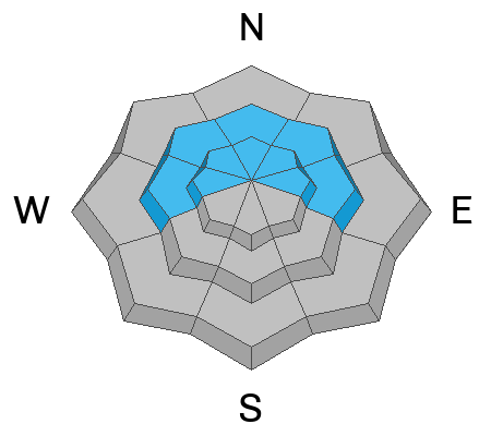
Due to the supportability of the Christmas Eve Rain Crust (CERC) in the majority of terrain, triggering an avalanche that fails in the persistent weak layer of faceted snow down near the ground is not likely, however, moderate winds and fresh snowfall today will put a new load on top of this layer and on some isolated slopes where the CERC is thinner, avalanches failing on this PWL may be possible.

Additional Information

We're all excited about the fresh new snow and improved riding conditions, especially with the slow start to the season. Everyone (us included) is antsy to get some fresh turns. Longtime local professionals noted some less-than-safe travel practices in the backcountry yesterday. We have a responsibility to one another to cross slopes one at a time, be aware of who’s above and below us, and to pick uptracks with the least exposure. We tell you these things not to wag fingers, but to have you come home to and with all of your friends and family tonight. It’s what we all want for each other.

General Announcements

This information does not apply to developed ski areas or highways where avalanche control is normally done. This forecast is from the U.S.D.A. Forest Service, which is solely responsible for its content. This forecast describes general avalanche conditions and local variations always occur.