Join us at our 2nd Annual Blizzard Ball

Forecast for the Provo Area Mountains

Nikki Champion
Issued by Nikki Champion on
Wednesday morning, January 4, 2023
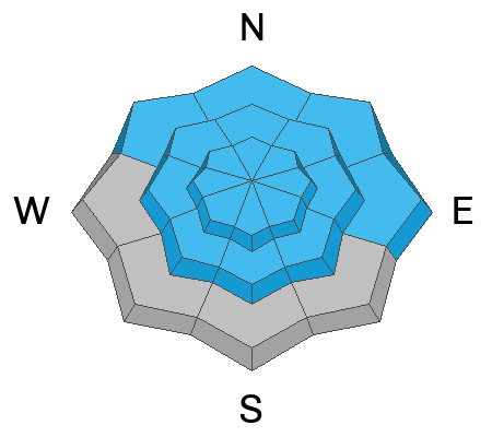
The avalanche danger is CONSIDERABLE at all upper elevations and at mid-elevation aspects facing west through north through southeast where avalanches may step down into older facets, leading to large and destructive avalanches. At all lower elevations and mid-elevation aspects facing southwest, and south where the persistent weak layer is less likely to cause avalanches the avalanche danger is MODERATE.

Today, natural avalanches are possible and human-triggered avalanches are likely.

While the avalanche danger is not as obvious as it was a few days ago, avalanche conditions remain dangerous. There is great riding to be had on slopes less steep than 30 degrees.
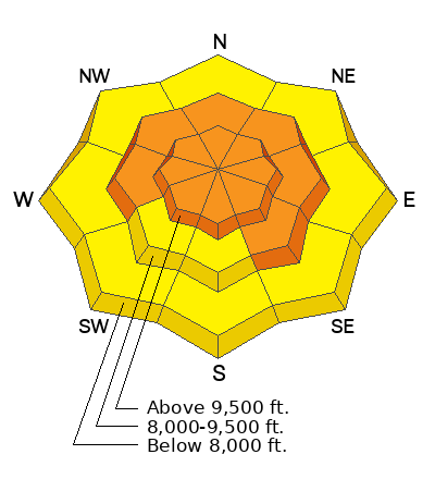
Low
Moderate
Considerable
High
Extreme
Learn how to read the forecast here
Weather and Snow
Under broken skies, most locations report an additional tracea amount of low-density snow overnight. Temperatures are in the mid-teens to low 20s F. Winds are blowing 5-15 mph from the southwest at mid-elevations. At upper elevation ridgelines, winds average 20 mph from the west-north-west with gusts up to 40 mph.
Today, skies will be partly cloudy with the chance of an occasional snow shower. No additional accumulation is expected. Temperatures will climb into the upper 20s and low 30s F and winds will be westerly averaging 10-20 mph at mid-elevations with gusts up to 20 mph, and averaging 20-30 mph with gusts up to 40 mph at upper elevations. Winds will continue to increase into the evening, and begin shifting southwesterly.

Snow Depths throughout the Wasatch
  • Cottonwood Canyons 70-115"
  • PC Ridgeline 50-85"
  • Ogden Area Mountains 70-85"
  • Provo Area Mountains 50-90"
The next system should move through the area beginning Thursday evening, slated to bring another 4-8" to the Provo mounatins.
Recent Avalanches
No new avalanches reported in the Provo area mountains.

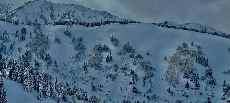
In the Central Cottonwoods, in Upper Silverfork drainage, between Doug's Drop and the Football field, a large hard slab avalanche appeared to fail on the persistent weak layer up to 1000' wide. The timing of this avalanche is unknown, it likely occurred sometime between January 2nd and January 3rd. Drew plans to head up there today and get more information.
Photo: Ian Reddel
Yesterday there were reports of explosive-triggered avalanches failing from ski area operations. Some of these avalanches were 4-8' deep, failing within the persistent weak layer near the ground.

Check out our observations page for the most recent information.
Ad
Avalanche Problem #1
Persistent Weak Layer
Type
Location
Likelihood
Size
Description
This last storm was a significant loading event for our November faceted layer. Reports are trickling in of avalanches that ran on the persistent weak layer (PWL). With all the new snow blanketing the old snow, I think we're well on our way to healing this PWL. That being said, I don't think it is healed yet and that is why the danger remains at CONSIDERABLE for today. We are in a situation where the likelihood is decreasing, but the consequence remains large. Any avalanche that fails into the November facets would bone-breaking, season-ending, deadly and destructive avalanche.

Nearly half of all avalanche accidents happen during times of considerable danger. Today is a day for careful snowpack evaluation and cautious route finding. Things are getting better, but we just need to give it more time - until then we can continue to enjoy low-angle powder skiing, and riding.
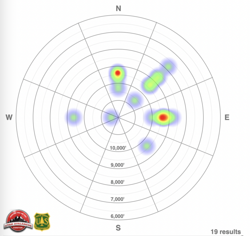
Avalanche heat map for the last week (12/29/22-01/04/23) for Salt Lake, Provo and Ogden area mountains. Excluding wet snow instabilities.
Avalanche Problem #2
Wind Drifted Snow
Type
Location
Likelihood
Size
Description
With a bump in winds overnight and so much soft snow available for transport, you are likely to find sensitive slabs of wind-drifted snow on all upper-elevation slopes. The new soft slabs will be most pronounced on lee-ward facing slopes, but elevated winds can load any aspect because winds swirl and change direction as they pass through the mountains, this is known as cross-loading.
Look for cracking, collapsing, and rounded pillows of new snow and avoid steep terrain where you could trigger them. These shouldn't pose too much hazard by themselves today - the concern is if they step down into the buried persistent weak layer.

Out of the wind zone: You could still trigger a loose dry avalanche in steep terrain. While the new snow is rapidly stabilizing, a surefire way to avoid any deeper new snow avalanches is to choose terrain under 30 degrees.
General Announcements
This information does not apply to developed ski areas or highways where avalanche control is normally done. This forecast is from the U.S.D.A. Forest Service, which is solely responsible for its content. This forecast describes general avalanche conditions and local variations always occur.