Join us at our 2nd Annual Blizzard Ball

Forecast for the Provo Area Mountains

Dave Kelly
Issued by Dave Kelly on
Tuesday morning, January 3, 2023
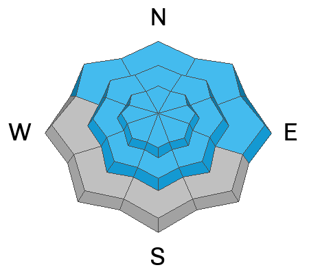
The avalanche danger is CONSIDERABLE at all mid and upper elevations and at lower elevations northwest-north-east where avalanches may step down into older facets, leading to large and destructive avalanches. At lower elevation west-south-southeast aspects where the persistent weak layer is less likely to cause avalanches the avalanche danger is MODERATE.

Today, natural avalanches are possible and human triggered avalanches are likely.

This is a day when the avalanche danger is not as obvious as it was even a few days ago. Assess slopes carefully as we have just had a lot of new snow and things are settling out. With overcast skies and bit of fluff overnight there is still good riding to be had on slopes less than 30 degrees and that's where I will be headed today.
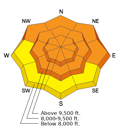
Low
Moderate
Considerable
High
Extreme
Learn how to read the forecast here
Weather and Snow
Under overcast skies most locations are reporting 1-2" of low density snow. Trailhead temperatures are in the high teen's F. Winds are blowing southwest 18 gusting to 30 MPH at the 9000' ridgelines.
Today, continued light snowfall with 1-2" of snow expected. Temperatures will be 23-27 F. Winds at the 9000' ridgelines will blow from the west-southwest 20 gusting to 25 MPH this morning and at the 11,000' ridgelines west-northwest 20 gusting to 35 MPH. Winds are forecasted to increase later this afternoon.

Snow Depths throughout the Wasatch
  • Provo Area Mountains 50-90"
  • Cottonwood Canyons 70-110"
  • PC Ridgeline 50-80"
  • Ogden Area Mountains 70-85"
Recent Avalanches
Backcountry travelers continued to report avalanches that ran during the storm.

Yesterday there were reports of explosive triggered avalanches from ski area operations. Some of these avalanches were 4-8' deep, 400' wide, and ran 1500'-2500' of vertical.

Check out our observations page for the most recent information.
Ad
Avalanche Problem #1
Persistent Weak Layer
Type
Location
Likelihood
Size
Description
This last storm was a significant loading event for our November faceted layer. Reports are trickling in of avalanches that ran on the persistent weak layer (PWL). With all the new snow blanketing the old snow surface I think we're well on our way to healing this PWL. I don't think it is healed yet and that is why the danger remains at CONSIDERABLE for today. Any avalanche that fails into the November facets would be a bone breaking, day ruining, season ending avalanche.

What stands out to me today is that there is a possibility of seeing natural avalanches and human triggered avalanches are likely. Nearly half of all avalanche accidents happen during times of considerable danger. Today is a day for careful snowpack evaluation and cautious route finding. Things are getting better- enjoy the lower angle powder skiing and give this weak faceted layer some more time.

Read more about avalanche danger HERE.
Avalanche Problem #2
Wind Drifted Snow
Type
Location
Likelihood
Size
Description
Last night's low density snow will be easily moved around with any hint of wind. You may see some wind drifted snow and small wind drifted snow avalanches. Look for cracking, collapsing, and rounded pillows of new snow. These shouldn't pose a hazard by themselves- the concern is if they step down into the buried persistent weak layer.
Avalanche Problem #3
New Snow
Type
Location
Likelihood
Size
Description
You may trigger a loose dry avalanche in steep terrain. Observers reported stabilizing within the new snow yesterday. This will only continue to improve. A sure fire way to avoid any deeper new snow avalanche is to choose terrain under 30 degrees.
General Announcements
This information does not apply to developed ski areas or highways where avalanche control is normally done. This forecast is from the U.S.D.A. Forest Service, which is solely responsible for its content. This forecast describes general avalanche conditions and local variations always occur.