Forecast for the Provo Area Mountains

Dave Kelly
Issued by Dave Kelly for
Tuesday, January 31, 2023
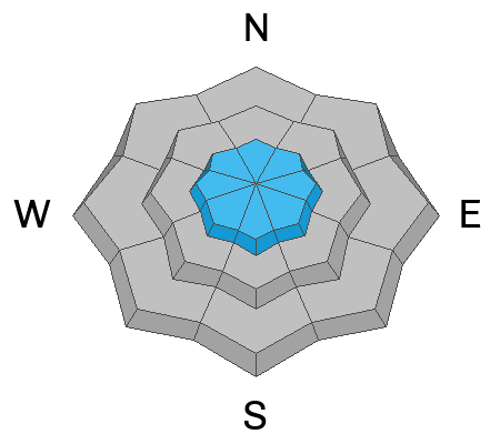
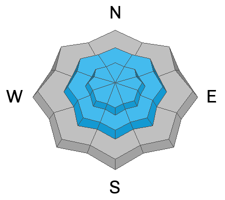
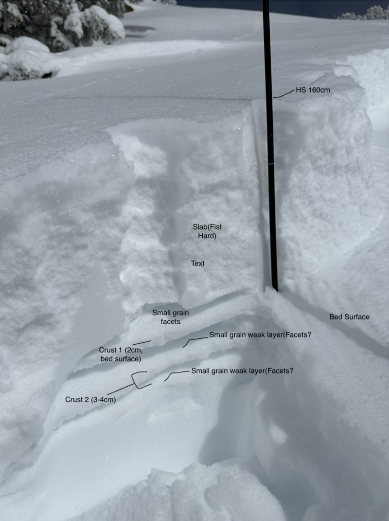
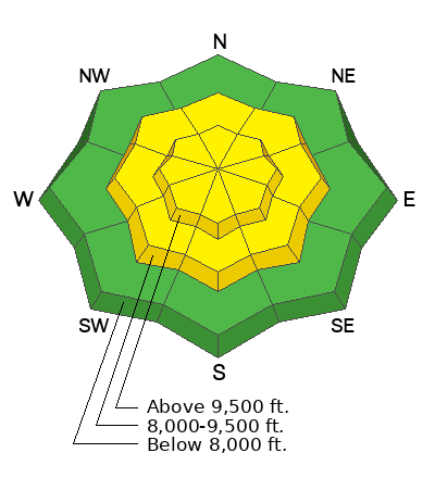
The avalanche danger is MODERATE on mid and upper elevations with wind-drifted snow and for slab avalanches running on a crust/facet combination buried 2-3' below the surface at mid and upper elevations. The avalanche danger is LOW in lower elevation terrain. Expect dry loose avalanches in steep terrain.

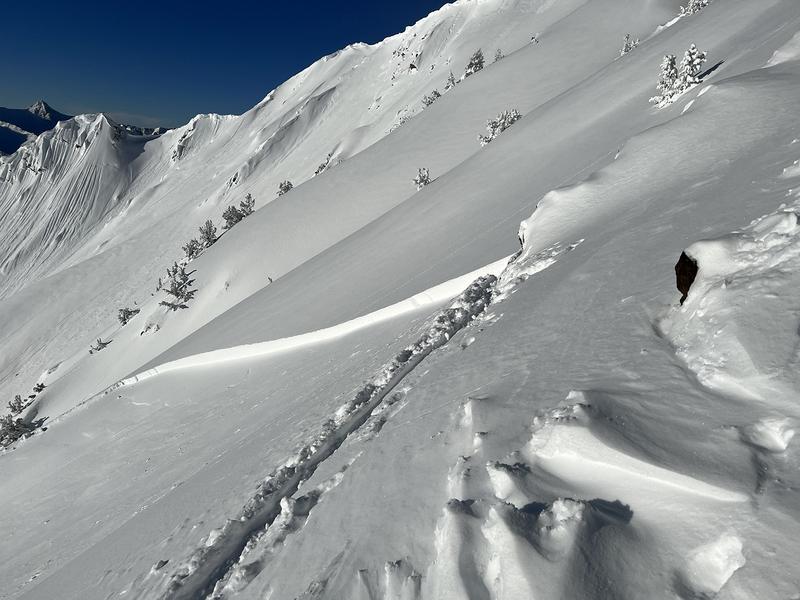
Human triggered avalanches are possible in mid and upper elevation terrain. Assess the new/old snow interface to determine if there is a faceted crust present particularly on west-south-southeast aspects.

Ice climbers should be aware of overhead hazard and expect to see loose snow avalanches as soon as the sun warms the snow.
Low
Moderate
Considerable
High
Extreme
Learn how to read the forecast here
Weather and Snow
Under clear skies mountain temperatures are well below 0 F. As of 0700 AM it is -12 F at Aspen Grove. Winds are blowing lightly from the west and southwest at the 8000' ridgelines.
Today, winds will blow from the north-northwest 15 MPH gusting to 25 MPH at the 9,000' ridgelines and 30 to 40 MPH at the 11,000' ridgelines. Wind speeds are forecast to decrease throughout the day. Skies will be partly cloudy with temperatures 17-21 F.
Recent Avalanches
There were reports over the weekend of avalanches 100-450' wide that ran on the interface between the new snow and the faceted crust. This crust/facet combination is most pronounced on west-south- southeast aspects. I would be digging down 2-3' deep to determine if this crust was present and how it was reacting to extended column tests before committing to slopes approaching 35 degrees.

Check out all observations HERE.
Ad
Avalanche Problem #1
Wind Drifted Snow
Type
Location
Likelihood
Size
Description
Watch for cracking in the surface snow and avoid smooth rounded pillowy features below ridge tops and on the leeward side of gullies. Any slopes with large overhanging cornices will be a sign that the slope below has seen recent wind loading and has the potential to avalanche with the additional weight of an ascending or descending rider.
Wind-drifted snow avalanche on south facing Little Superior (Photo- Jason)
Avalanche Problem #2
New Snow
Type
Location
Likelihood
Size
Description
Over the last few days there were slab avalanches that got my attention. These avalanches failed on the new/old snow interface where there was a faceted crust present. There is a great report HERE from an AIARE Pro 2 class about how they assessed this crust facet combination.

Loose dry avalanches are possible in steep terrain at all elevations. Watch for warming on solar aspects at mid and low elevations and avoid traveling underneath these slopes as loose snow avalanches may entrain enough snow to push you over a cliff band or into trees.

Snowpit profile of an avalanche on southwest facing Flagstaff Ridge that failed on small grained facets above a crust (Photo- Little)
Additional Information
Mark and I discuss this weekend's avalanche activity and forecaster mindset in this video.
General Announcements
This information does not apply to developed ski areas or highways where avalanche control is normally done. This forecast is from the U.S.D.A. Forest Service, which is solely responsible for its content. This forecast describes general avalanche conditions and local variations always occur.