Forecast for the Provo Area Mountains

Drew Hardesty
Issued by Drew Hardesty for
Tuesday, January 30, 2024
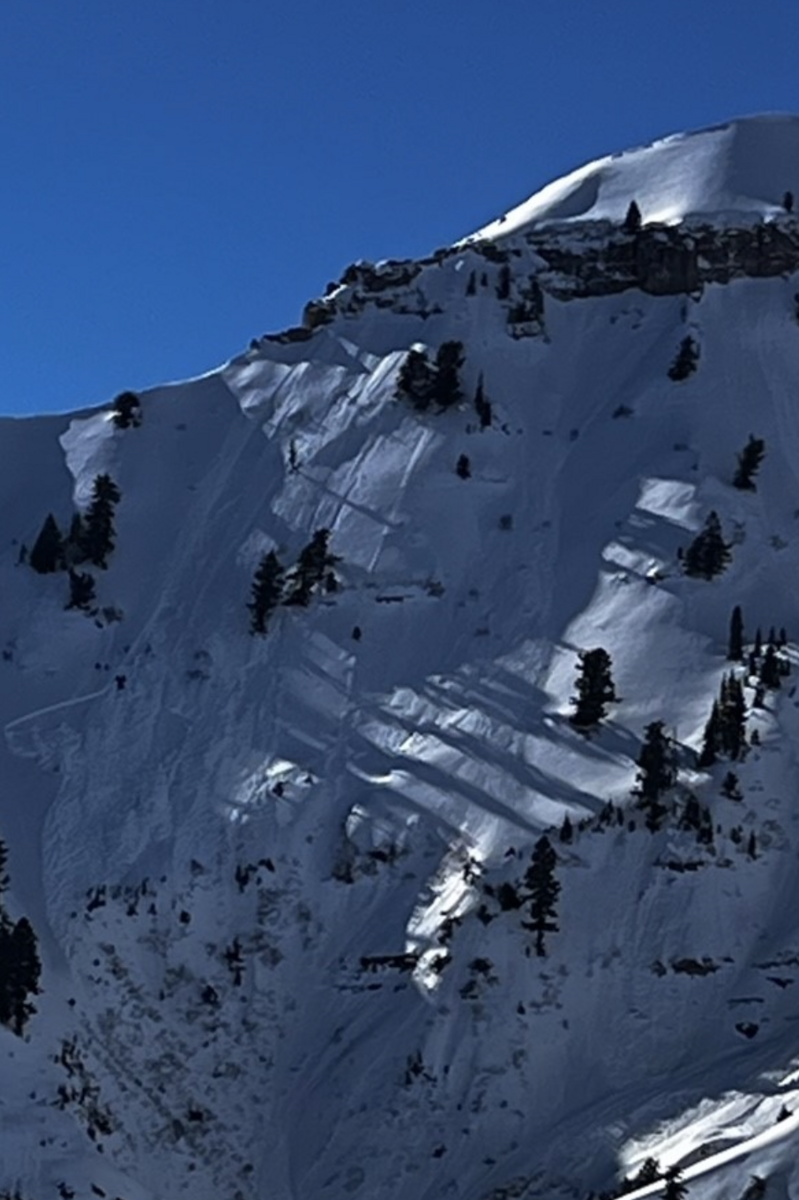
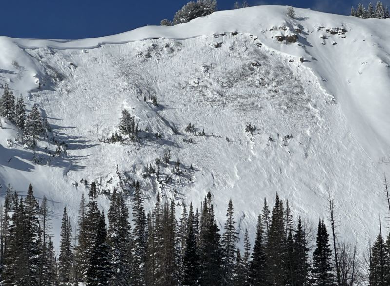
A tricky MODERATE DANGER exists on steep west to north to southeast facing slopes for triggering a 2-5' thick hard slab avalanche that fails on a persistent weak layer.
With clear skies and skyrocketing temps, the danger for wet avalanches will rise to CONSIDERABLE on all steep sunny (as well as low elevation shady) slopes. Don't overstay your welcome in the oven.
Low
Moderate
Considerable
High
Extreme
Learn how to read the forecast here
Special Announcements
Join us for a Motorized Backcountry 101: Introduction to Avalanches class on February 2-3 down on the Skyline. Click HERE for more information.
Weather and Snow
Skies are clear.
Mountain temperatures remain inverted, with ridgetop temps in the upper 30s while basins and trailheads are in the upper 20s. Winds are from the south and are hardly a whisper.
For today, we'll have mostly clear skies, light winds from the south and temps rising again to near 40°F up high and near 50°F down low. That's not a misprnt.
Riding conditions remain excellent in the sun and wind sheltered terrain. Solar aspects and low elevation northerlies have a crust that will soften with daytime warming. Developing surface hoar may be noted in sheltered terrain.
The Outlook: Rosy. From my vantage, the pattern looks fairly active again, with a storm Thursday afternoon through Saturday and another one lined up for early next week; each possibly with a tropical moisture tap. The southern mountains should receive preferential treatment, but we won't get left standing at the altar.
Recent Avalanches
With skyrocketing temps yesterday, many wet loose and a few wet slab avalanches barreled down steep solar terrain as they became wet and unstable. Woody from UDOT Provo captured some significant wet loose and WET SLAB photos on predominantly westerly facing aspects on Timp and Cascade and a new one in upper Slide Canyon (Weiss pic below) In the Salt Lake mountains on Sunday, a skier was caught and carried in a large avalanche that failed on our PWL from December. This was on a steep northwest facing slope on Gobblers Knob.
Ad
Avalanche Problem #1
Wet Snow
Type
Location
Likelihood
Size
Description
With clear skies and warmer overnight temperatures, wet avalanches will start to run earlier today than yesterday, starting on east then south then west and eventually some northwest facing slopes. In steep, sustained and confined terrain, some of these wet avalanches will run fast and far and easily lead to significant debris piles. We had lots of reports of long running destructive avalanches across the range. In some areas, much more destructive wet slab avalanches may occur, from either being pried out by wet loose sluffs from above, or - in some cases - melt water percolating down to structural interfaces (density changes and/or facets and crusts).
Travel advice: If you see pinwheels and rollerballs and are finding the snow start to become unsupportable, move on to low angle terrain or cooler aspects.
Avalanche Problem #2
Persistent Weak Layer
Type
Location
Likelihood
Size
Description
Some areas of Provo have some of the weakest and potentially suspect conditions across the northern half of the state. Even though you may not hear collapsing or see cracking, you may still trigger a hard slab avalanche 2-4' thick on our weak PWL from December. I was in Provo Sunday near Timponeeke and found very weak faceted snow underneath a 3' thick hard slab. Even though my tests were not damning, I didn't trust the structure and stayed on low angle terrain. The most recent avalanche into old weak faceted snow was noted on the 21st in upper AF and on the 25th - the Ant Knolls along the Wasatch Back (photo).
General Announcements
This information does not apply to developed ski areas or highways where avalanche control is normally done. This forecast is from the U.S.D.A. Forest Service, which is solely responsible for its content. This forecast describes general avalanche conditions and local variations always occur.