Forecast for the Provo Area Mountains

Greg Gagne
Issued by Greg Gagne for
Friday, January 27, 2023
The avalanche danger is MODERATE at upper elevations where there are sensitive slabs of wind-drifted snow. The avalanche danger is LOW outside of wind-affected terrain and in the low and mid elevations.
Long-running sluffs are also possible in steep, sustained terrain.

Cornices continue to grow in size. Avoid traveling below or along corniced ridgelines as they can break further back than you might expect.
Low
Moderate
Considerable
High
Extreme
Learn how to read the forecast here
Special Announcements
Join the UAC, Weston Backcountry, Utah Mountain Adventures, and more vendors this Sunday, January 29 for the Brighton Beacon Bash near the Milly Chalet from 9 am to 4 pm. Beacon practice, backcountry ski and board demos, and much more! Click HERE for more info.
Weather and Snow
Temperatures range through the teens and winds are from the west/northwest. Below about 10,000', wind speeds are generally light with gusts in the teens. But things change above 10,000' with winds gusting into the 20's mph. At 11,000', winds are averaging in the 40's with gusts into the 50's mph. A trace of snow fell overnight.
For today, temperatures will climb into the 20's with light snow throughout the day. Snowfall rates will increase mid-afternoon with a few inches of new snowfall expected by sunset. Below about 10,000', the west/northwest winds will remain light with gusts into the teens. Between 10-11,000' winds will gust into the 20's, with gusts in the 50's mph at 11,000'. There is the potential for very strong winds along upper-elevation ridgelines with gusts up to 80 mph.
Snowfall overnight and into Saturday, with snow totals up to 6" expected by later Saturday. Another storm Sunday afternoon into Monday.

Aspects facing south and southwest have a thin sun crust underneath any new snow.
Recent Avalanches
On Thursday, observers were finding pockets of sensitive wind drifted snow at the upper elevations. We received a nice observation from a party on the Cold Fusion Couloir where they encountered wind drifted snow and large cornices. Another party ice climbing in Provo Canyon reported a sluff of loose snow. When ice climbing in Provo Canyon, be aware that avalanches can come down on top of you and even getting caught in a small sluff can be consequential.
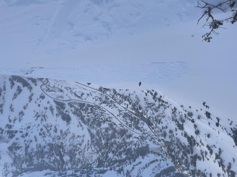
To our north in the Salt Lake mountains, the most notable avalanche involved a catch-and-carry on a Southeast aspect on Little Superior at 10,300'. This involved a fresh wind drift up to 18" thick where the rider was carried for 60' before coming to a stop on top of the snow surface. The avalanche continued for another 800' vertical. Huge thanks to the party involved for the excellent writeup, description, and photos, including the photo below.
Ad
Avalanche Problem #1
Wind Drifted Snow
Type
Location
Likelihood
Size
Description
Areas of sensitive slabs of wind-drifted snow can be expected at the upper elevations, especially in open terrain above 10,000'. These wind drifts have been isolated in recent days, but with increasing wind speeds today, I am expecting these drifts to be more widespread. These drifts will be 6-18" thick and they may allow you to get onto the wind slab before cracking, possibly even above you. Watch for signs of wind-drifted snow including dense snow that cracks around your skis or snowboard, as shown below. (Photo from Prescott)
Cornices continue to grow in size and will be sensitive, possibly breaking further back than you anticipate. Give them a wide berth by traveling well-away from corniced ridgelines.
General Announcements
This information does not apply to developed ski areas or highways where avalanche control is normally done. This forecast is from the U.S.D.A. Forest Service, which is solely responsible for its content. This forecast describes general avalanche conditions and local variations always occur.