Forecast for the Provo Area Mountains

Trent Meisenheimer
Issued by Trent Meisenheimer for
Saturday, January 19, 2019
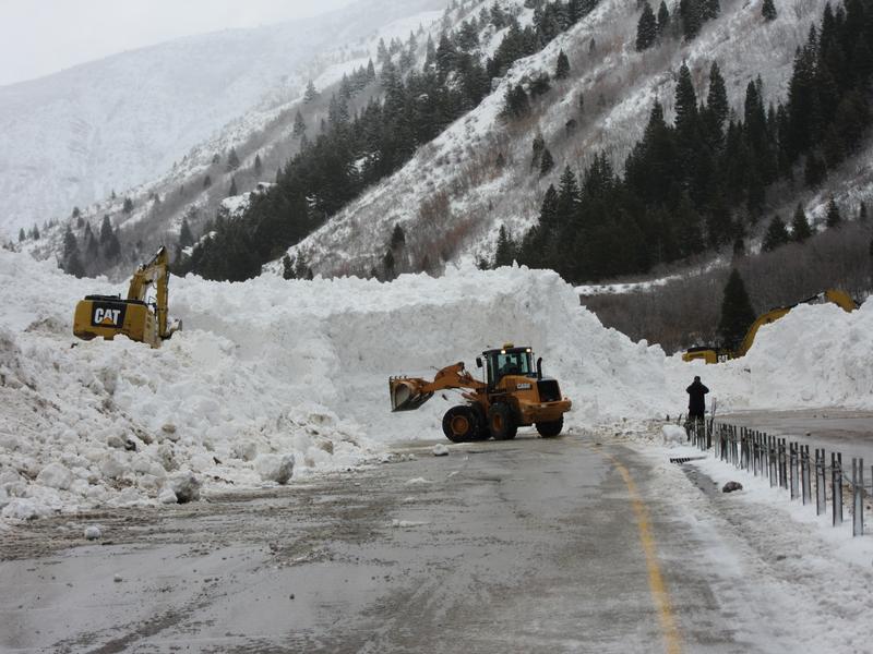
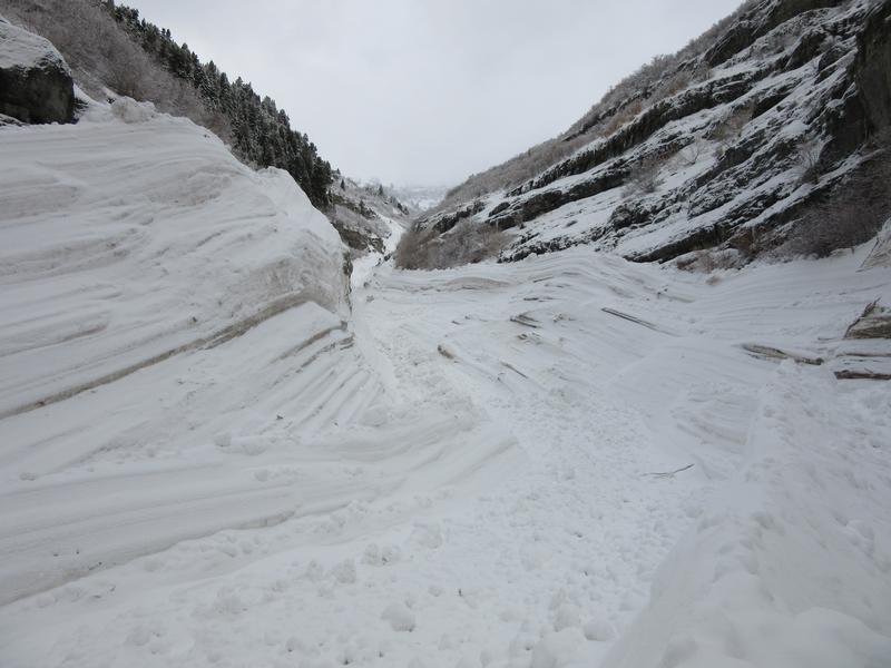
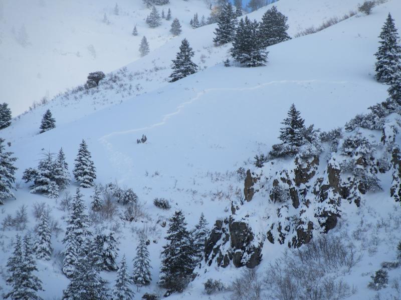
The Avalanche Danger remains HIGH on all upper elevation slopes, CONSIDERABLE on all mid elevation slopes. Avoid all travel in avalanche terrain, which is slopes steeper than about 30 degrees and traveling below steep slopes and in avalanche runout zones. Today’s wind and warming temperatures will keep the snow unstable. Those with excellent avalanche and route finding skills will find an untracked wonderland of snow on low angle, wind sheltered slopes with excellent turning conditions.

While the backcountry will be dangerous over the next several days, enjoy the Greatest Snow on Earth at some of the Greatest Ski Resorts on Earth where they employ teams to help mitigate the risk.
Low
Moderate
Considerable
High
Extreme
Learn how to read the forecast here
Avalanche Warning
AN AVALANCHE WARNING CONTINUES FOR THE MOUNTAINS OF NORTHERN UTAH, TO INCLUDE THE BEAR RIVER RANGE, THE WESTERN UINTAS, AND THE ENTIRETY OF THE WASATCH RANGE. STRONG WINDS AND HEAVY SNOWFALL HAVE PUSHED THE AVALANCHE DANGER TO HIGH. NATURAL AND HUMAN TRIGGERED AVALANCHES ARE LIKELY. AVOID BEING ON OR BENEATH STEEP MOUNTAIN TERRAIN. AN ELEVATED AVALANCHE DANGER WILL PERSIST THROUGH THE MLK HOLIDAY WEEKEND.
Special Announcements
A search is resuming this morning for a skier buried in a large avalanche around 5:00 pm yesterday by Electric Lake, on the Manti/Skyline Plateau. The skier is not wearing a beacon. Preliminary accident report HERE. Brett and Mark will be at the accident scene today, and the accident report will be updated as they get more details.
Weather and Snow
This week’s rough storm totals are 2' with 2.44" snow-water-equivalent. 48 hour snow water equivalent is reported to be 3.12-3.62". Strong winds blew from the southwest and northwest. The snow has settled, and low angle turning is now good.
Currently, clouds are increasing, and temperatures cold - in the single digits and low teens. The westerly winds picked up in the past few hours - averaging 10 to 15 mph, gusts across the high peaks 35 to 45 mph. Winds speeds will continue to increase through late morning before decreasing this afternoon. Gusts to 50 mph at the high elevations and averages to 25 mph at the mid elevation ridge lines are expected. Temperatures will warm into the upper 20s to mid 30s, and an inch or two of snow is possible later today. Total snow stakes are 75-85" in Provo Canyon and 60-70" in American Fork.

Greg's Most Excellent Week in Review is hot off the presses. INFO
Recent Avalanches
No new backcountry avalanches were reported to the avalanche center yesterday. However, UDOT forcaster John Woodruff took some amazing photos of avalanches from this past storm cycle. The Slide Canyon avalanche was massive and in places the debris was 60' feet deep.
Photos: First two below are the Slide Canyon avalanche. Then another showing a natural avalanche around the Sundance backcountry.
Ad
Avalanche Problem #1
Wind Drifted Snow
Type
Location
Likelihood
Size
Description
The southwesterly winds are strong enough this morning to drift the snow into another layer of sensitive wind slabs. The old, but still dangerous wind drifts from Thursday are now hidden, but could still produce large, soft and hard slab avalanches 2 to 3 feet deep and hundreds of feet wide on many aspects at the mid and upper elevations. Drifts are to the lee of ridgelines and cross-loaded into couloirs and gullies and may be triggered at a distance or break above you. Unstable storm snow will continue to be reactive to human weight on all aspects at the mid and upper elevations. These too are often viewed as "manageable" but with this much snow you'd be gambling with your life.
For today, avoidance is key and sticking to low angle terrain (less than 30°) with nothing steep above or adjacent to you, is the only tool in the tool box for safety.
Avalanche Problem #2
Persistent Weak Layer
Type
Location
Likelihood
Size
Description
We have overloaded the various faceted, sugary weak layers in our snowpack. You can trigger a deep slide on one of these layers on a steep slope, especially with a shallow snow pack. Also, any shallower, new snow slide or triggered wind drift may “step down”, breaking on one of these deeper weak layer, resulting in a large, dangerous avalanche.
For today, avoidance is key and sticking to low angle terrain (less than 30°) with nothing steep above or adjacent to you, is the only tool in the tool box for safety.
Avalanche Problem #3
Wet Snow
Type
Location
Likelihood
Size
Description
Today, we have rapidly warming temperatures. If we see any periods of strong sunshine, you can expect the snowpack on the sunny aspects and lower elevations to warm rapidly and begin to avalanche. The crux however, will be the cloud cover for today. The clouds could cover the sky just enough that we won't see warming of the snow surface. If you're traveling in sunlit terrain today, keep an eye on the snow surface and look for visual clues like roller balls and wet loose sluffs. If you're seeing this it's time to change your aspect to a more shady one.
Additional Information
General Announcements
This information does not apply to developed ski areas or highways where avalanche control is normally done. This forecast is from the U.S.D.A. Forest Service, which is solely responsible for its content. This forecast describes general avalanche conditions and local variations always occur.