Join us at our 2nd Annual Blizzard Ball

Forecast for the Provo Area Mountains

Nikki Champion
Issued by Nikki Champion on
Wednesday morning, January 11, 2023
The avalanche danger is HIGH at all upper and mid elevations where heavy snowfall, heavy rain, and strong winds have created very dangerous avalanche conditions. New snow and wind-drifted snow avalanches may step down into older facets, leading to large and destructive avalanches.
The avalanche danger is HIGH at all lower elevations due to the overhead hazard and heavy rain. Yesterday, a very large hard slab avalanche hit the Provo River.

Avoid travel below steep terrain as avalanches have the potential to run into lower elevation flat areas near trailheads or overrun ice climbing routes.
Low
Moderate
Considerable
High
Extreme
Learn how to read the forecast here
Weather and Snow
Overnight mountain locations reported 6-9" of new snow and .90-1.62" of water. Storm totals are up to 15-30" of snow. Currently, it is still snowing in the mountains, but the peak snowfall rates have passed.
This morning, trailhead temperatures are in the mid 20's F. Winds have transitioned to the northwest and are blowing 10-20 gusting to 30 MPH at the mid-elevation ridgelines. At the upper elevation ridgelines, winds are blowing 30 mph gusting near 90 mph.
Today will bring continued cloudy skies and snowfall this morning, before tapering off this afternoon. Temperatures will climb into the upper-20s and low 30s F and winds will remain elevated, but begin to decrease throughout the day, blowing from the northwest 15-25 mph with gusts up to 55 mph. We could see another 1-3" of accumulation before the high pressure moves into the area for Thursday and Friday before a more active pattern returns.
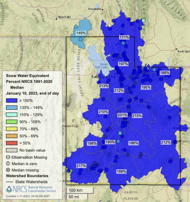
Overall water totals are impressive for the entire state, with snow water equivalent percent close to 200% in most areas.
Recent Avalanches
The Provo area mountains went through an impressive natural cycle yesterday morning. Including large hard slab avalanches as well as wet-loose avalanches. One of the most impressive being Bridalviel falls. That naturalled and hit the Provo river.
Ski areas saw long-running wet loose avalanches.
Find all recent avalanches HERE.
Ad
Avalanche Problem #1
Wind Drifted Snow
Type
Location
Likelihood
Size
Description
With a huge bump in northwest winds overnight, gusts up to 90 mph, and so much soft snow available for transport, you are likely to find sensitive slabs of wind-drifted snow on all mid and upper-elevation slopes. The new soft slabs will be most pronounced on lee-ward facing slopes, but elevated winds can load any aspect because winds swirl and change direction as they pass through the mountains, this is known as cross-loading.
Look for cracking, collapsing, and rounded pillows of new snow and avoid steep terrain where you could trigger them.
Any wind-drifted avalanche may step down into a deeper buried weak layer resulting in a larger avalanche.
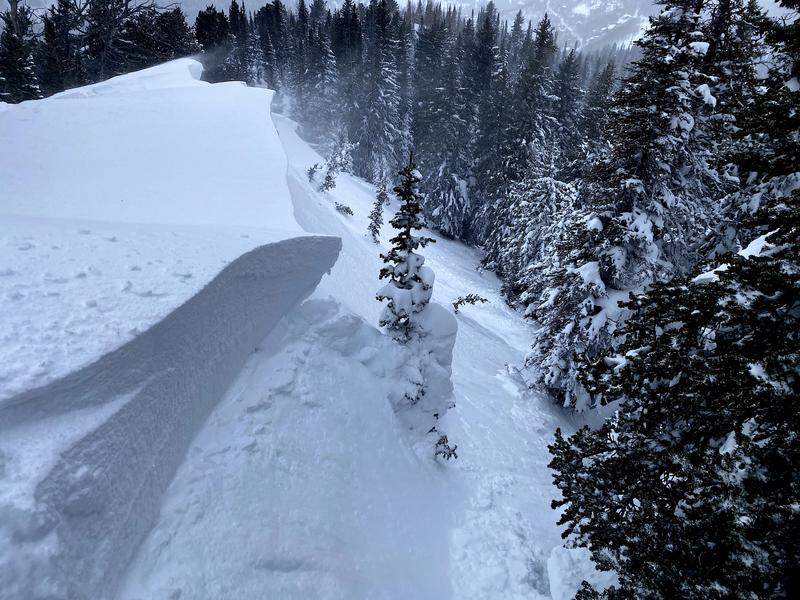
Example of the soft slab avalanches of wind drifted snow you could find today. Brighton Hill - B. Nalli. Find full observation HERE.
Avalanche Problem #2
New Snow
Type
Location
Likelihood
Size
Description
Storm totals of 15-30" of new snow over the past 24 hours will create both sensitive soft slabs of new snow and fast, long-running sluffs on all aspects at mid and upper elevations. While new snow avalanches can be consequential on their own - the primary concern is if they step down into the buried persistent weak layer.
I suspect at lower elevations where it is warmer the new snow is bonding quite well to the old snow surface.
Avalanche Problem #3
Persistent Weak Layer
Type
Location
Likelihood
Size
Description
The deeply-buried persistent weak layer (PWL) from November continues to gain strength and it has become harder to initiate an avalanche on this layer. It may take a significant trigger - this could include a large cornice fall, multiple riders on a slope at a time, or another avalanche adding more weight to the snowpack, and stepping down to trigger this layer. Any avalanche triggered on this weak faceted snow would be 2-7' deep.
Areas where you are more likely to trigger this PWL, are shallow thinner spots, rocky ridges, and mid-elevation terrain.
This report from Parley's Canyon still shows weak faceted snow buried under 3' of harder-density snow.
General Announcements
This information does not apply to developed ski areas or highways where avalanche control is normally done. This forecast is from the U.S.D.A. Forest Service, which is solely responsible for its content. This forecast describes general avalanche conditions and local variations always occur.