Join us at our 2nd Annual Blizzard Ball

Forecast for the Ogden Area Mountains

Greg Gagne
Issued by Greg Gagne on
Friday morning, March 29, 2024
The avalanche danger is MODERATE on all mid and upper-elevation slopes where triggering a soft slab of wind-drifted or new snow is possible. Any avalanche may break down 1-2' deep. The avalanche danger is LOW at low elevations.
Low
Moderate
Considerable
High
Extreme
Learn how to read the forecast here
Special Announcements
Support the UAC website backend platform to ensure the ongoing security of the website and the data stored on the site rebuild by donating to our spring campaign.
Weather and Snow
This morning: Skies are mostly cloudy and temperatures range through the 20's F. Throughout most of the day Thursday, winds were from the south/southwest and strong at the mid and upper elevations, with gusts up to 40 mph. Winds shifted to the northwest with the arrival of the cold front late yesterday afternoon and are now from the north/northwest and light, gusting less than 10 mph, with gusts in the teens at 11,000'.
24-hour snow totals are 6-8" throughout the Ogden-area mountains, with storm totals of ~2' since Sunday.
Today: Snow showers that will only add an inch. Temperatures will rise into the low to mid 30's F. Winds will be from the south/southwest and light, but will increase by early afternoon, with gusts in the 20's and 30's mph by late afternoon at the mid and upper elevations.

March is not going out quietly as winds increase overnight and into Saturday, with 4-6" of new snow possible by Saturday morning. A stronger system overnight Saturday into at least Sunday.
Recent Avalanches
Snow safety teams at local resorts reported sensitive wind and storm slabs yesterday.
Ad
Avalanche Problem #1
Wind Drifted Snow
Type
Location
Likelihood
Size
Description
Moderate to strong winds on Thursday created sensitive soft slabs of wind-drifted snow at the mid and upper elevations. Many of these drifts will now be covered by fresh snow, so you will need to dig down into the snow to determine if a slope has been wind-drifted. Avalanches involving wind-drifted snow may be up to 2' deep.

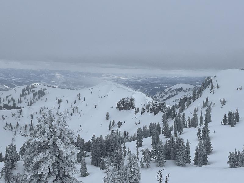
Sensitive cornices can be found along many exposed ridgelines at the mid and upper elevations. Avoid traveling on or below corniced ridgelines as a cornice collapse could - at a minimum - involve a large amount of snow onto the slope below or even trigger a larger and deeper slab avalanche. The photo below is from the Bear River Range to our north, but illustrates the kind of wind-loading and corniced ridges we have in the Ogden-are mountains. (Photo from UAC Logan forecast).
Avalanche Problem #2
New Snow
Type
Location
Likelihood
Size
Description
Triggering an avalanche involving sluffing or soft slabs of new snow is possible on all steep slopes at the mid and upper elevations. Avalanches may fail in one of many different weak layers in the nearly 2' of settled storm snow from this past week.
General Announcements
This information does not apply to developed ski areas or highways where avalanche control is normally done. This forecast is from the U.S.D.A. Forest Service, which is solely responsible for its content. This forecast describes general avalanche conditions and local variations always occur.