Forecast for the Ogden Area Mountains

Evelyn Lees
Issued by Evelyn Lees for
Thursday, March 28, 2019
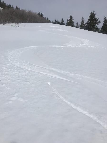
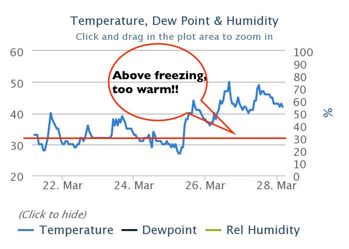
The avalanche danger is MODERATE for wet snow avalanches - both loose sluffs and wet slabs - on all but the upper elevation, northerly facing slopes. Temperatures will remain above freezing at most elevations until tonight.
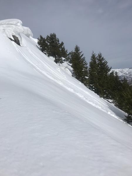
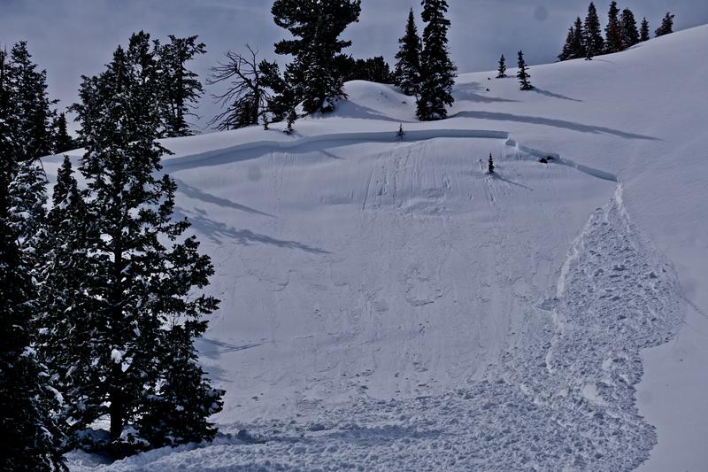
The avalanche danger is also MODERATE on steep mid and upper elevation slopes for triggering a slab of wind drifted snow or storm snow, possibly breaking on surface hoar or facets. These may be triggered at a distance.
Low
Moderate
Considerable
High
Extreme
Learn how to read the forecast here
Special Announcements
We need your help. In an effort to increase awareness and prevent future fatalities we need to reach more people with our daily avalanche forecasts, expand the Know Before You Go program, and increase the number of on-snow avalanche courses. Please consider a donation to the UAC to help us raise $25,000 by April 8. Help your support of the UAC by making a donation HERE. Thank you -
Weather and Snow
The string of warm mornings in the Ogden area mountains continues - it's in the low 40°F at 7,500’ and you pretty much need to hit the high ridge lines for the temperatures to drop below freezing. The southwesterly winds have been cranking overnight at the upper elevations, 40 to 45 mph averages, with gusts in the 50s. Mid elevations have averaged 25 to 30 mph, gusts in the 40s.
A first, weak front will arrive late morning, with a second, colder wave early this evening. Strong winds are expected to continue until about mid morning, when they will shift to the northwest and decrease. Expect convective snow showers to develop this afternoon, with an inch or two of snow possible, with the chance of an isolated thunderstorm. Temperatures will remain warm through midday, slowly cooling this afternoon. - highs will be in the low to mid 40s at 8,000’ and in the upper 20s to low 30s along the highest ridges. The rain/snow line will be around 7,500’. Overnight, a second front moves in, with moderate northwest winds, colder temperatures, and steady snow. 3 to 6” possible by tomorrow morning, with the rain/snow line falling to about 5,000’.
timing is everything - nice turns early in the day on supportable "corn like" crusts. Brian Smith photo
Recent Avalanches
Yesterday. parts of the Ogden area mountains had a very active day of wet loose sluffs on all but high, northerly facing slopes. The largest slides reported released near mid and upper elevation rocky areas, and were wet, loose sluffs large enough to bury a person.
Cornice fall and small wet loose sluff, Brian Smith photo.
Ad
Avalanche Problem #1
Wet Snow
Type
Location
Likelihood
Size
Description
There have been above freezing temperatures for over 72 hours at the mid and low elevations. The wet snowpack will be slow to cool today, and wet loose sluffs and wet slab avalanches are possible on steep slopes of all aspects at the low and mid elevations.
Wet loose sluffs will be easy to trigger on steep slopes anywhere the snow is wet or soggy. Stay on lower angle slopes at the mid and low elevations and avoid travel in and below run out zones. Snow is often extra warm and soggy near rocks or in shallower snowpack areas. Be especially alert for additional heating of the snow if the clouds thin, the wind stops blowing or it rains where you are.
Wet Slabs are the tricky ones - this is when water pools in deeper layers in the snowpack, hiding beneath shallowly frozen crusts. Signs to watch for - collapsing, punchy or bending crusts, or when you are breaking through the crusts. A wet slab can break loose when you think you’re on a supportable frozen snow. Again, avoid this wet snow problem by staying on lower angle slopes at the mid and low elevations.
Below is a 7 day temperature graph from the Ben Lomond Snotel, 7,688'. ° F on the left axis, red line is 32° F
Avalanche Problem #2
Persistent Weak Layer
Type
Location
Likelihood
Size
Description
Preserved surface hoar and faceted, recrystallized snow was buried on the shady terrain of the mid and upper elevations. Audible collapsing was noted prior to Monday's avalanche release, the last reported slide on this layer. Collapsing and avalanches also occurred on this layering in the Cutler Ridge area on Friday. This layering should be viewed as suspect, and slopes should be assessed individually with conservative decision making always a good call. Hopefully, the warm temperatures are getting deep enough into the snowpack
Fortunately, this layering is easy to recognize and test with both compression and extended column tests. Collapsing and cracking are sure signs of instability. These may be triggered remotely. Photo of Perry Reservoir area slide from Monday below - observation HERE.
Avalanche Problem #3
Wind Drifted Snow
Type
Location
Likelihood
Size
Description
Expect hard slabs of wind drifted snow both along the ridge lines and well off ridge lines. The southerly winds have been eroding and drifting snow for over 24 hours. The drifts will be most widespread on upper elevation, northerly facing slopes, but scattered drifts will also be found at the mid elevations and cross loaded around sub ridges and mid slope break overs. Wind drifts can be hard and supportable or cracky, and often look smooth and rounded.
Cornices are too large to tangle with or try to intentionally trigger. Avoid these monsters.
General Announcements
This information does not apply to developed ski areas or highways where avalanche control is normally done. This forecast is from the U.S.D.A. Forest Service, which is solely responsible for its content. This forecast describes general avalanche conditions and local variations always occur.