Donate to the 2024 Spring Campaign to help rebuild the UAC website.

Forecast for the Ogden Area Mountains

Greg Gagne
Issued by Greg Gagne for
Sunday, March 19, 2023
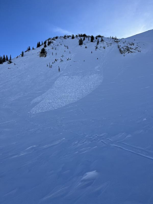
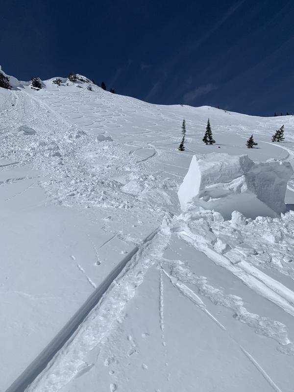
The avalanche danger is MODERATE at the upper elevations on aspects facing northwest through northeast and southeast where you can trigger avalanches in recent and fresh slabs of wind-drifted snow. Watch for cracking as a sign of unstable conditions. The danger is LOW elsewhere.
Also watch for loose, wet avalanches if the snow surface becomes damp from warmer temperatures.

With heavy snowfall forecast beginning tonight, expect a rising avalanche danger on Monday and into this week.
Low
Moderate
Considerable
High
Extreme
Learn how to read the forecast here
Special Announcements
Please consider donating to the spring campaign to help our team implement innovative tools to better provide you with the information you rely on.
Weather and Snow
This morning: Skies are partly cloudy and temperatures are in the upper teens F. Winds are from the south/southwest and are moderate to strong above about 8,500' averaging in the 20's mph with stronger gusts.
Today: Temperatures will rise into the upper 30's F, although it will feel cooler in wind-exposed locations where the south/southwest winds will average in the teens and 20's mph with stronger gusts. Skies will become partly to mostly-cloudy.
This Week: Apparently, the mountains didn't get the calendar alert that Monday is the first day of Spring. The National Weather Service has issued a winter storm warning beginning at 9 pm tonight and lasting through Tuesday morning with snowfall totals of 1-2 feet by Tuesday likely. A brief break followed by a second storm later this week.
Recent Avalanches
The southerly winds increased on Saturday morning and lasted through late afternoon, creating small pockets of sensitive wind drifts in exposed, upper elevation terrain. Although we received no reports from the Ogden mountains, further to our south in the the Salt Lake mountains, there were reports of small, skier-triggered slides in these fresh wind drifts, including two riders caught and carried on a west aspect at 10,200' on Red Baldy where one rider was carried 50' and a second rider carried 150' in a slide that was only 3" deep and 80' wide (photo below). There was also a natural cornice fall in Cardiff Fork in Big Cottonwood Canyon.
Ad
Avalanche Problem #1
Wind Drifted Snow
Type
Location
Likelihood
Size
Description
Today's south/southwest winds will create fresh slabs of wind-drifted snow at the upper elevations. Although these drifts should be shallow (less than 12") and not very wide (less than 50'), I am expecting any fresh drifts to be as sensitive as they were on Saturday. Watch for cracking in these recent and fresh wind drifts as an indication of instability.

Today's strong winds will also add heft and sensitivity to the already-immense cornices that adorn most mid and upper-elevation ridgelines. On Saturday, a cornice collapsed naturally onto a southwest aspect off Cardiff Peak, leaving large, dense blocks of snow below the slope (photo below). It is possible that a natural or human-triggered cornice fall could trigger a larger avalanche on the slope below. I would avoid traveling underneath any corniced ridgeline and stay well back from the edge when traveling along ridges with cornices.
Avalanche Problem #2
Wet Snow
Type
Location
Likelihood
Size
Description
I'm unsure of how wet the snow surface will become today. On one hand, this past week's storm snow has seen three days of sunshine and has adjusted to the warming and today's stronger winds should keep the snow surface cool. However, today's temperatures will rise to well-above freezing and cloud cover may create some greenhousing. Watch for signs of unstable wet snow such as rollerballs and long-running sluffs of wet snow.
Additional Information
For those considering visiting the alpine terrain in the southern Wasatch, Mark Staples provides an assessment of the current snowpack and how it is not as straightforward as we may expect.
General Announcements
This information does not apply to developed ski areas or highways where avalanche control is normally done. This forecast is from the U.S.D.A. Forest Service, which is solely responsible for its content. This forecast describes general avalanche conditions and local variations always occur.