UDOT PLANNED AVALANCHE CLOSURES!!

Forecast for the Ogden Area Mountains

Greg Gagne
Issued by Greg Gagne for
Saturday, March 18, 2023
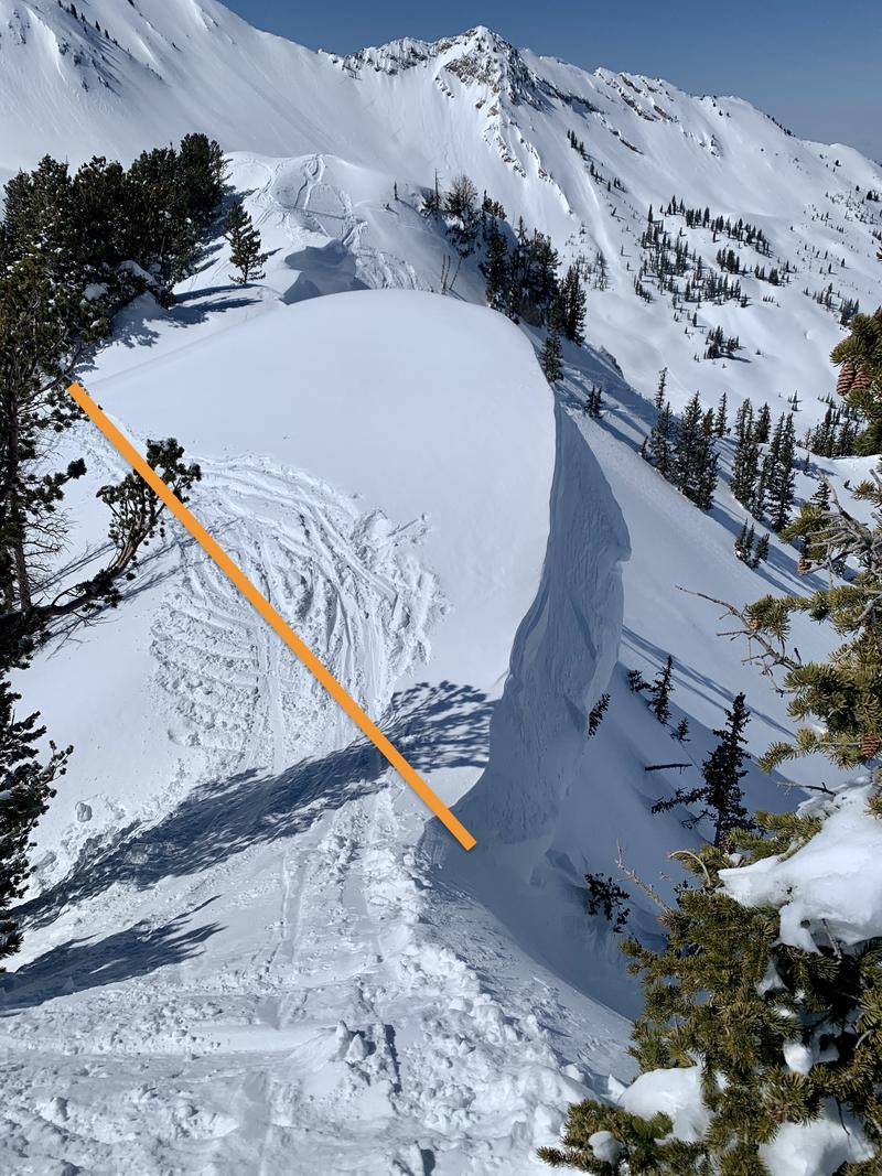
The avalanche danger is mostly LOW with areas of MODERATE at the upper elevations where you can trigger avalanches failing in dense slabs of recent storm snow and wind-drifted snow.
Sunshine today will increase the risk of wet, loose avalanches on steep slopes facing southeast through west.

Roof-a-lanches are a hazard this season in our mountain communities. Do not let children play in the snow underneath steep roofs loaded with snow.
Low
Moderate
Considerable
High
Extreme
Learn how to read the forecast here
Special Announcements
Please consider donating to the spring campaign to help our team implement innovative tools to better provide you with the information you rely on.
Weather and Snow
This morning: Skies are clear and temperatures range through the mid teens F. Winds are generally from a south/southeast direction and light, around 10 mph, but there was a period overnight with gusts into the 20's mph at the upper elevations.
Today: Temperatures will rise into low to mid 30's F and the east/southeast winds will remain light, gusting into the teens at the upper elevations. Skies will be mostly sunny.
Looking ahead: Skies will cloud over on Sunday and winds will increase, ahead of a storm late Sunday and into Monday. A possible break on Tuesday before yet another storm for late this coming week.

Many southerly-facing slopes will have a crust from sunshine the past two days.
Recent Avalanches
There were no reports of avalanches on Friday from the Ogden area mountains.

On Wednesday in the town of Alta, a child playing with a group of friends in the snow was buried underneath an avalanche that came down from a steep roof above. Fortunately, through an efficiently-organized recovery effort, the child was dug out and survived. These are appropriately called "roof-a-lanches" and will remain a hazard in our mountain communities this Spring. Do not let children play in the snow underneath steep roofs filled with snow. Please share this message.
Ad
Avalanche Problem #1
Wind Drifted Snow
Type
Location
Likelihood
Size
Description
You can find soft slabs of wind-drifted snow on isolated slopes at the upper elevations - and I think you are most likely to find reactive wind drifts in terrain where graupel (snow grains shaped like pellets) has pooled, such as below cliff bands.

Cornices are huge and may become sensitive to the strong sunshine. Give cornices a wide berth as they often break farther back than expected. Cornices are signs that a slope has been wind loaded and a cornice fall could trigger a larger slab of wind-drifted snow below. The photo below provides an example of where a cornice might break back.
Avalanche Problem #2
Wet Snow
Type
Location
Likelihood
Size
Description
Snow from the mid-week storm has now seen two days of strong sunshine and I'm expecting less wet avalanche activity today, but today will be warmer than the past two days and am therefore expecting some wet loose avalanche activity on the solar aspects: those slopes facing southeast through west. Watch for signs of unstable wet snow such as rollerballs.
Additional Information
For those considering heading to the alpine terrain in the southern Wasatch, in this video, Mark Staples provides an assessment of the snowpack in the southern Wasatch and how it is not as straightforward as we may expect.
General Announcements
This information does not apply to developed ski areas or highways where avalanche control is normally done. This forecast is from the U.S.D.A. Forest Service, which is solely responsible for its content. This forecast describes general avalanche conditions and local variations always occur.