Currently: Temperatures in the Ogden mountains range through the 20's and low 30's F, with a few outlying low elevation stations in the upper 30's F. Westerly winds continue to highlight the weather, with averages in the 20's and 30's mph at the mid and upper elevations, with gusts in the 40's and 50's at the upper elevations. 1-3" of new snow has fallen in the past 24 hours, but with the strong winds most of this new snow ended up quickly getting transported into fresh wind-drifts. Many exposed aspects facing southwest at the upper elevations have been scoured from the sustained southwesterly winds.
For Today: Snow showers are possible today, and we'll be lucky to pick up 1-3” of new snow. Skies will be partly to mostly cloudy and temperatures warming into the mid and upper 30’s F. Winds will continue to blow out of the west, averaging in the 20's and 30's mph at the mid and upper elevations, with stronger gusts. At the upper elevations gusts will exceed 50 mph.
For this Coming Week: A mild westerly flow with warm temperatures and windy conditions. We may pick up a trace to 1" of new snow every occasional 12-hour period - perhaps up to 2" on Wednesday. A hint of a promising colder storm late Thursday/Friday, but waiting for weather models to come into agreement before we get any confidence in that system.
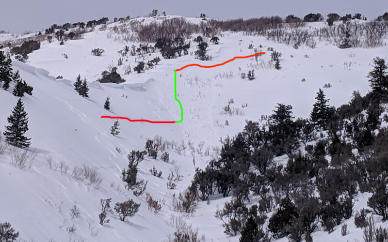
An experienced rider intentionally triggered a wind slab on an east aspect on North Ogden Divide on Monday, briefly taking a ride before exiting the slide. You can read more about this occurrence on this
link. [Photo: ogdenavalanche.org]
We also received an excellent observation from Cutler Ridge by Derek DeBruin (
link). I especially appreciate the comment "The avalanches from yesterday (Sunday) left us suspicious and conservative in our route selection" as recent avalanches are the reddest of the red flags!
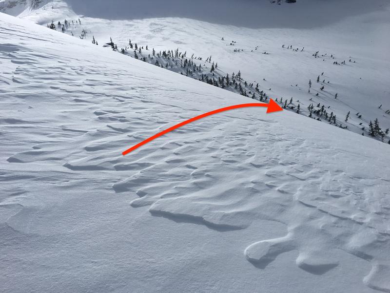
Mitigation work at Ogden-area resorts was limited as it was difficult to get into upper elevation terrain, but reports of small naturals from cornice falls were reported.