Forecast for the Ogden Area Mountains

Trent Meisenheimer
Issued by Trent Meisenheimer for
Wednesday, February 21, 2024
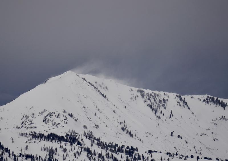
Today the avalanche danger is CONSIDERABLE across all mid and upper-elevation steep slopes for both Wind-Drifted Snow and a Persistent Weak Layer avalanche problem. Avalanches can fail 1-3 feet deep and hundreds of feet wide. The avalanche danger is also CONSIDERABLE for Wet-Snow avalanches across the low and mid-elevations. Avoid being in or underneath avalanche paths, as avalanches can travel long distances.
Careful route-finding and conservative decision-making will be essential today.
Low
Moderate
Considerable
High
Extreme
Learn how to read the forecast here
Special Announcements
Join the UAC and Inspired Summit Adventures for the grand opening of our new Transceiver Training Park at Pinebrook, Sunday, February 25, from 3:00-6:00PM.
Weather and Snow
Under a moist southwest flow, it continues to snow in the mountains with another 4-6 inches (0.65-1.50" swe) of new snow in the past 24 hours. The wind remains from the southwest and blows 20-30 mph with gusts into the 30s & 40s across the upper elevations. Mountain temperatures range from 25-35 °F, and I suspect the rain/snow line is still hovering around 7,500'.
Today, we can expect more heavy snowfall in the morning, with 1-2 inches per hour rates. This storm is a giant mess of moisture, and a lot will depend on where the wave sets up and produces snow. One model this morning shows 2.5" of snow throughout the day, while another shows 15 inches. Take your pick. Snowfall will begin to decrease after lunch. Temperatures will decrease as well throughout the day as the wind shifts to the west and finally to the northwest later this evening. Winds will remain at elevated speeds of 15-25 mph throughout the day.
The best riding and turning conditions are found at the mid and upper elevations, where the snow is cold and dry.
Recent Avalanches
Yesterday, there were no recent avalanches or observations submitted. However, local Doug Wewer took a nice photo on Monday of wind transport off Ben Lomond (pic below).
Ad
Avalanche Problem #1
Wind Drifted Snow
Type
Location
Likelihood
Size
Description
Strong wind and heavy snowfall have created unstable avalanche conditions across many aspects and elevations. Strong wind has whipped up the new snow, creating sensitive soft or hard slabs of wind-drifted snow. Avalanches could fail 1-3 feet deep on a variety of density changes within the recent storm snow.
I would wait and let the snowpack settle over the next few days before venturing on or underneath steep terrain. As Drew Hardesty classically said last year, "The glue is yet to dry."
Avalanche Problem #2
Persistent Weak Layer
Type
Location
Likelihood
Size
Description
On Valentine's Day, we buried and preserved a thin crust with faceted snow above or below it. This crust can be found by digging down 1-3 feet deep. This setup has caused avalanches over the past week. The issue is complicated as it varies from slope to slope and by elevation. Because of this, I recommend avoiding steep south-facing terrain for now. Plenty of power on the north side of the compass where this layer does not exist.
Avalanche Problem #3
Wet Snow
Type
Location
Likelihood
Size
Description
Warm temperatures, along with a rain/snow line that ebbs and flows to 7,500', means we may see wet-loose avalanches today. Roller balls, pinwheels, and sinking into the surface snow are all signs of instability.
Natural avalanches can start way up high as dry snow and turn wet as they travel downhill, picking up the damp and saturated snow. Avoid being in run-out zones and in any terrain trap across the lower elevations today.
General Announcements
This information does not apply to developed ski areas or highways where avalanche control is normally done. This forecast is from the U.S.D.A. Forest Service, which is solely responsible for its content. This forecast describes general avalanche conditions and local variations always occur.