Forecast for the Ogden Area Mountains

Greg Gagne
Issued by Greg Gagne for
Friday, December 29, 2023
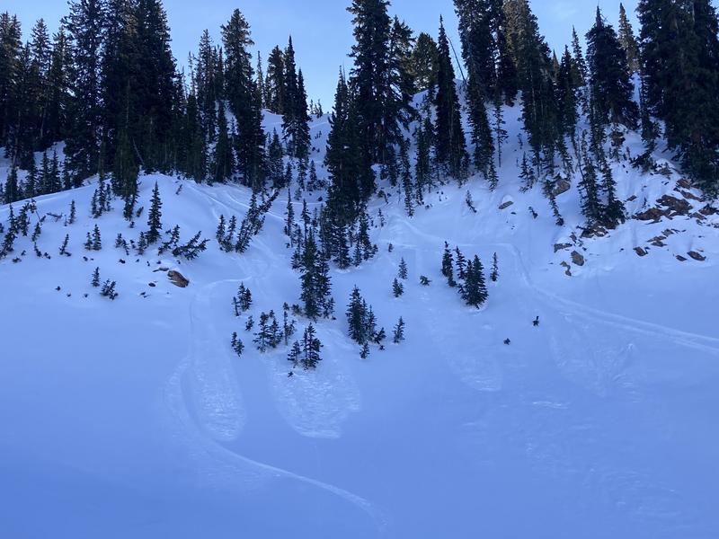
The avalanche danger is LOW and traveling with normal caution is advised when traveling in avalanche terrain. Watch for sluffing in the dry/loose snow surface on steep shady slopes and in isolated areas at the upper elevations, you may encounter shallow slabs of wind-drifted snow.
Low
Moderate
Considerable
High
Extreme
Learn how to read the forecast here
Special Announcements
To fulfill our mission, the UAC relies on our amazing backcountry community. Your support helps pay for the daily avalanche forecast, free awareness presentations across the state, and new tools like the new Avalanche and Observation Explorer. As the end of the year approaches, please consider donating to the UAC.
Weather and Snow
This morning: temperatures are in the low to mid 30's F and winds are from the west and light, less than 10 mph.
Today: mostly sunny skies with temperatures rising into the upper 30's F. Winds will be from the southwest and remain light but will increase overnight and into Saturday.
General Outlook: The next chance for snow is 8-10 days out.

On Thursday, my partner and I wandered throughout North Park, Black Canyon, and Cutler Ridge and found a supportable snowpack with easy travel, with the recrystallized snow at the surface (often called "recycled powder" or "square powder") providing decent riding conditions.
Recent Avalanches
Other than continued sluffing in the weak snow at the surface, no backcountry avalanches were reported from Thursday.
Ad
Avalanche Problem #1
Normal Caution
Type
Location
Likelihood
Size
Description
The avalanche danger is low and applying normal caution when traveling in avalanche terrain is advised. Although avalanches are unlikely, they are not impossible. In isolated areas, you may encounter:
  • Shallow, soft, and hard slabs of wind-drifted snow along the highest ridgelines. These slabs are most common on north, east, and southwest-facing slopes. Soft slabs may exhibit shooting cracks and are typically sensitive to triggers. Hard slabs, however, can be smooth and round and might not release until you’re well onto the snow surface.
  • Long-running, loose, dry sluffs (see photo below) on steep, shady, wind-protected slopes as the snow surface continues to weaken.
  • A larger avalanche breaking down into faceted snow in steep, thin, rocky terrain on aspects facing northwest through east.

Remember that low danger is not the same as no danger. Read more about the Danger Ratings HERE.
General Announcements
This information does not apply to developed ski areas or highways where avalanche control is normally done. This forecast is from the U.S.D.A. Forest Service, which is solely responsible for its content. This forecast describes general avalanche conditions and local variations always occur.