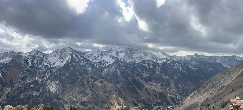
A cold front moving through Utah will bring significant snowfall to the mountains, with 6–12 inches expected at the upper elevations, and up to 18 inches in favored zones like upper Little Cottonwood Canyon. Snow levels will drop to around 5,000 feet, bringing light accumulation to higher valleys, especially in southwest Wyoming and the Wasatch Back. The Wasatch Front is expected to see minimal snow, though lake-effect snow could add some accumulation west of Salt Lake. Temperatures will be 10–20 degrees below normal. This snow will be falling on 1–3 inches of damp snow or bare ground across most of the range.
So far, the season has been quiet, with snow lingering from the October 17–18 storm. Rough totals for snowfall and snow water equivalent (SWE) from that storm include:
- Little Cottonwood Canyon (LCC): 8" snow / 1.5" SWE
- Big Cottonwood Canyon (BCC): 8" snow / 1.8" SWE
- Park City (PC): 4" snow / 1.65" SWE
- Ogden: 1–3" snow / 1–2" SWE
- Provo: 6–12" snow / 2.0" SWE
Through the weekend, another cold, wet weather system will bring fall-like conditions to Utah, with cooler temperatures across the region. Thursday will start with warmer, breezy weather as the system moves inland, bringing light showers to far northern Utah near the Idaho border. By the weekend, temperatures will range from the mid-40s to mid-50s in Salt Lake City.
This storm could lay down our first weak layer of the season, though it’s too early to worry just yet. As you get out, take note of where snow melts and where it sticks around. Snow that doesn’t melt could become a problem layer for future avalanches.
For now,
it’s hardly worth getting your skis or sled out—hiking boots will do. Snow depth across the Wasatch is generally under 10 inches, and the main hazard is hitting rocks or other ground obstacles.
North-facing terrain of Alta and Snowbird, looking west toward the Pfeifferhorn and Coalpit Headwall. Photo by Drew from his field day yesterday up Cardiff.
We've received a few snow and avalanche observations as people start getting out. Find them
HERE.


