Forecast for the Moab Area Mountains

Eric Trenbeath
Issued by Eric Trenbeath for
Tuesday, April 9, 2024
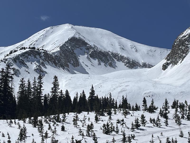
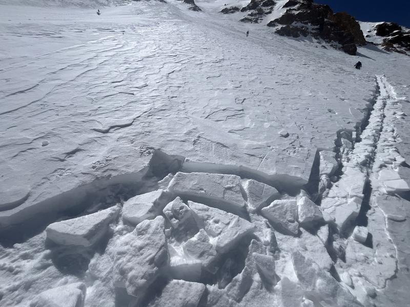
The avalanche danger is generally LOW. Small avalanches remain possible on isolated terrain features or in areas of extreme terrain. Be on the lookout for stiff, shallow deposits of wind drifted snow.
There are some slick, hard surfaces out there and slide for life conditions may exist. Stay situationally aware and consider carrying tools for self arrest if venturing into larger, steeper terrain.
As temperatures increase throughout the week, so will the likelihood for loose wet activity.
Low
Moderate
Considerable
High
Extreme
Learn how to read the forecast here
Special Announcements
Road Conditions: The Geyser Pass road is melted out down to the dirt.
Grooming: Grooming is done for the season.
Weather and Snow
6:00 a.m. Snow and Weather Data
24 Hour Snow 0" 72 Hour Snow 2" Season Total Snow 192" Depth at Gold Basin 59"
Winds on Pre-Laurel Peak: ENE 5-10 Temp 16° F Percent of Normal: 125%

Weather
NE winds overnight have been light, skies are clear, and it's 16° in Gold Basin. Today look for sunny skies, light NE-NW winds, and high temps in the mid to upper 30's. Dry and increasingly warmer weather is on tap through the week.
General Conditions
Truth be told it's not that good up there but with the current weather pattern we could see corn snow developing on mid and low elevation, southerly aspects by tomorrow or Thursday. Wind and dust over the weekend did a number on the snow surface which, for the most part, consists of a variety of crusts, and textured or hard surfaces. Sun exposed slopes will become damp today and although I don't expect much loose, wet activity yet, it's something to keep an eye on.
Conditions on Mount Tukuhnikivatz or Tuk (pronounced touque). Many folks this time of year set their sites on this iconic mountain. If you are set on going up, be prepared for challenging conditions including firm snow, breakable crusts, and possibly some isolated, shallow, stiff wind slabs. Ski crampons will be helpful on the skin up, and carrying a tool for self arrest is recommended.
You can see from the photo above that it's pretty wind affected up there. An ascent and descent of Tuk right now will definitely build character. It's not an easy undertaking in these conditions. And although the snowpack is mostly stable, even a small triggered wind slab up there could sweep you off your feet and take you for a gnarly ride.
Snowpack and Weather Data
Gold Basin Storm Stake (10,000')
Gold Basin SNOTEL site (10,000')
SNOTEL site near Geyser Pass Winter Trailhead (9600')
Wind Station on Pre-Laurel Peak (11,400')
NWS forecast for the La Sal Mountains.
Recent Avalanches
Click here to see the La Sal avalanche database. Prudent backcountry travelers will want to know what slopes have previously avalanched, as some of these slopes hold shallow, weak snow.
Ad
Avalanche Problem #1
Normal Caution
Type
Location
Likelihood
Size
Description
Most terrain has LOW danger. LOW doesn't mean NO however. Here are a few things to be aware of:
  • Isolated, shallow stiff slabs of wind drifted snow are lurking about. They aren't going to bury you, but they could be problematic, especially in areas of extreme terrain where a shallow slab release could sweep you off your feet and carry you over a cliff. If you find the snow breaking up into blocks like this, you've found a wind slab. Most are pretty well stuck into place but it's something to keep an eye out for.
  • Slick, hard snow surfaces exist and slides for life are possible. Stay aware of your situation and your exposure. Consider carrying tools for self arrest if you plan to venture into larger, steeper terrain.
  • With warmer temperatures ahead, we'll have to start paying attention to loose wet activity on sun exposed slopes.
  • Areas with poor snowpack structure, or in other words, weak faceted snow under old wind slabs can still be found out there. More the exception than the rule, you can nevertheless find this structure in repeat running slide paths, along wind swept ridges, and along wind scoured slope margins near rocky outcrops. If you are getting into higher, more extreme terrain, it's worth poking around and looking for this weak structure, and maybe reconsidering your line if you find it.
Additional Information
Want some more insight into the La Sal Mountains as well as the communal impacts of a tragic avalanche? Check out the latest UAC podcast with forecaster Eric Trenbeath where he discusses the range, it's often treacherous snowpack, and how the devastating avalanche in February, 1992, affected the Moab community.
Our avalanche beacon checker sign and beacon training park are up and running. A huge thanks to Talking Mountain Yurts for sponsoring those this season!
Sign up for forecast region-specific text message alerts. You will receive messages about changing avalanche conditions, watches, warnings and road plowing closures.
Follow us on Instagram @utavy_moab
General Announcements
This forecast is from the U.S.D.A. Forest Service, which is solely responsible for its content. This forecast describes general avalanche conditions and local variations always occur.