Donate to the 2024 Spring Campaign to help rebuild the UAC website.

Forecast for the Moab Area Mountains

Eric Trenbeath
Issued by Eric Trenbeath for
Monday, April 15, 2019
Special Announcements
I've stopped issuing regular forecasts for the season but that doesn't mean the end of avalanches. I will continue to update this forecast with basic information and problems to look for after significant weather events through the end of the month. You can also use the weather links below.
It's been quite a year with lots of snow, and more than a few avalanches. I would like to thank everyone who helped out this season including local business sponsors Moab Gear Trader, Talking Mountain Yurts, and ROAM Industry. Your continued support is greatly appreciated! I would also like to thank our local observers and volunteers. It's great to have such a solid crew of engaged and knowledgeable folks out skiing, riding, and looking at the snow. Your information is invaluable, and it has really helped me up the level of my forecasts! And finally, I want to thank Voile for transporting me through the snow, and Arva for providing me with some extra security with their Reactor Airbag System. Looking forward to seeing you all next year!
Weather and Snow
New snow totals in Gold Basin (10,000')
Snotel totals at the Geyser Pass Trailhead (9600')
Winds at 11,000 feet on Abajo Peak (11,330') about 45 miles south.
National Weather Service point forecast.
Recent Avalanches
It was an active season for avalanches in the La Sals this year. For a partial list of avalanches go here.
Ad
Avalanche Problem #1
Normal Caution
Type
Location
Likelihood
Size
Description
It's full spring and I've stopped issuing regular forecasts but that doesn't mean the end of avalanches. Changing weather including new snow, wind, warm weather, and nights without a refreeze can significantly affect the snowpack causing a change in avalanche conditions. These are the problems you are going to want to look out for:
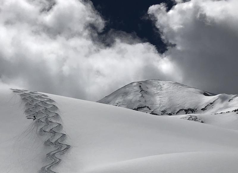
Wet snow: With a strong sun and warm temperatures, wet snow avalanches are often the primary concern in the spring. Both loose wet, and wet slab avalanches are possible this time of year. As the day heats up the snow becomes saturated as it begins to melt and water runs through the snowpack. Work with the sun and get off of steep slopes as they become wet and sloppy. Signs of instability include roller balls, pinwheels, and loose snow point releases or sluffs. Several nights without a refreeze contribute greatly to snow instability making wet slab avalanches more likely. Pay attention to overnight low temperatures, and if the snow feels punchy and unsupportable, even first thing in the morning, it's not a good to day to be in the mountains.
New Snow: Spring storms can bring significant amounts of new snow to the mountains, and anytime we get about 6" or more we have to start looking at the possbility for avalanches wiithin the new snow. New snow avalanches can occurr as loose, dry sluffs that run on the underlying slick surface, or as soft, cohesive slabs that have bonded poorly. Even small sluffs can be problematic in the wrong place as they could sweep you off your feet and carry you into trees or over a cliff. Soft slabs, even shallow ones can pack even more of a punch. Signs of instability include cracking in the snow surface and other avalanches.
Wind Drifted Snow: Wind moves snow around creating unstable drifts on the leeward sides of ridge crests and terrain features. Snow starts moving with wind speeds above 15 mph, and the stronger the winds, the more snow gets moved. Wind drifts are recognizable by their smooth, rounded appearance and often feel hollow undernearth. Wind slabs can be soft or hard and they tend to stabilize after a few days, but they can sometimes linger for a week or even longer. And like loose snow sluffs, even a shallow wind slab can be problematic in consequential terrain. Learn to recognize and avoid steep, wind drifted slopes.
General Announcements
Your information can save lives. If you see anything we should know about, please help us out by submitting snow and avalanche observations HERE. You can also call me at 801-647-8896, or send me an email: [email protected].
Support the UAC through your daily shopping. When you shop at Smith's, or online at REI, Backcountry.com, Patagonia, NRS, Amazon, eBay by clicking on these links, they donate a portion of your purchase to the UAC. If you sell on eBay, you can have your See our Affiliate Page for more details on how you can support the UAC when you shop
This forecast is from the U.S.D.A. Forest Service, which is solely responsible for its content. This forecast describes general avalanche conditions and local variations always occur.