Forecast for the Moab Area Mountains

Eric Trenbeath
Issued by Eric Trenbeath for
Friday, April 1, 2022
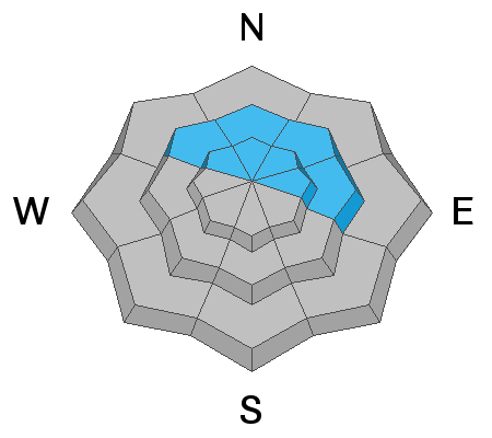
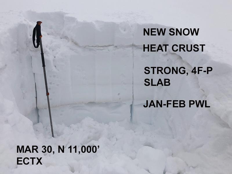
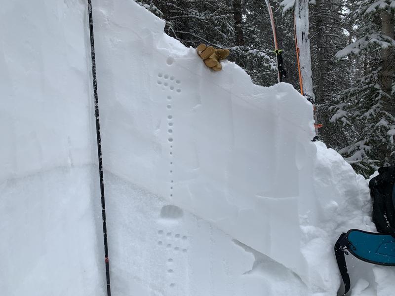
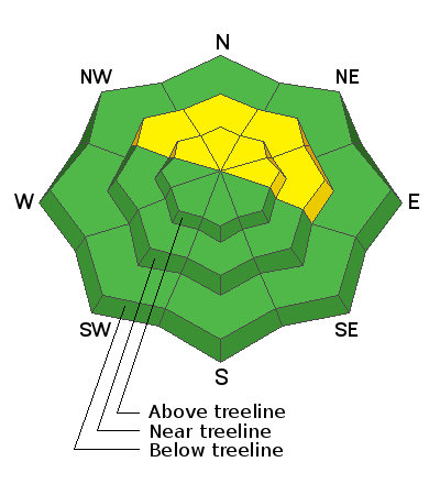
The snowpack has gained a lot of strength since the big meltdown, and we are finally turning the corner toward stable conditions. An isolated or MODERATE avalanche danger remains on steep slopes facing NW-N-NE-E, where human triggered avalanches failing on a buried persistent weak layer remain possible. This is a low probability, high consequence scenario with the greatest danger existing on steep, complex terrain right around treeline. In addition, mid-week snow and wind formed drifts on all aspects above treeline. Remain on the lookout for unstable drifts on the leeward sides of terrain features such as ridge crests, sub-ridges, and gully walls, particularly in areas of more consequential terrain. Most other terrain has generally LOW danger.
As we turn this corner into greater stability, continue to be mindful of terrain complexities such as steep convexities and blind break overs. Practice safe travel techniques and only expose one person to danger at a time.
Low
Moderate
Considerable
High
Extreme
Learn how to read the forecast here
Special Announcements
We'd like to thank our incredible community for your support of the 2022 Spring Campaign. We raised $75,000 in two weeks to help grow our avalanche forecasting program. Thank You!
Road Conditions: The road is a mix of dirt and mud down low and a few inches of snow up high. It gets sloppier as the days warm up. All wheel drive and good tires are recommended.
Grooming: Trails into Gold Basin were groomed on Wednesday.
Weather and Snow
6:00 a.m. weather data:
24 Hour Snow 1" 72 Hour Snow 4" Base Depth at Gold Basin 57" Wind WNW 5-15 Temp 26F
The mountains picked up a little over an inch of snow last night bringing totals up to 9" since Monday. Today we'll see sunny skies, light NW winds, and high temps rising into the mid to upper 30's. Saturday will again see sunny skies with temps in the mid 40's. Clouds should develop Saturday night ahead of a shortwave trough tracking through the Northern Rockies, followed by another low pressure system on Monday. Neither of these look like they will produce much snow for us.
Snowpack
You should be able to find some good riding and turning conditions out there today on sheltered, and upper elevation northerly aspects. After the big meltdown over the weekend, mountain temperatures this week have remained cool, but solar aspects have seen enough sun to crust over. NW winds mid-week mostly affected only the highest elevations, but they were blowing and drifting snow as well as scouring and lightly crusting some exposed surfaces. In our travels on Wednesday, we found fresh drifts 12"-18" deep on leeward, southerly facing slopes, while cross-loading was also occurring on N-NE aspects. Most of these drifts should be stuck in place today, but keep an out for them, on the leeward sides of terrain features, especially in consequential terrain.
The Jan-Feb persistent weak layer is still present though stability tests are consistently showing the layer to be non-reactive. I feel safe in saying that we have moved into a low probability, but nevertheless, high consequence scenario. The weakest snow exists right around treeline, and steep, complex, featured terrain in this zone is where you are most likely to find trouble.
Snow and Weather Links
Gold Basin SNOTEL site (10,000')
Storm Totals in Gold Basin
Wind Station on Pre Laurel Peak (11,700')
Ad
Avalanche Problem #1
Persistent Weak Layer
Type
Location
Likelihood
Size
Description
A persistent weak layer of faceted snow still exists near treeline and above on NW-N-NE-E aspects beneath a slab that is 2'-3' thick. Time and recent warm temperatures have helped this layer to gain strength. Up in the alpine on Wednesday, we found a strong, stiff slab overlying the weak layer and an extended column test produced no results for a score of ECTX. This has become the trend and I feel safe in saying that we have moved into a low probability, but nevertheless, high consequence scenario. The weakest snow exists right around treeline, and steep, complex, featured terrain in this zone is where you are most likely to find trouble.
We dug this snowpit up in the alpine on Wednesday. The weak layer is still present but it is much less loose, and sugary, and the overriding slab is very strong. Stability tests produced no failure and we felt good about the terrain we were in. Right around treeline the layer is more pronounced, and that's where you are most likely to find trouble. If you are branching out into bigger terrain, dig some holes and perform your own tests.
Dave Garcia dug this snowpit on Tuesday near treeline on a NE aspect just over 11,000'. Here the weak layer remains dry and loose but it did display signs of strengthening while the overriding slab is also very stiff and strong. Stability tests produced no results. Read his complete observation here.
General Announcements
Who's up for some free avalanche training? Get a refresher, become better prepared for an upcoming avalanche class, or just boost your skills. Go to https://learn.kbyg.org/ and scroll down to Step 2 for a series of interactive online avalanche courses produced by the UAC.
This forecast is from the U.S.D.A. Forest Service, which is solely responsible for its content. This forecast describes general avalanche conditions and local variations always occur.