Sign Up for the Utah Snow and Avalanche Workshop (USAW) on December 7th!

Observation: Gold Basin

Observation Date
3/29/2022
Observer Name
Garcia
Region
Moab » Gold Basin
Location Name or Route
Funnel, Tele Gold
Weather
Sky
Obscured
Precipitation
Light Snowfall
Wind Direction
Southwest
Wind Speed
Light
Weather Comments
Sky was obscured for most of the day. Light snowfall accumulated 1 inch during the day. The sun came out for maybe 30 minutes around 4 PM.
Snow Characteristics
New Snow Depth
5"
New Snow Density
Medium
Snow Surface Conditions
Powder
Dense Loose
Snow Characteristics Comments
5 inches of medium density snow containing a fair bit of graupel.
Red Flags
Red Flags
Poor Snowpack Structure
Red Flags Comments
The faceted layer is still identified in snow pits. The warm temperatures over the weekend and subsequent freezing have helped the weak layer gain some strength.
Avalanche Problem #1
Problem
Wind Drifted Snow
Trend
Same
Problem #1 Comments
South winds quickly backed off this morning and did not blow as advertised. I observed no snow transport today. It helps that the new snow came in warm and moist, and would take some strong wind to blow around. More snow and wind in the forecast tonight, we'll see how that plays out.
Avalanche Problem #2
Problem
Persistent Weak Layer
Trend
Decreasing Danger
Problem #2 Comments
On northerly facing slopes, the buried persistent weak layer did not get saturated by water during the recent heat wave. I found a dry snowpack on Northerly slopes near and above treeline. I got an ECTX in a NE facing pit at 11,060'. I found a strong slab sitting above the weak layer. The faceted weak layer was showing signs of rounding and was more cohesive than in previous pits.
Snow Profile
Aspect
Northeast
Elevation
11,100'
Slope Angle
37°
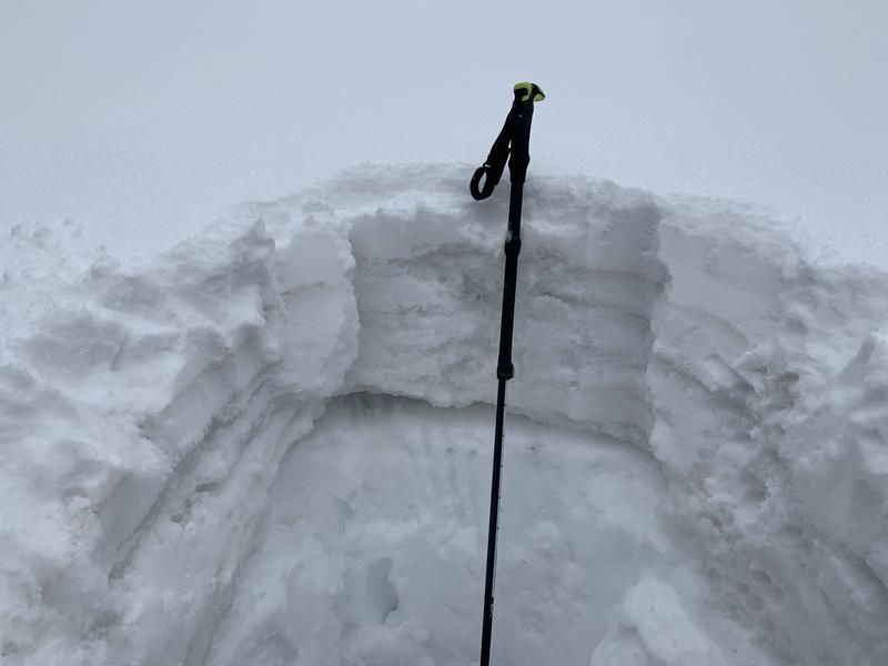
Photo 1: NE facing pit wall at 11,060' showing the hand hardness
Photo 2: The buried persistent weak layer showing signs of rounding. The grid on the crystal card is 3mm.
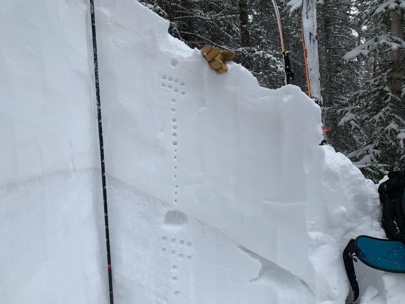
Photo 3: A west facing pit at 10,400'. I found a layer of wet facets (partially frozen) 40cm below the surface. Another night of below freezing temperatures should have this layer locked up tomorrow.
Today's Observed Danger Rating
Moderate
Tomorrows Estimated Danger Rating
None
Coordinates