24 Hour Snow 0" 72 Hour Snow 0" Base Depth in Gold Basin 66" Wind NW 15 G17 Temp 15F
Yesterday, high temperatures were near 48F and southerly winds averaged about 30 mph, with gusts in the 40-mph range until backing off and wrapping around to the NW. Today, expect clearing skies with a high temperature near 30F and NW winds 10-15 mph. Dry and warming conditions prevail through the rest of the week.
Snowpack Discussion
Warm temps and a strong March sun have rapidly settled last week's snow. Today, sun-exposed slopes will contain a supportive melt-freeze crust following a strong freeze last night. Many slopes on the southerly side of the compass have produced numerous small wet-loose activity over the last few days.
Southwest winds during the height of the storm last Thursday drifted snow onto leeward slopes forming slabs 24"-30" thick near and above treeline. Additionally, yesterday, I observed drifting snow, but not to a significant extant due to the lack of snow available for transport.
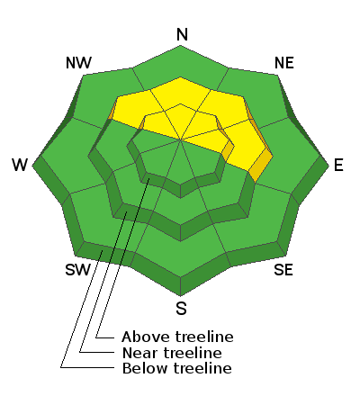
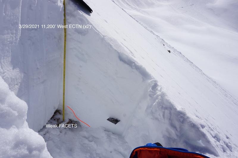
Digging deeper into the snowpack, we still have a deep persistent slab problem. Weak, sugary, faceted snow still exists near the ground, especially at higher elevations on NW-E aspects. This weak layer is stubborn-to-trigger in areas where the snow is deeper than about 6'. However, in shallow snowpack areas, the additional weight of a rider could affect these buried weak layers. Slopes with steep convexities and rocky, more radical terrain are where you are most likely to trigger an avalanche failing on weak, faceted snow.
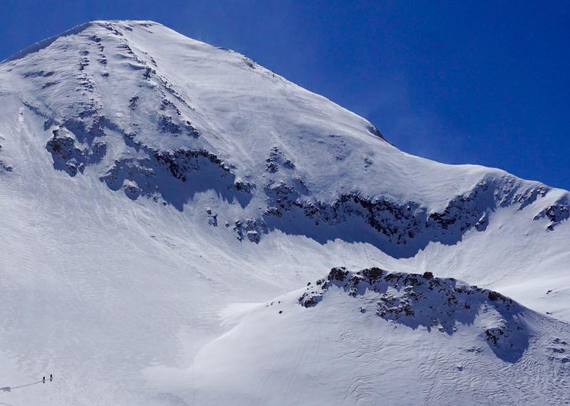
A lot of terrain in this photo remains problematic. Rock bands, steep convexities, and thin snowpack areas abound. These are likely trigger points for an avalanche where even a relatively small slide could have devastating consequences. The complex terrain features are also subject to wind-loading and cross-loading can occur from a variety of wind directions.
Remember to practice good travel techniques: spacing out or crossing one at a time can help limit your exposure. Choose safe places to dig snowpits that limit your exposure to overhead hazard.
As the photo illustrates, sometime we let our guard down, but, these best practices can save your life in the event that your stability assessment is wrong.
Yesterday, I observed a shallow wind slab in very steep terrain on a North aspect above treeline that probably ran sometime in the past few days.


