Join us at our 2nd Annual Blizzard Ball

Forecast for the Moab Area Mountains

Dave Garcia
Issued by Dave Garcia on
Tuesday morning, March 22, 2022
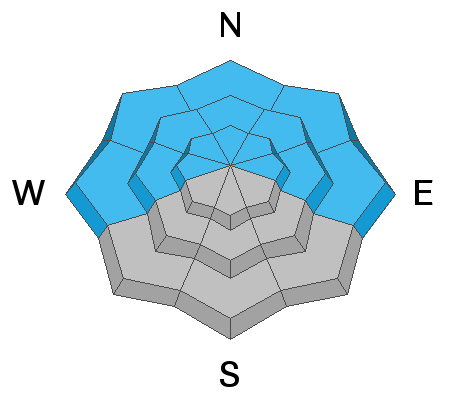
Strong and gusty Northerly winds have created a CONSIDERABLE avalanche danger on all aspects above treeline. Be on the lookout for fresh, unstable drifts of wind deposited snow. Fresh drifts are easily recognized by their smooth rounded appearance. Cracking and hollow sounds are sure signs of instability. Avoid steep wind drifted slopes today.
There is a MODERATE danger for triggering an avalanche on a buried persistent weak layer on slopes facing W-N-E at all elevations. Avalanches failing on this layer will be over 2 feet deep.
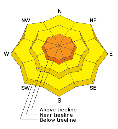
Low
Moderate
Considerable
High
Extreme
Learn how to read the forecast here
Special Announcements
Please help support avalanche forecasting throughout Utah. Donate to the Spring Campaign to help raise the funds to support the forecasting you rely on.
Road Conditions: The road is a mix of dirt, mud, and patches of packed snow. It gets sloppier as the days warm up. All wheel drive and good tires are recommended.
Grooming: Trails will be covered in fresh snow today. No grooming is scheduled.
Weather and Snow
6:00 a.m. weather data:
24 Hour Snow 0" 72 Hour Snow 7" Base Depth at Gold Basin 62" Wind NNE 20-30 Temp 18F
It will be another windy day in the Mountains. Sustained North winds will blow 20-25 mph. Mountain temperatures will stay below freezing today with highs in the low 20’s. We will see clear skies with plenty of sunshine. It looks like the North winds will stay with us today and tomorrow ahead of a strong warming trend shaping up for the end of the week.
Snowpack
A quick moving low pressure system dropped 7 inches of snow Sunday night into Monday morning. This provided a nice refresh on all aspects. Strong spring sunshine did a number on the solar aspects on Monday, but you’ll find plenty of nice soft snow on the Northerlies. Unfortunately the new snow came with strong winds out of the North. This has created fresh drifts on all aspects near tree line and above. The wind has not backed off, and drifts will become deeper and more easily triggered today than they were yesterday. The buried persistent weak layer of faceted snow that formed during the Jan-Feb high pressure remains the primary concern and it is still capable of producing dangerous, human triggered avalanches over two feet deep on all slopes facing the north side of the compass.
Snow and Weather Links
Gold Basin SNOTEL site (10,000')
Storm Totals in Gold Basin
Wind Station on Pre Laurel Peak (11,700')
Recent Avalanches
No recent avalanches have been reported in the La Sal range.
Ad
Avalanche Problem #1
Persistent Weak Layer
Type
Location
Likelihood
Size
Description
A persistent weak layer of loose, sugary faceted snow exists on W-N-E aspects beneath a slab that is 2'-3' thick. In my recent travels I am still finding the weakest snow on northerly aspects right around treeline and below. Above treeline this problem is being compounded by recent wind drifted snow. Blowing and drifting snow is increasing the weight and depth of the existing slab. The additional weight will put even more stress on the buried weak layer of facets, pushing this layer even closer to its breaking point. Stability tests show that avalanches are becoming harder to trigger on this layer, but the additional load from the wind will increase the likely hood for triggering an avalanche today.
Avalanche Problem #2
Wind Drifted Snow
Type
Location
Likelihood
Size
Description
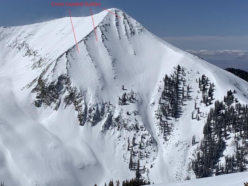
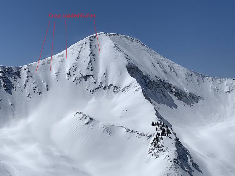
You will find fresh, sensitive wind drifts on all aspects today. North winds have not backed off and there is 7 inches of new snow available for transport. Slopes facing S and W will be the direct deposition zones. These slopes were easily managed yesterday, but today expect to find larger and more widespread wind slabs on these aspects. I observed cross loading on Northerly aspects near and above treeline in my travels yesterday. This should get your attention, as these aspects also harbor the buried persistent weak layer. Fresh drifts today will be 1 to 2 feet deep, large enough to take you for a wild ride though rocks or over cliff bands. A triggered wind slab also has the ability to step down to the buried layer of facets causing an even deeper and more dangerous avalanche. Recent drifts are recognizable by their smooth rounded appearance and they may sound hollow underneath. Avoid steep slopes where you can detect recent deposits of wind drifted snow.
General Announcements
Who's up for some free avalanche training? Get a refresher, become better prepared for an upcoming avalanche class, or just boost your skills. Go to https://learn.kbyg.org/ and scroll down to Step 2 for a series of interactive online avalanche courses produced by the UAC.
This forecast is from the U.S.D.A. Forest Service, which is solely responsible for its content. This forecast describes general avalanche conditions and local variations always occur.