UDOT PLANNED AVALANCHE CLOSURES!!

Forecast for the Moab Area Mountains

Eric Trenbeath
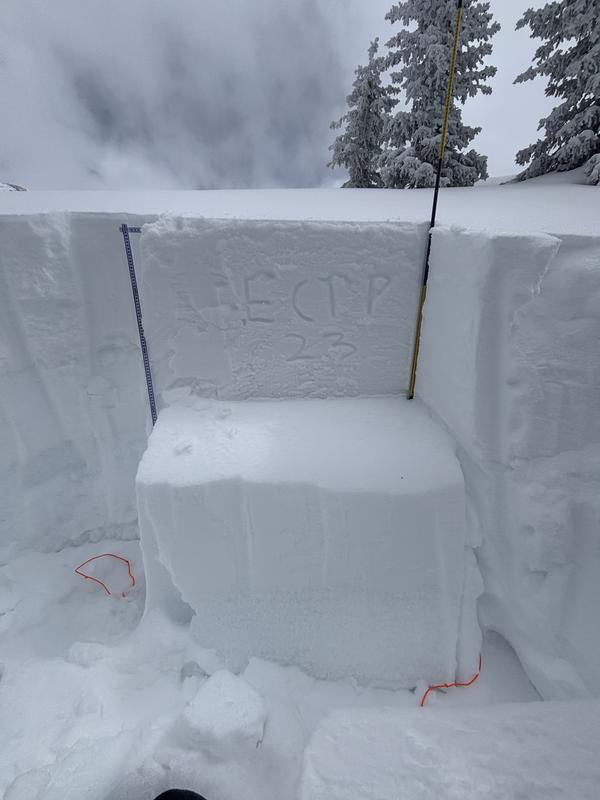
Issued by Eric Trenbeath on
Sunday morning, March 16, 2025
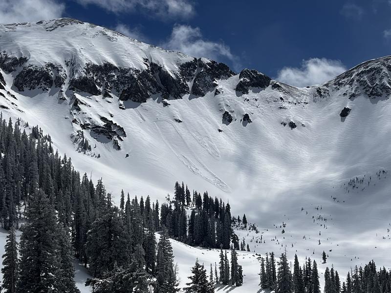
A CONSIDERABLE avalanche danger remains on steep, wind drifted slopes above treeline that face NW-N-NE-E. Human triggered avalanches involving fresh slabs of wind drifted snow are likely. A MODERATE danger exists on these same aspects at mid elevations and on SE facing slopes. Avoid steep slopes that have recent deposits of wind drifted snow.
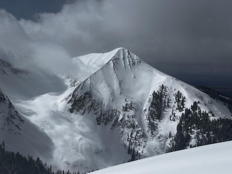
A solid MODERATE danger exists on steep slopes that face W-N-E where human triggered avalanches 2-4 feet deep failing on a buried persistent weak layer are possible. The danger is most pronounced on steep northerly aspects near treeline. Any avalanche failing on a weak faceted layer will be deep, dangerous, and potentially unsurvivable.
As the day heats up the danger will rise to MODERATE for loose, wet avalanches on sun exposed slopes. Signs of instability include rollerballs, pinwheels, and sloppy wet snow. Stay off of, and out from under steep slopes when these signs are present.
Low
Moderate
Considerable
High
Extreme
Learn how to read the forecast here
Special Announcements
The Utah Avalanche Center is excited to host Mountainfilm on Tour in Moab at Star Hall on 3/21 and 3/22. Click here for tickets and information.
Our Spring Campaign is in full swing, and there are two great ways to support forecasting, awareness, and education across Utah: Donate to our Spring Campaign, or Bid on items in our Spring Auction. Every dollar donated helps keep the backcountry community on top.
They will not be working on the Loop Road today and the road is open.
Geyser Pass Road: The road has not been plowed but many vehicles have made it up. The lower half has already mostly melted out, but deep ruts with packed snow underneath exist on the upper end. It will get muddy today. 4x4 required.
Grooming Conditions: Brian Murdock and I packed and rolled out the trail into Gold Basin on Friday.
Weather and Snow
6 A.M. Snow and Weather Data
24 Hour Snow: 2" 72 Hour Snow: 12" Season Total Snow: 109" Depth at Gold Basin: 52"
Winds on Pre-Laurel Peak: N/A Temp: 11° F Percent of Normal (SWE): 91%
Weather
Pre Laurel Peak wind station and the Gold Basin storm stake are down as we install upgrades including a web cam to the site.
It's going to be a beautiful day in the mountains with sunny skies, warm temperatures climbing into the mid to upper 30's, and slightly breezy southwest winds. Clouds begin to move in tonight and southerly winds will be on the increase ahead of a Pacific trough approaching the west coast. Monday looks to be mostly cloudy, windy, and warm. The trough reaches the Four Corners on Tuesday bringing us our next shot of welcome snow.
General Conditions
It's been a great couple of days with up to a foot of new snow fallen since early Friday. The sun has poked out here and there so there may be a few lightly crusted surfaces this morning, but by and large, cloud cover and cool temperatures have preserved the snow surface in most locations. Reports from the backcountry yesterday were of excellent conditions all around, see this observation from Ryan Huels. Winds haven't been too out of hand but they've been steady, first out of the southwest, and then shifting west to northwest. Continue to avoid steep, wind drifted slopes, particularly those facing the north side of the compass. On slopes facing W-N-E, persistent weak layers of faceted snow remain fairly widespread with a dense, hard slab 2-3 feet thick resting on top. Snowfall last week put pressure on these buried weak layers producing several large avalanches. The recent snow has not tipped the scales for a natural cycle this time around, but deep and dangerous, human triggered avalanches remain possible. The bullseye zone for this problem is on steep, northerly aspects near treeline. And finally, with a strong sun and warm temperatures just hitting the cold snow for the first time, be on the lookout for signs of loose, wet instability as the day heats up.
Snowpack and Weather Data
Gold Basin SNOTEL site (10,000')
SNOTEL site near Geyser Pass Winter Trailhead (9600')
Wind Station on Pre-Laurel Peak (11,400')
NWS forecast for the La Sal Mountains.
Recent Avalanches
In our travels on Friday, we observed this natural wind slab avalanche in Talking Mountain Cirque.
See the complete avalanche database here.
Ad
Avalanche Problem #1
Wind Drifted Snow
Type
Location
Likelihood
Size
Description
Recently formed wind slabs continue to be the primary threat today. They are the most widespread on north through easterly aspects near and above treeline which is also where you are also most likely to encounter a persistent weak layer problem. Steep, wind drifted slopes in these areas should be avoided. You may also find recent deposits of wind drifted snow on southeasterly aspects. Look for fresh drifts on the leeward sides of ridge crests and terrain features, priamrily in upper elevation, wind expsoed terrain. Fresh drifts are often recognizable by their smooth, rounded appearance and cracking is a sign of instability.
The NE face of Tukno is heavily wind drifted as are most slopes near and above treeline facing the north half of the compass.
Avalanche Problem #2
Persistent Weak Layer
Type
Location
Likelihood
Size
Description
Typically, by this time of year, we are getting close to putting our PWL problem in our rear view mirror. Unfortunately, we have a particularly weak and shallow snowpack this season brought on by few storms and long dry spells. Prior to the Valentine's Day storm, pretty much the entire snowpack was loose, weak, and faceted on slopes facing W-N-E. The Valentine's Day storm built a thick, dense slab on top of this weak structure creating one of the worst snowpacks I've ever seen. The Valentine's storm produced a few natural avalanches but not a widespread cycle and things were left hanging in the balance. The storm last week added a little more weight producing a few more avalanches including one very large, full depth release in Horse Creek. And here we are again. The underlying structure remains very poor and we've added a little more weight. The bullseye area for this problem is on steep, northerly aspects near treeline, and the likelihood decreases the further you step outside of this area. Personally, however, I'm going to continue to avoid any slope steeper than 30 degrees where this structure exists.
Ryan Huels performed an extended column test on a west aspect yesterday and got a score of ECTP 23. We had similar results on Friday. Although stubborn, any propagation shows a propensity to avalanche, it's just a matter of finding the right trigger point. This could happen after one or many people have skied the same slope. It's just not something I'm comfortable messing with right now.
Avalanche Problem #3
Wet Snow
Type
Location
Likelihood
Size
Description
As the day heats up, and cold snow sees the sun for the first time, loose wet avalanches will be possible. The danger follows the sun with east facing slopes heating up first, then south, and then west. Signs of instability include rollerballs, pinwheels, and sloppy wet snow. Stay off of, and out from under steep slopes when these signs are present.
Additional Information
Check out the latest UAC podcast with forecaster Brett "Kowboy" Kobernick where he discusses faceted persistent weak layers and how "nobody is immune from getting killed in an avalanche."
Sign up for text alerts to get the most up to date information about changing conditions, road plowing, special avalanche announcements.
Follow us on Instagram @utavy_moab
General Announcements
This forecast is from the U.S.D.A. Forest Service, which is solely responsible for its content. This forecast describes general avalanche conditions and local variations always occur.