Forecast for the Moab Area Mountains

Dave Garcia
Issued by Dave Garcia for
Tuesday, March 14, 2023
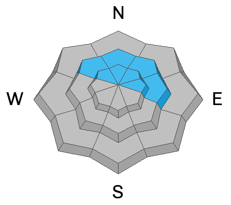
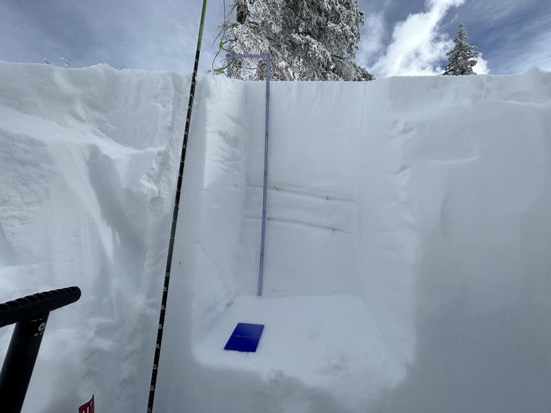
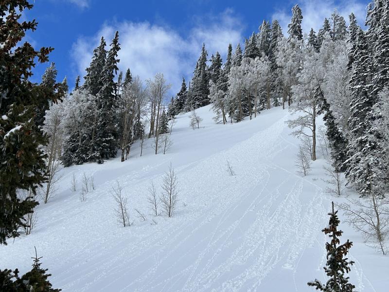
Today the avalanche danger is MODERATE and you will find two distinctly different avalanche problems depending on which side of the compass you choose to travel. Weak layers of faceted snow exist on slopes that face NW-N-NE-E and human triggered avalanches are POSSIBLE. On these Northerly aspects, backcountry travelers will need to carefully evaluate snow and terrain. Strong March sunshine will quickly heat up the solar aspects this morning, and both human triggered and natural wet loose avalanches are POSSIBLE on slopes that face W-SW-S-SE-E. You'll want to move off of steep solar aspects as the day heats up.
Heads Up - another Atmospheric River event moves into our region tonight and the avalanche danger will be on the rise in the coming days.
Low
Moderate
Considerable
High
Extreme
Learn how to read the forecast here
Special Announcements
The Banff Centre Mountain Film Festival World Tour is coming to Moab March 17-18. For tickets and information go here.
Geyser Pass Road: The road is open. 4x4 recommended.
Grooming: All trails are covered in fresh snow.
Weather and Snow
6:00 a.m. Snow and Weather Data
24 Hour Snow 0" 72 Hour Snow 4" Season Total Snow 247" Base Depth at Gold Basin 86"
Winds on Pre Laurel Peak S 11-15 Temp 13

Weather
We will see sunny skies and light winds out of the SW this morning. Clouds will build this afternoon and wind speeds will increase to 20-25 mph later today. A mid-level long wave trough reaches the west coast this afternoon. The next atmospheric river event will move across the Great Basin today, producing another warm and wet storm for the La Sals. Snow will start tonight, with the heaviest snowfall rates on Wednesday. At times we could receive 1-2" of snow per hour. We should see at least an inch of water from this storm. Snow will continue into Thursday morning and skies should clear up for Thursday afternoon and Friday.

General Conditions
Skiing and riding conditions have been excellent the last few days. The strong March sun was out in full force yesterday, and solar aspects will have a thin crust on them this morning. Roller balls were widespread on the Southerlies, and I also observed some small, loose wet avalanches. Solar aspects will receive direct sun this morning, and you'll want to keep your eye out for these signs of wet activity. The best skiing and riding today will be found on shady slopes on the North side of the compass. Cold, dry powder still exists on Northerly aspects. Weak layers of snow also exist on these shady slopes. Yesterday, I found them to be gaining strength, but you will still want to get out your shovel and do some stability evaluation if you are getting on steep slopes on the North side of the compass.
To see more details of my fieldwork from yesterday, click here.

Snowpack and Weather Data
Gold Basin Storm Stake (10,000')
Gold Basin SNOTEL site (10,000')
SNOTEL site near Geyser Pass Winter Trailhead (9600')
Wind Station on Pre-Laurel Peak (11,400')
NWS forecast for the La Sal Mountains.
Recent Avalanches
There have been no recent avalanches. See the La Sal avalanche database here.
Ad
Avalanche Problem #1
Persistent Weak Layer
Type
Location
Likelihood
Size
Description
Weak layers of faceted snow exist in the top meter of the snowpack on Northerly aspects. In my travels yesterday, I found these layers to be gaining strength and they didn't react to stability testing. Friday's storm dropped almost two inches of water on our snowpack and did not produce any avalanches. This is another good sign that these layers have gained some strength. With that said, I still recommend digging down and assessing these weak layers if you are choosing to travel on Northerly facing slopes. These weak layers are not widespread, you may find them on some slopes and not on others.
This snow pit is on a NW facing slope at 11,080 ft. You can see the 2/22 interface down 53cm and the 2/14 interface down 69cm. You'll want to look for and evaluate these two layers if you are getting into slopes steeper than 30 degrees today.
Avalanche Problem #2
Wet Snow
Type
Location
Likelihood
Size
Description
The sun will be out long enough this morning that wet loose avalanches will be possible on steep solar aspects. Look for the surface snow to warm up quickly, become wet, and begin producing both natural and human triggered wet loose avalanches. Roller balls and pinwheels moving downhill are an indication that the surface snow is heating up and becoming increasingly wet. Avoid being on steep solar aspects if the snow has become wet an unsupportable.
I observed this small, wet loose avalanche on Monday.
Additional Information
General Announcements
This forecast is from the U.S.D.A. Forest Service, which is solely responsible for its content. This forecast describes general avalanche conditions and local variations always occur. This forecast will be updated by 7:30 tomorrow morning.