UDOT PLANNED AVALANCHE CLOSURES!!

Forecast for the Moab Area Mountains

Eric Trenbeath
Issued by Eric Trenbeath for
Friday, February 17, 2023
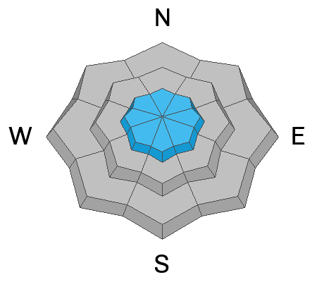
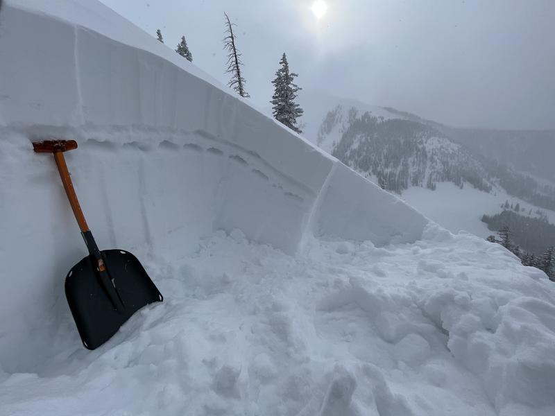
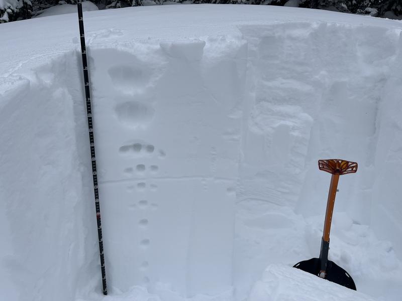
A MODERATE danger exists for human triggered avalanches involving soft slabs of wind drifted snow on all aspects above treeline. The danger is greatest on steep slopes facing NW-N-NE-E where drifted snow may be overlying a layer of weak, sugary, faceted snow. Human triggered avalanches 1'-2' deep are possible in these areas. Most other terrain has generally LOW danger.
Low
Moderate
Considerable
High
Extreme
Learn how to read the forecast here
Special Announcements
Geyser Pass Road: The road is plowed and the surface is snowpacked.
Grooming: Gold Basin through Geyser Pass are freshly groomed.
Weather and Snow
6:00 a.m. Snow and Weather Data
24 Hour Snow 0" 72 Hour Snow 8" Season Total Snow 198" Base Depth at Gold Basin 74"
Winds on Pre Laurel Peak SW 0-5 Temp 8 F
Weather
Calm winds and clear skies are promising a beautiful day in the mountains. A weak shortwave will bring some high clouds to the area later today and tonight, but for the most part high pressure over the region will keep things mostly sunny and dry through the weekend. The weather begins to turn on Tuesday with a significant looking Atmospheric River eventn shaping up for Wednesday.

General Conditions
Skiing and riding conditions remain quite good. In our travels across the range on snow machines yesterday we found great powder snow on all aspects near and below treeline though you can occasionally feel the underlying hard snow surface. We observed no signs of instability although we avoided steep, wind drifted slopes above treeline. North facing slopes still look fat with recent wind drifts, and I'm still a little baffled by the distribution of a weak, faceted layer that keeps turning up from time to time in these areas. For the time being, I'm going to keep it dialed back until I have a better handle on this.

Snowpack and Weather Data
Gold Basin Storm Stake (10,000')
Gold Basin SNOTEL site (10,000')
SNOTEL site near Geyser Pass Winter Trailhead (9600')
Wind Station on Pre-Laurel Peak (11,400')
NWS forecast for the La Sal Mountains.
Recent Avalanches
No new avalanches have been reported. See the La Sal Avalanche database here.
Ad
Avalanche Problem #1
Wind Drifted Snow
Type
Location
Likelihood
Size
Description
An accumulated foot of snow and moderate to strong winds on Tuesday night formed soft slabs of drifted snow on all aspects near and above treeline. The deepest drifting occurred on northerly aspects and this is your primary area of concern. Wind drifts are often recognizable by their smooth, rounded appearance. They may also feel dense or hollow underneath, and cracking is a sign of instability.
In my travels on Wednesday, I was able to crack out numerous drifts such as this on all aspects. Slabs of drifted snow are gaining strength and are less sensitive to weight of a skier or rider, but they may release once you are further on to a slope. Approach suspected wind drifted slopes with caution, and avoid areas with steep convexities or blind "break-overs."
Avalanche Problem #2
Persistent Weak Layer
Type
Location
Likelihood
Size
Description
Unfortunately, a layer of weak, faceted snow that formed on the old snow surface is now turning up too often to be ignored. The tricky part is that it doesn't exist everywhere, and in some cases it's lying under older wind slabs. Dave Garcia and Chris Benson have both detailed it in their most recent observations. In my travels on Wednesday, I discovered a weak layer of faceted snow on a northerly aspect around 11,000'. On a nearby NE aspect I didn't find this layer, and I didn't find it in my travels over in Dark Canyon yesterday. What this means is that for the time being, you're going to need to do a slope by slope analysis if you're thinking about into steep, northerly facing terrain.
I've highlighted the weak layer of faceted snow I found here by pressing into it with my hand. This is on a N aspect at 11,000'.
I dug this pit on a nearby NE aspect at 11,000' and didn't find the weak layer.
Additional Information
Are you wondering how cell phones and other electronic devices can interfere with your avalanche transceiver? The "20/50 Rule" is that you want your beacon 20cm (8") away from other electronics while transmitting and 50cm (20") away from electronics while searching. Get the full scoop here.
General Announcements
This forecast is from the U.S.D.A. Forest Service, which is solely responsible for its content. This forecast describes general avalanche conditions and local variations always occur. This forecast will be updated by 7:30 tomorrow morning.