Forecast for the Moab Area Mountains

Eric Trenbeath
Issued by Eric Trenbeath for
Thursday, February 16, 2023
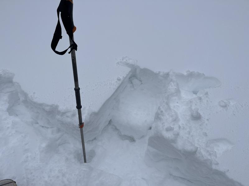
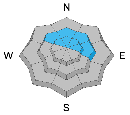
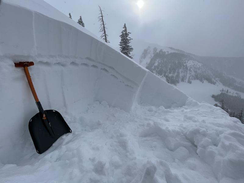
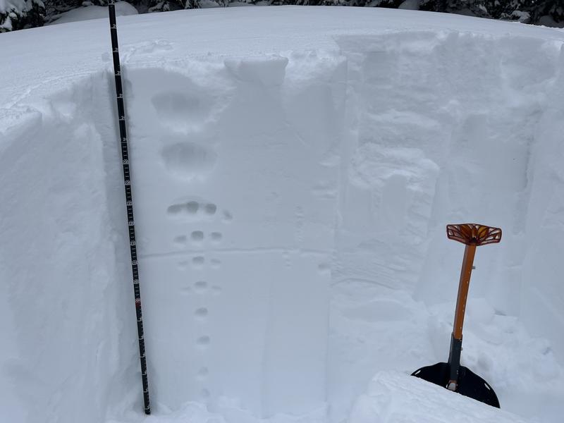
A MODERATE danger exists for human triggered avalanches involving soft slabs of new and wind drifted snow on all aspects near and above treeline. The danger is greatest on steep, wind drifted slopes facing NW-N-NE-E where an underlying layer of weak, sugary, faceted snow may be found.
Steep, wind drifted, northerly facing terrain should be avoided today. Approach all other aspects with caution. Look for recent drifting and signs of instability such as cracking in the snow surface.
Low
Moderate
Considerable
High
Extreme
Learn how to read the forecast here
Special Announcements
Geyser Pass Road: Crews started working yesterday and will be back up today to finish the job. The gate may be closed while work is in progress.
Grooming: Matt packed out all trails yesterday and will be back up fine tuning today.
Weather and Snow
6:00 a.m. Snow and Weather Data
24 Hour Snow 1" 72 Hour Snow 12" Season Total Snow 198" Base Depth at Gold Basin 74"
Winds on Pre Laurel Peak ENE 5-10 Temp -2 F
Weather
Under clear skies frigid temps this morning are about 20 degrees below normal. Today will be sunny and cold with high temps creeping up to around 10 degrees. Light northerly winds will add to the chill. High pressure is moving in from the west and we'll see sunny skies and warmer temps tomorrow. A series of weak disturbances will usher in some clouds over the weekend, with the next real possibility for snow coming mid next week.

General Conditions
Skiing and riding conditions are greatly improved with a foot of new snow but I wasn't excited by everything I saw out there yesterday. Drifting was fairly widespread on all aspects near and above treeline, and the new snow had also coalesced into a dense, cohesive slab. More concerning is the presence of buried, weak, faceted snow that keeps turning up on northerly aspects. It's not widespread, but there is enough of it out there that it is becoming a problem. This means it's not going to be "game on" as soon as the recent snow instabilities settle out, and you'll have to dig down and look for this weak layer before stepping out into larger, northerly facing terrain.

Snowpack and Weather Data
Gold Basin Storm Stake (10,000')
Gold Basin SNOTEL site (10,000')
SNOTEL site near Geyser Pass Winter Trailhead (9600')
Wind Station on Pre-Laurel Peak (11,400')
NWS forecast for the La Sal Mountains.
Recent Avalanches
On Tuesday, Dave observed a handful of dry loose avalanches that ran naturally in steep terrain.
This dry loose avalanche ran naturally in the steep chutes above Tele Gold.
See the La Sal Avalanche database here.
Ad
Avalanche Problem #1
Wind Drifted Snow
Type
Location
Likelihood
Size
Description
Soft slabs of recent and wind drifted snow exist on all aspects near and above treeline with the greatest danger existing on steep, northerly facing terrain. Wind drifts are recognizable by their smooth, rounded appearance. They may also feel dense or hollow underneath, and cracking is a sign of instability.
In my travels yesterday, I was able to crack out numerous drifts such as this on all aspects. Terrain features can cause mountain winds to swirl and change direction, and load a variety of aspects. You are likely to find fresh wind drifts on the lee side of exposed ridges and in and around terrain features. Watch for and avoid drifts on gully walls, under cliff bands, along sub-ridges, in scoops, saddles, and sinks.
I also found that the new snow had formed a dense, cohesive soft slab in many areas. Storm slab instabilities typically settle out after a day or two, but utilize test slopes to see how this slab is behaving before committing to steeper terrain.
Avalanche Problem #2
Persistent Weak Layer
Type
Location
Likelihood
Size
Description
Unfortunately, a layer of weak, faceted snow that formed on the old snow surface is now turning up too often to be ignored. The tricky part is that it doesn't exist everywhere, and in some cases it's lying under older wind slabs. Dave Garcia and Chris Benson have both detailed it in their most recent observations. The good news is that in most cases, you don't have to dig down far to find it.
I've highlighted the weak layer of faceted snow I found here by pressing into it with my hand. This is on a N aspect at 11,000'.
I dug this pit on a NE aspect at 11,000' and didn't find the weak layer. This means you are going to have to do some digging before venturing into steep, northerly facing terrain.
Additional Information
Are you wondering how cell phones and other electronic devices can interfere with your avalanche transceiver? The "20/50 Rule" is that you want your beacon 20cm (8") away from other electronics while transmitting and 50cm (20") away from electronics while searching. Get the full scoop here.
General Announcements
This forecast is from the U.S.D.A. Forest Service, which is solely responsible for its content. This forecast describes general avalanche conditions and local variations always occur. This forecast will be updated by 7:30 tomorrow morning.