We will be holding a Backcountry 101 course Feb 18, 19. It's a great introduction to understanding avalanche hazard and how to travel through the mountains safely.
Go here for details and to register. And a huge thanks to our friends at
Moab Gear Trader for their sponsorship of this course!
Road Conditions: The road to Geyser Pass Trailhead is mostly down to the dirt. Some patchy areas of packed snow and ice remain and they are slick. AWD and good tires are recommended.
Grooming: Trails have not been groomed in awhile but the surface remains hard packed and relatively smooth. Follow LUNA (Lower Utah Nordic Alliance) on Instagram @luna_moab
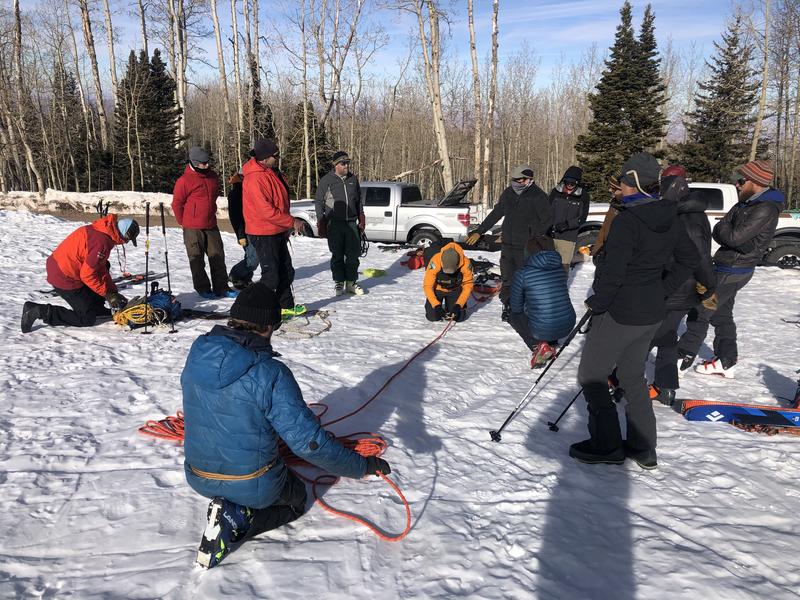
Members of the Grand County Winter Rescue Team turned out for ropes and toboggan training at the Geyser Pass Trailhead on Saturday. This solid crew is a great asset to our winter backcountry community. Thanks team!
6:00 a.m. weather data:
24 Hour Snow 0" 72 Hour Snow 0" Base Depth at Gold Basin 39" Wind SW 10-15 Temp 19F
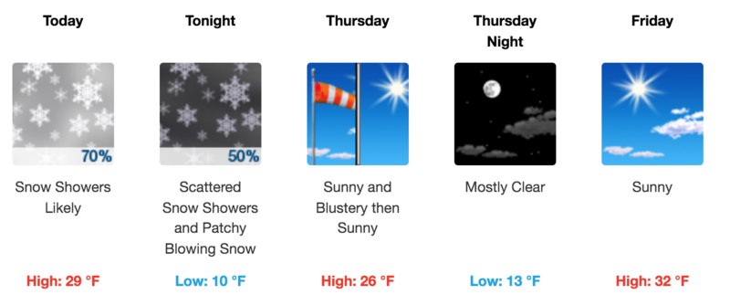
A trough and associated cold front will move through the area today bringing a chance for light snowfall to the mountains. Mostly light SW winds will shift to NW by this afternoon after the front passes through. A chance for snow showers will linger into tonight followed by clearing skies and blustery NW winds on Thursday as dry northwesterly flow and a ridge of high-pressure rebuilds to the west. The next hope for snow and a change in the pattern comes early next week.
Snowpack
Light snowfall amounts will not affect the avalanche danger, nor are they likely to improve conditions much but it will be good to see the sun go away! From an avalanche perspective, our attention remains focused on the existing snow surface and the development of loose, sugary,
faceted snow. Near surface facets can become the next weak layer in the snowpack when new snow lands on top. This weak, sugary, non-cohesive layer can also produce dry
loose snow avalanches.
Currently, the weakest snow can be found on steep, shady, northerly aspects right around treeline and below. In some areas such as this, the entire snowpack has become loose and faceted. Above treeline, conditions are much more variable ranging from from wind scoured and sun crusted, to boiler plate. Where crusts are thin, the snow is faceting underneath. This makes mapping of this future weak layer tricky. Generally speaking, the more sheltered the area, the more likely the the surface is to be weak and faceted. When new snow finally comes, slope by slope analysis will be required when getting into steep terrain.