Forecast for the Moab Area Mountains

Issued by Eric Trenbeath on
Friday morning, December 31, 2021
Friday morning, December 31, 2021
HEADS UP! HEAVY SNOWFALL AND STRONG WINDS WILL CAUSE THE AVALANCHE DANGER TO RISE QUICKLY TODAY!
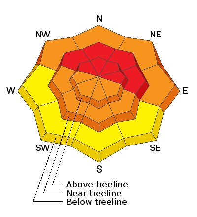
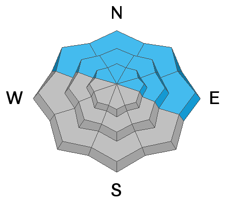
The avalanche danger is CONSIDERABLE this morning and will likely reach HIGH on steep, wind drifted slopes that face NW through E as the day progresses. Recent, new, and wind drifted snow threaten to dangerously overload an underlying, weak snowpack and dangerous, natural and human triggered avalanches will grow increasingly more likely throughout the day. Most other terrain at mid and upper elevations will see a rising CONSIDERABLE avalanche danger. Backcountry travelers need to have excellent route finding skills. Travel in avalanche terrain is not recommended.

Low
Moderate
Considerable
High
Extreme
Learn how to read the forecast here


