Join us at our 2nd Annual Blizzard Ball

Forecast for the Moab Area Mountains

Eric Trenbeath
Issued by Eric Trenbeath on
Thursday morning, December 30, 2021
HEADS UP! HEAVY SNOWFALL AND STRONG WINDS WILL CAUSE THE AVALANCHE DANGER TO RISE OVER THE NEXT 24 HOURS!
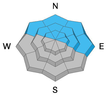
The avalanche danger remains CONSIDERABLE on steep, mid and upper elevation, wind drifted slopes that face NW through E and human triggered avalanches are likely in these areas. The danger will likely reach HIGH sometime tonight. Backcountry travelers today will need to be alert to changing conditions that signify an increase in danger, and have excellent route finding skills. Avoid steep, wind drifted slopes and give run out zones a wide berth.
The avalanche danger is MODERATE on low elevation northerly aspects and on mid and upper elevation slopes facing the south side of the compass where you can detect recent deposits of wind drifted snow.
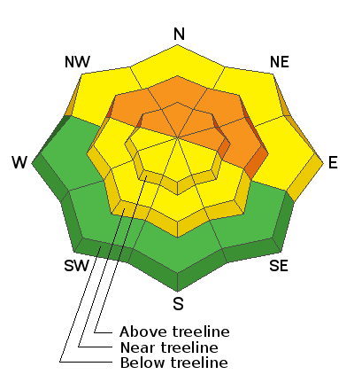
Low
Moderate
Considerable
High
Extreme
Learn how to read the forecast here
Special Announcements
Road Conditions: Grand County plowed yesterday. The road will be snow packed and slick, and AWD with good tires are recommended.
Grooming: Grooming will be temporarily on hold with continued snow in the forecast and a downed tree that needs to be cleared.
Weather and Snow
24 Hour Snow 1" 72 Hour Snow 15" Base Depth in Gold Basin 40" Wind SW 15-25 Temp 17F
Gold Basin SNOTEL site (10,000')
Storm Totals in Gold Basin
Wind Station on Pre Laurel Peak (11,700')
NWS Weather Forecast
A powerful storm system is headed our way with the most intense period of snowfall occurring tonight through Friday. Southwesterly winds are on the increase this morning ahead of a deep trough dropping southward across the Great Basin. Today look for cloudy skies, blustery SW winds blowing in the 25-35 mph range with developing snow showers by this afternoon with 2"-4" possible. With the arrival of the cold front late tonight, we should start to see heavy snowfall with 6"-8" likely by Friday morning. Heavy snowfall should continue through the day with another 6"-10" possible.
Snowpack
The mountains have received 15" of snow at 1.3" Snow Water Equivalent (SWE) since Monday. Snow totals since Christmas Eve are up around 20". Excellent powder conditions exist in sheltered areas below treeline. Exposed areas have been heavily wind blasted, and nearly continuous wind loading has deposited deep drifts on to leeward slopes. Snowpits reveal the continued presence of weak, sugary, October facets beneath a slab. This slab ranges from 2'-3' thick on terrain facing NW through E. Stability tests show that this persistent weak layer is stubborn to react, but with continued wind loading, and with more snow in the forecast, a fair amount of uncertainty surrounds it. What is certain is that any avalanche failing on these weak facets would be deep and dangerous.
Overall snow cover remains quite thin and rocks, stumps, and deadfall continue to pose hazards.
Ad
Avalanche Problem #1
Wind Drifted Snow
Type
Location
Likelihood
Size
Description
Blowing and drifting snow has formed new wind slabs on leeward slopes that face primarily NW through E, but the gusty, erratic behavior of the winds may have deposited snow on a variety of aspects. Look for fresh drifts on the leeward sides of terrain features such as sub ridges, gully walls, and rock outcroppings. Fresh drifts are recognizable by their smooth, rounded appearance, and cracking is a sign of instability. On northerly aspects, wind drifted snow has added stress to older slabs on top of a buried persistent weak layer and dangerous, human triggered avalanches 2'-3' deep are possible. Avoid steep, wind drifted slopes, especially those that face the north side of the compass.
Avalanche Problem #2
Persistent Weak Layer
Type
Location
Likelihood
Size
Description
On slopes facing NW through E, fresh deposits of wind drifted snow have formed over top of a dense slab, 2'-3' thick, that exists on a persistent weak layer of loose, sugary facets. Over the past two weeks, these slabs have grown increasingly stubborn to release but to be sure, any avalanche triggered on this weak, faceted layer would be deep and dangerous. With more wind drifted snow continuing to add stress to this persistent weak layer, steep slopes facing NW through E are best avoided.
Additional Information
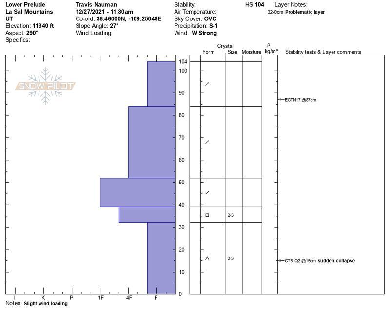
Travis Nauman provided us with another great pit profile. What we are looking for are harder layers over weak layers. The further a layer moves to the left, the harder it is. Note the soft, weak layer of sugary "facets" or "depth hoar" at the base of the snowpack with obvious harder layers forming a slab on top.
General Announcements
Who's up for some free avalanche training? Get a refresher, become better prepared for an upcoming avalanche class, or just boost your skills. Go to https://learn.kbyg.org/ and scroll down to Step 2 for a series of interactive online avalanche courses produced by the UAC.
This forecast is from the U.S. Forest Service, which is solely responsible for its content. This forecast describes general avalanche conditions and local variations always occur.