We will be giving a free Know Before You Go Avalanche Awareness talk on Tuesday, Dec 6 at 6:00 p.m. at the MARC (111 E 100 N).
Join us for the
1st Annual UAC Moab/LUNA Winter Kickoff Party on Saturday, Dec 10 at the MARC. The event will be from 7-9 PM. Get your
tickets here. Join the Utah Avalanche Center and the Division of Outdoor Recreation to celebrate the
Fourth Annual Avalanche Awareness Week, from December 4 - December 11. Click
HERE to view a full list of events throughout the state.
Road Conditions: Grand County has not yet begun plowing the road to Geyser Pass Trailhead. The road is hard-packed snow and slick in places. Good tires and all wheel drive are recommended.
Grooming: The Geyser Pass Road above the winter trailhead closes on Dec 15. Grooming will commence after that, but but for now, the road abiove the trailhead is snowpacked and well traveled and cross country ski conditions are pretty good.
24 Hour Snow 0" 72 Hour Snow 0" Season Total Snow 41" Base Depth at Gold Basin 24"
Winds on Pre Laurel Peak S 15-25 Temp 26F
Trace amounts of snow fell in the mountains yesterday while westerly winds eased off for awhile. They've shifted back to southerly and have ramped up a bit blowing in the 15-25 mph range along ridgetops. Today look for cloudy skies with a slight chance for snow showers, breezy SW winds, and high temps in the upper 20's at 10,000'. Unsettled weather continues but with no storm favoring our area. Our best shot right now looks to be around Wed-Thu.
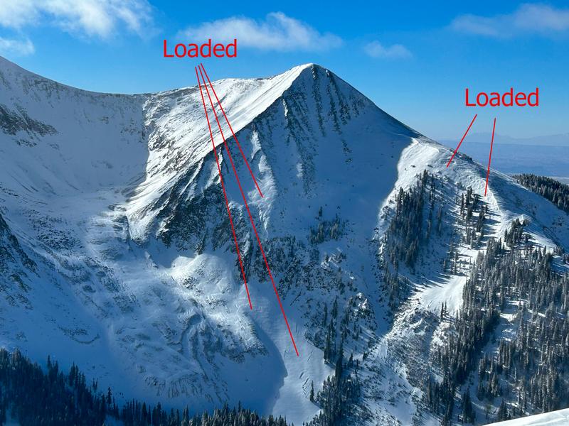
Strong, gusty, south through westerly winds this week have formed potentially unstable
slabs of wind drifted snow on leeward slopes near and above treeline. Alternately, windward surfaces are scoured, crusted, and sculpted. Complicating the picture are new
wind slabs on top of older ones, all of which are sitting on top of a foundation of weak, sugary, faceted snow. The bottom line is that the snowpack isn't shaping up all that well and we will soon be facing a
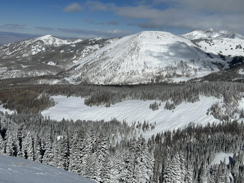
persistent weak layer problem. It's also still low tide out there with lots of rocks, stumps, and logs lurking about. It's just not quite game on yet, we need another foot or so of snow.
If you are getting up into the mountains please
submit an observation and let us know what you are seeing!
No recent avalanches have been reported from the backcountry.