Join us at our 2nd Annual Blizzard Ball

Forecast for the Moab Area Mountains

Eric Trenbeath
Issued by Eric Trenbeath on
Thursday morning, January 9, 2025
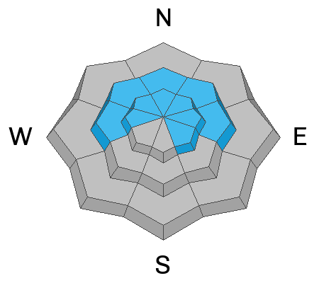
The avalanche danger is MODERATE on steep slopes near and above treeline that face W-N-E, and on SE aspects above treeline. Human-triggered avalanches failing on a persistent weak layer of faceted snow are POSSIBLE. In most cases, avalanches will break about a foot deep but in some outlying areas in the alpine, full depth avalanches are possible. Minimize the risk for full depth avalanches by avoiding thin slope margins and areas of rocky, more radical terrain.

A MODERATE danger also exists for avalanches involving recently formed slabs of wind-drifted snow on all aspects above treeline. Look out for and avoid smooth, rounded pillows of recently deposited, wind drifted snow. Cracking is a sign of instability.

Many slopes have thin cover and rocks, stumps, and logs are lurking just beneath the surface.
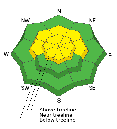
Low
Moderate
Considerable
High
Extreme
Learn how to read the forecast here
Special Announcements
Geyser Pass Road: Surface is mainly snowpacked and icy. AWD with good tires required.
Grooming Conditions: Trails were last groomed on Monday.
Weather and Snow
6 A.M. Snow and Weather Data
24 Hour Snow: 0" 72 Hour Snow: 1" Season Total Snow: 58" Depth at Gold Basin: 30"
Winds on Pre-Laurel Peak: NNW 35-45 G 67 Temp: 13° F Percent of Normal (SWE): 100%
Weather
A weak and fast moving system will keep snow to the north while bringing very windy conditions to our area today. Northwesterly winds began to ramp up around 9:00 p.m. last night averaging 20-25 mph until about 4:00 a.m. this morning. Then they really got going with average speeds in the 30's and 40's, with gusts in the 50's and even 60's. Look for clouds this morning with mostly sunny and blustery conditions later today. NE winds will blow in the 20-25 mph range with gusts to 40. High temps will be the upper teens. Ugh. Friday will be mostly calm, clear, and cold. Another system to the north will bring a slight chance for snow on Saturday.
General Conditions
In spite of the overall low snow depth, conditions have been remarkably good since last weekend's 5 inches of new snow capped off the Christmas storm. I'm afraid that has likely come to an end, however, with the current windy conditions. Ryan Huels was up yesterday and he found "excellent skiing" on sheltered northerly aspects and a "mixed bag" in exposed terrain with alternating areas of hard and soft snow (see his observation here). Jake Etter also sent in an observation. Things will be even more mixed today, and you will have to seek out the most sheltered areas below treeline to find soft snow and to keep from being blown over.
Ryan also observed unstable test results on a weak layer of faceted snow buried and preserved by the Christmas storm. This layer is about a foot below the surface and is easily located with a quick dig. Human-triggered avalanches up to a foot deep or more are possible and you will need to evaluate each slope individually for a slab over this weak layer. When in doubt, seek out slopes less than 30 degrees in steepness. For more information on this weak layer, see Dave's video in the persistent weak layer problem description down below.
Additionally, strong winds out of the north have blown and drifted snow into shallow fresh slabs on all aspects above treeline. Fresh drifts could be sensitive to the weight of skiers and riders. Backcountry travelers will need to look out for and avoid areas of drifted snow.
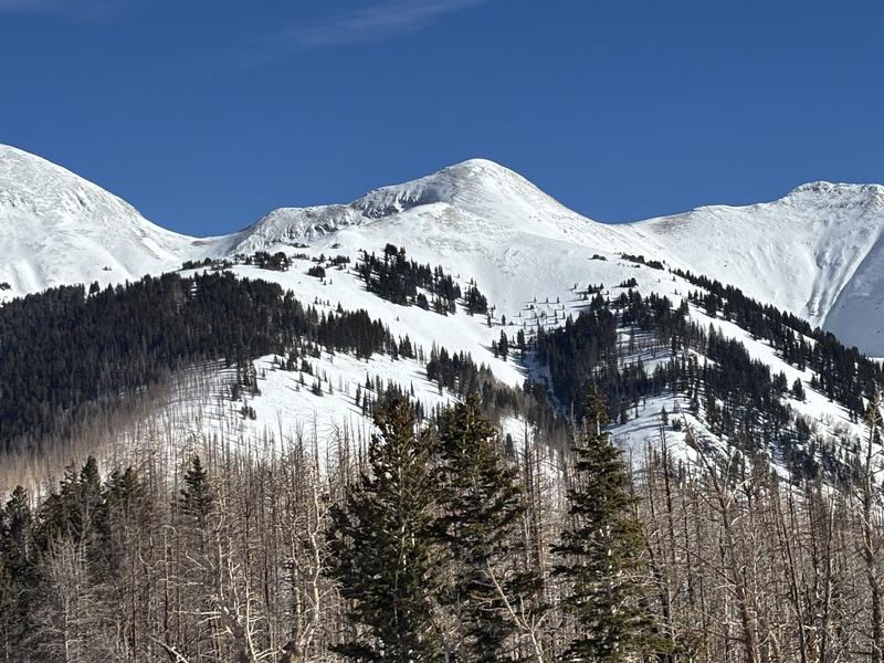
Nice view of the Laurel Ridge with scoured, wind affected conditions above treeline. The Pre Laurel Peak wind station is located on top of the sub peak dead center in the foreground. Ryan Huels photo.
Snowpack and Weather Data
Gold Basin SNOTEL site (10,000')
SNOTEL site near Geyser Pass Winter Trailhead (9600')
Wind Station on Pre-Laurel Peak (11,400')
NWS forecast for the La Sal Mountains.
Recent Avalanches
Ad
Avalanche Problem #1
Persistent Weak Layer
Type
Location
Likelihood
Size
Description
Recent and wind-drifted snow has added additional stress to buried persistent weak layers increasing the likelihood of human-triggered avalanches in some locations. The danger is greatest on steep, wind-loaded, northerly aspects near treeline and above.
A layer of near-surface facets (NSF) formed during the long December dry spell. This layer is now buried about a foot deep and has been sensitive in recent stability tests. It is especially reactive in areas where the wind has drifted enough snow to form a stiff slab on top. Strong winds over the past few days have made this problem more widespread. Human-triggered avalanches are most likely to fail here first and could be 1-3 feet deep in drifted areas. It is important to carefully analyze any slope you are considering by digging down to see if the poor structure exists. Avalanches triggered on this weak layer could also step down into our second faceted weak layer at the base of the snowpack. Avalanches failing on this layer would be deep, dangerous, and possibly un-survivable.
The overall height of snow is still relatively shallow, and the faceted snow at the base of the pack will remain a concern until we get a much deeper snowpack. While the chances are low, full-depth hard slab avalanches failing on the basal facets remain possible in thin snowpack areas or steep, rocky, radical terrain. To avoid this problem, we are simply avoiding big lines in alpine terrain.
In the video below, Dave Garcia demonstrates the reactive potential in our primary layer of concern.
Avalanche Problem #2
Wind Drifted Snow
Type
Location
Likelihood
Size
Description
Strong winds blowing from the north over the past couple of days have whipped up a fresh slabs of wind-drifted snow. Look for unstable slabs on all aspects above treeline. This problem is most pronounced in the alpine, but I wouldn't be too surprised if some drifts penetrated into near treeline terrain as well. The recent drifts will be especially sensitive anywhere they have formed above the preserved NSF layer that was buried on 12-25.
  • Wind slabs often form on the lee-side of exposed ridges and in and around terrain features. Watch for and avoid drifts on gully walls, under cliff-bands, along sub-ridges, and in scoops, saddles, and sinks.
  • Drifted snow is stiffer and more compacted than non-drifted snow, and hard drifts often produce hollow, drum-like sounds when you walk on them.
  • Freshly formed wind slabs can be quite sensitive and are often remotely triggered.
  • Shooting cracks in drifted snow are a sure sign of instability.
Additional Information
The final accident reports for Porter Fork and Davenport Hill up in the Wasatch Mountains have been completed. Our hearts go out to all who were affected by these tragic events.
Sign up for text alerts to get the most up to date information about changing conditions, road plowing, special avalanche announcements.
Follow us on Instagram @utavy_moab
General Announcements
This forecast is from the U.S.D.A. Forest Service, which is solely responsible for its content. This forecast describes general avalanche conditions and local variations always occur.