Join us at our 2nd Annual Blizzard Ball

Forecast for the Moab Area Mountains

Eric Trenbeath
Issued by Eric Trenbeath on
Monday morning, January 9, 2023
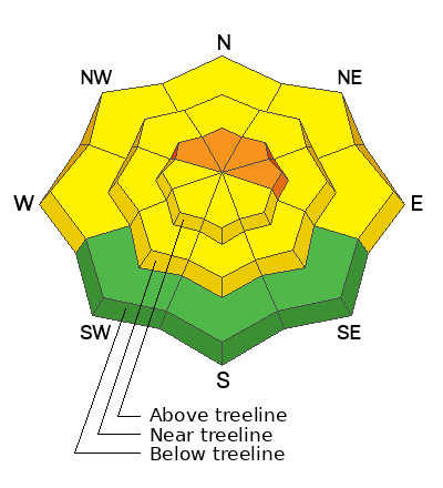
Though the area of greatest concern is diminishing, a CONSIDERABLE avalanche danger remains on steep, wind drifted, northerly facing slopes above treeline. Human triggered avalanches failing on a buried persistent weak layer remain likely in this zone.

A MODERATE danger exists in most other areas and human triggered avalanches are possible.

Travel tip: Stick to low angle sheltered terrain for the BEST and SAFEST riding today.
Low
Moderate
Considerable
High
Extreme
Learn how to read the forecast here
Special Announcements
Improve your avalanche awareness and rescue skills and sign up for our Backcountry 101 Class on January 20, 21.
Road Conditions: The road is plowed but areas of soft snow exist near the top. AWD and good tires recommended.
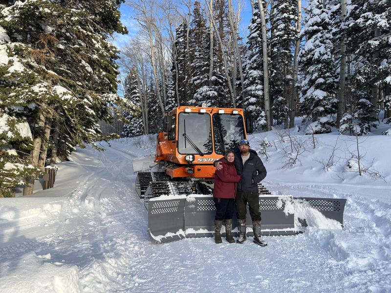
Grooming: We've got some new grooming equipment in town! Give a huge shout out to locals Gavin and Crystal Harrison who have graciously offered up their services to the LUNA program! They've also been busy cleaning up the soft snow on the upper end of the road.
Weather and Snow
24 Hour Snow 0" 72 Hour Snow 0" Season Total Snow 130" Base Depth at Gold Basin 58"
Winds on Pre Laurel Peak S 15-20 G30 Temp 21F
Weather
Southerly winds have been blowing in the high country for the last 36 hours. They should back off a bit today as zonal flow takes over. Weak, embedded shortwaves ahead of an approaching trough will bring partly cloudy skies with a chance for snow developing tonight. The main event, or what's left of it, will come Tuesday night into Wednesday as a low pressure trough and the remnants of an atmospheric river slides into the region. It currently looks like we might see about 6" of snow. Stay tuned.

General Conditions
In spite of the relentless southerly winds, I continued to find excellent settled powder conditions on all aspects below treeline yesterday. I had the sled out to cover ground, and even the wide open meadows and rolling terrain around Geyser Pass still had good snow. Near treeline and below, I have also been finding generally strong snow over a deeply buried and compressed weak layer. Above treeline, winds have stripped some areas while alternately loading others. Slabs overriding the persistent weak layer are thinner, and trigger points are more plentiful. Recent wind loading has complicated the pattern. This combination makes human triggered avalanches more likely in this zone.
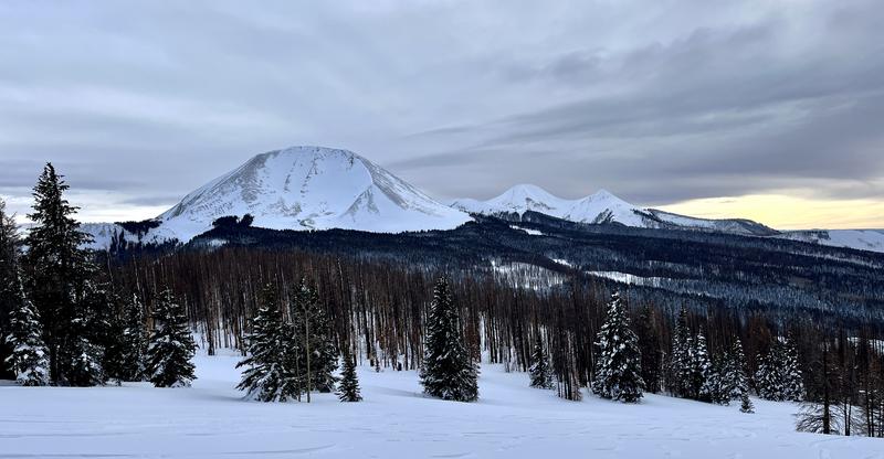
In this photo of the North Face of Mount Mellenthin you can see the effects of the wind above treeline.
As we trend towards Moderate danger, consider this: most avalanche fatalities occur when the danger is moving up from Moderate to Considerable, or back down from Considerable to Moderate.

Snowpack and Weather Data
Gold Basin Storm Stake (10,000')
Gold Basin SNOTEL site (10,000')
SNOTEL site near Geyser Pass Winter Trailhead (9600')
Wind Station on Pre-Laurel Peak (11,400')
NWS forecast for the La Sal Mountains.
Recent Avalanches
No new avalanches have been reported. Here is the La Sal Avalanche Database.
Ad
Avalanche Problem #1
Persistent Weak Layer
Type
Location
Likelihood
Size
Description
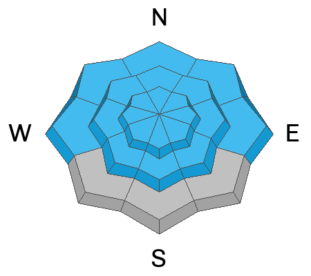
The widespread persistent weak layer (PWL) that formed in November is showing signs of strengthening and stability tests continue to be less reactive. This means avalanches are becoming harder to trigger but the consequences remain the same. Any avalanche triggered on this deeply buried PWL would be large and unsurvivable. The greatest risk exists on steep, wind drifted, northerly aspects above treeline. As we start to think about easing into larger terrain, areas to avoid include slopes with steep convexities or blind break-overs; thin snowpack areas along slope margins or near shallowly buried rock outcrops; and areas of steep, rocky, more radical terrain.
Avalanche Problem #2
Wind Drifted Snow
Type
Location
Likelihood
Size
Description
Southerly winds over the past 36 hours have created a complex landscape of scouring and windloading above treeline. Creating problems in and of themselves, recent slabs of wind drifted snow also add stress to the buried PWL, and a triggered wind slab could step down causing a deeper and more dangerous avalanche. Slabs of wind drifted snow will be most pronounced on slopes facing the north half of the compass and in areas above treeline, but crossloading is also a factor. Recognizable by their smooth, rounded appearance, stif wind slabs may sound hollow underneath. Look for wind slabs on the leeward sides of ridge crests, and terrain features such as gully walls and sub ridges, and avoid slopes with recent deposits of wind drifted snow.
Additional Information
The Avalanche Beacon Training Park is up and running just above the Geyser Pass Traihead. It's right there and easy to use, so get some practice as you head up for your next tour.
General Announcements
This forecast is from the U.S.D.A. Forest Service, which is solely responsible for its content. This forecast describes general avalanche conditions and local variations always occur. This forecast will be updated by 7:30 tomorrow morning.