Join us at our 2nd Annual Blizzard Ball

Forecast for the Moab Area Mountains

Eric Trenbeath
Issued by Eric Trenbeath on
Tuesday morning, January 3, 2023
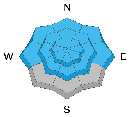
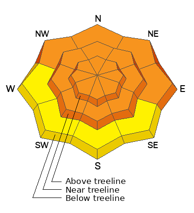
The avalanche danger is CONSIDERABLE on all aspects near and above treeline, and on northelry aspects below, where human triggered avalanches failing on a buried persistent weak layer are likely. The danger is greatest on steep, wind drifted slopes that face NW-N-NE-E. Backcountry travelers should continue to avoid slopes steeper than 30 degrees.
Low
Moderate
Considerable
High
Extreme
Learn how to read the forecast here
Special Announcements
Road Conditions: Grand County will be plowing today and the gate will be closed while plowing is in progress.
Grooming: LUNA Matt rolled out all trails yesterday to pack in the weekend storm snow.
Improve your avalanche awareness and rescue skills and sign up for our Backcountry 101 Class on January 20, 21.
Weather and Snow
24 Hour Snow 5" 72 Hour Snow 17" Season Total Snow 120" Base Depth at Gold Basin 64"
Winds on Pre Laurel Peak NA Temp 15F
Weather
The New Year's storm has moved on to the Plains. Wrap around moisture will keep us under cloudy skies with a slight chance for snow today. Winds will be mostly light to moderate and westerly. High temps at 10,000' will be in the low 20's. Brief ridging should allow for some partly sunny skies on Wednesday, with clouds building again on Thursday as the next Pacific storm system moves toward the region. Best chance for snow will be Thursday night into Friday but it doesn't look like a big producer at this time.

General Conditions
After a wild New Year's weekend of dense snow, rime, and wind, snowfall yesterday came in the form of good old fashioned powder. Dave Garcia and company were up yesterday and reported that conditions were about as good as it gets. More than 4' of snow has fallen over the past week and coverage is excellent. This load has been a good test for our buried persistent weak layer. We don't have a clear handle on it yet but it appears to be gaining strength in deeper snowpack areas. This is a good sign for the future but we still need some time to let this load adjust. For now, continuing to avoid slopes steeper than 30 degrees is the strategy.
Snowpack and Weather Data
Gold Basin Storm Stake (10,000')
Gold Basin SNOTEL site (10,000')
SNOTEL site near Geyser Pass Winter Trailhead (9600')
Wind Station on Pre-Laurel Peak (11,400')
NWS forecast for the La Sal Mountains.
Recent Avalanches
There hasn't been enough visibility to see if there has been any activity from the last storm. Here is a list of avalanches from last Wednesday's natural cycle.
Ad
Avalanche Problem #1
Persistent Weak Layer
Type
Location
Likelihood
Size
Description
Heavy snowfall over the past week has been a good test for the persistent weak layer (PWL) of faceted snow that developed during the cold dry period in mid November, but the jury is still out. This weak layer exists on all aspects and has produced several large, natural avalanches on steep, northerly aspects, as well as a couple on southerly aspects. In our travels over the past several days we have been finding signs that the weak layer is strengthening, but thinner snowpack areas remain a concern. We've also just had a siginificant load applied and things need time to adjust. For now, this PWL should be presumed guilty until proven innocent and slopes steeper than 30 degrees should be avoided.
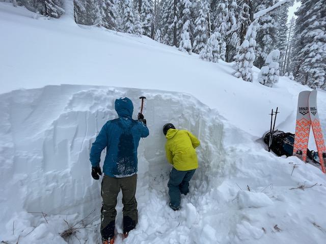
Dave Garcia and company dug this deep snowpit on a northerly aspect below treeline. The weak layer of concern is visible as a band of dust just above knee level. The overall depth and strength of the snow above the weak layer suggests we are moving in the right direction. Check out Dave's complete observation here.
Avalanche Problem #2
Wind Drifted Snow
Type
Location
Likelihood
Size
Description
Blowing and drifting snow over the weekend has has created fresh slabs over a foot deep on leeward slopes facing W-N-E near and above treeline. The greatest concern is the added weight and stress they have applied to the buried persistent weak layer. Steep, wind drifted slopes should be avoided as deep and dangerous, human triggered avalanches remain likely.
Avalanche Problem #3
New Snow
Type
Location
Likelihood
Size
Description
Reports from yesterday indicate a lack of slab properties within the most recent storm snow. Nevertheless, there is a foot of new snow lying around and loose snow sluffs remain a possibity in steep terrain. But we're not skiing or riding steep terrain yet right?
Additional Information
General Announcements
This forecast is from the U.S.D.A. Forest Service, which is solely responsible for its content. This forecast describes general avalanche conditions and local variations always occur. This forecast will be updated by 7:30 tomorrow morning.