Forecast for the Logan Area Mountains

Paige Pagnucco
Issued by Paige Pagnucco for
Saturday, April 9, 2022
The avalanche danger is generally LOW today.
Temperatures did not get below freezing for the second night in a row last night. Be cautious of areas of unsupportable snow on slopes steeper than 30 degrees.
As temperatures fall today stability should increase.
Low
Moderate
Considerable
High
Extreme
Learn how to read the forecast here
Special Announcements
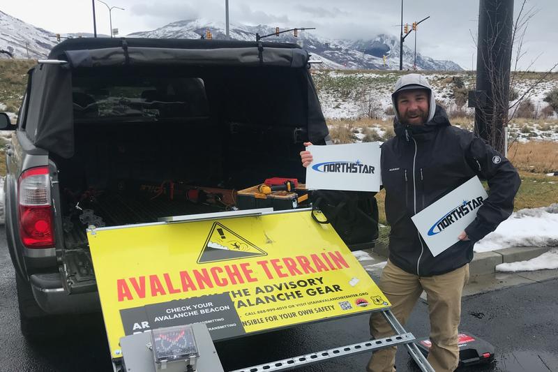
We took down the Franklin Basin Beacon Park and all the trailhead beacon checker signs yesterday. The park and signs are generously sponsored by Northstar - we really appreciate their continued support! Big thanks to Andy Checketts and Bill Chambers!
Weather and Snow
The 8400' Tony Grove Snotel reports 38°F this morning, and there is 53 inches of total snow at the site, containing 64% of normal SWE. West northwest winds are currently blowing around 19 mph at the 9700' CSI Logan Peak weather station with gusts in the 30's.
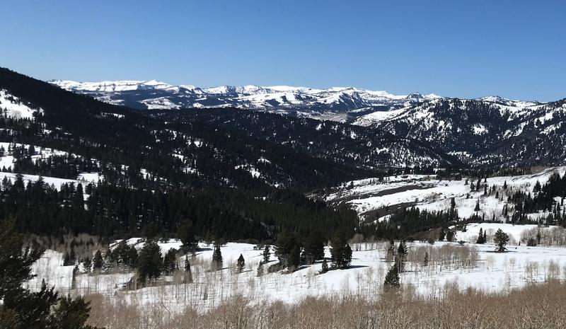
Spring conditions exist in the mountains right now with easy traveling and warm temperatures. We found excellent corn snow the past few days but today will be a little less enticing with a change in the weather on tap.
A dry cold front will move south through Utah today, bringing gusty winds and a return to cooler temperatures. Temperatures at 8500' will drop a few degrees from what they are now and westerly winds will blow 15-25 mph with gusts this afternoon in the 30's. There is a small chance for snow in the morning with clearing skies in the afternoon. A significant winter storm is possible Monday night into Wednesday, with unsettled and cold conditions continuing through the week.
The high elevation slopes in the Bear River Range still have a thick blanket of snow - it's getting to them that's the problem. Trailheads are melting out making for a longer ride on pavement or dirt before hitting snow.
Recent Avalanches
We observed a recent large, natural wet avalanche in upper Pine Canyon yesterday.

Check out all the recent backcountry observations and avalanche reports from across Utah HERE.
Ad
Avalanche Problem #1
Normal Caution
Type
Location
Likelihood
Size
Description
The avalanche danger is generally LOW today but that doesn't mean avalanches are not possible. Temperatures over the past few days and nights have remained well above freezing which can cause the snowpack to become unstable. As you travel today be mindful of steep slopes that have unfrozen snow. If you sink down into unsupportable snow, move off of and out from under slopes steeper than 30 degrees to lower angle terrain.
There are also areas where the snow will be firm and slick and a fall could mean a "slide for life." Avoid high consequence terrain like slopes with cliffs, rocks, or other hazards below. Consider carrying an ice axe as well to stop your fall.
Sticking to lower angle and low consequence terrain today will be your best bet for safe travel.
Continue to keep your guard up and look for any signs of snow instability. Evaluate snow and weather conditions as you travel.
Additional Information
  • Now is a great time to practice your avalanche rescue skills. Thanks to the generous support of Northstar, the Franklin Basin Beacon Training Park is up and running. The park is located directly west of the parking lot and is open for anyone to use. All you need is your beacon and probe. Please do not dig up the transmitters.
  • Always follow safe backcountry travel protocols. Go one person at a time in avalanche terrain, while the rest of your party watches from a safe area. (practice anytime while traveling on or under backcountry slopes steeper than 30°)
  • Check your avalanche rescue equipment, change your batteries, and practice often with your backcountry partners.
    Check slope angles, and to avoid avalanche terrain stay off of and out from under slopes steeper than 30° and adjacent slopes. Video Here
General Announcements
Special thank you to Polaris and Northstar...Video Here
Who's up for some free avalanche training? Get a refresher, become better prepared for an upcoming avalanche class, or just boost your skills. Go to https://learn.kbyg.org/ and scroll down to Step 2 for a series of interactive online avalanche courses produced by the UAC.
  • Please submit your observations from the backcountry HERE.
This information does not apply to developed ski areas or highways where avalanche control is normally done. This forecast is from the U.S.D.A. Forest Service, which is solely responsible for its content. This forecast describes general avalanche conditions and local variations always occur.