Donate to the 2024 Spring Campaign to help rebuild the UAC website.

Forecast for the Logan Area Mountains

Paige Pagnucco
Issued by Paige Pagnucco for
Friday, April 8, 2022
The avalanche danger is LOW this morning and will rise to MODERATE with daytime heating.
Warming temperatures and the high sun angle will increase the possibility for wet avalanches at all elevations and on all aspects.
Low
Moderate
Considerable
High
Extreme
Learn how to read the forecast here
Weather and Snow
The 8400' Tony Grove Snotel reports 36°F this morning, and there is 54 inches of total snow at the site, containing 68% of normal SWE. North northwest winds are currently blowing around 11 mph at the 9700' CSI Logan Peak weather station with gusts in the 20's.
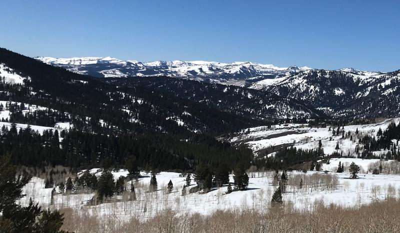
Spring conditions exist in the mountains right now with easy traveling and warm temperatures. We found excellent corn snow yesterday but today, the warmer temperatures will shorten your time frame for supportable snow.
  • It will be sunny again in the mountains today, with high temperatures at 8500' around 53°F. Winds blowing 7-16 mph will switch from the southeast to the southwest by the afternoon.
  • It will be partly cloudy tonight with low temperatures around 25°F and 16 to 18 mph southwest winds.
  • The weather changes Saturday - we'll see partly sunny skies, a high temperature around 38°F, northwest winds blowing 15 to 25 mph, and a chance for snow.
  • Sunday will be colder with temperatures in the high 20's F and west winds blowing 18 to 23 mph with gusts as high as 36 mph. Less than an inch accumulation is expected.
  • The best chance for significant snowfall is Monday evening into Tuesday.
The high elevation slopes in the Bear River Range still have a thick blanket of snow - it's getting to them that's the problem. Trailheads are melting out making for a longer ride on pavement or dirt before hitting snow.
Recent Avalanches
No new avalanches were reported in the Logan Zone since the rapid warmup at the end of March, which caused many natural wet loose and wet slab avalanches in the Wellsville and Bear River mountain ranges.

Check out all the recent backcountry observations and avalanche reports from across Utah HERE.
Ad
Avalanche Problem #1
Wet Snow
Type
Location
Likelihood
Size
Description
The high sun angle combined with very warm temperatures could create heightened avalanche conditions and increase the chance for human-triggered loose wet and potentially wet slab avalanches. When the snow surface is damp and saturated, the snowpack is becoming unstable. In general in the spring:
  • Get an early start so you can get off the snow early before it is softened by seasonal midday warmth.
  • Avoid and stay out from underneath overhanging cornices.
  • If you start sinking into soft, saturated snow, it's time to change your route, get off and out from under slopes steeper than 30°, or head home.
  • Rollerballs and pinwheels are good indicators of weakening snow.
  • Wet avalanches move slowly but can be very dangerous in the wrong terrain - Avoid terrain traps and gullies to minimize your exposure.
Additional Information
  • Now is a great time to practice your avalanche rescue skills. Thanks to the generous support of Northstar, the Franklin Basin Beacon Training Park is up and running. The park is located directly west of the parking lot and is open for anyone to use. All you need is your beacon and probe. Please do not dig up the transmitters.
  • Always follow safe backcountry travel protocols. Go one person at a time in avalanche terrain, while the rest of your party watches from a safe area. (practice anytime while traveling on or under backcountry slopes steeper than 30°)
  • Check your avalanche rescue equipment, change your batteries, and practice often with your backcountry partners.
    Check slope angles, and to avoid avalanche terrain stay off of and out from under slopes steeper than 30° and adjacent slopes. Video Here
General Announcements
Special thank you to Polaris and Northstar...Video Here
Who's up for some free avalanche training? Get a refresher, become better prepared for an upcoming avalanche class, or just boost your skills. Go to https://learn.kbyg.org/ and scroll down to Step 2 for a series of interactive online avalanche courses produced by the UAC.
  • Please submit your observations from the backcountry HERE.
This information does not apply to developed ski areas or highways where avalanche control is normally done. This forecast is from the U.S.D.A. Forest Service, which is solely responsible for its content. This forecast describes general avalanche conditions and local variations always occur.