Forecast for the Logan Area Mountains

Toby Weed
Issued by Toby Weed for
Tuesday, March 7, 2023
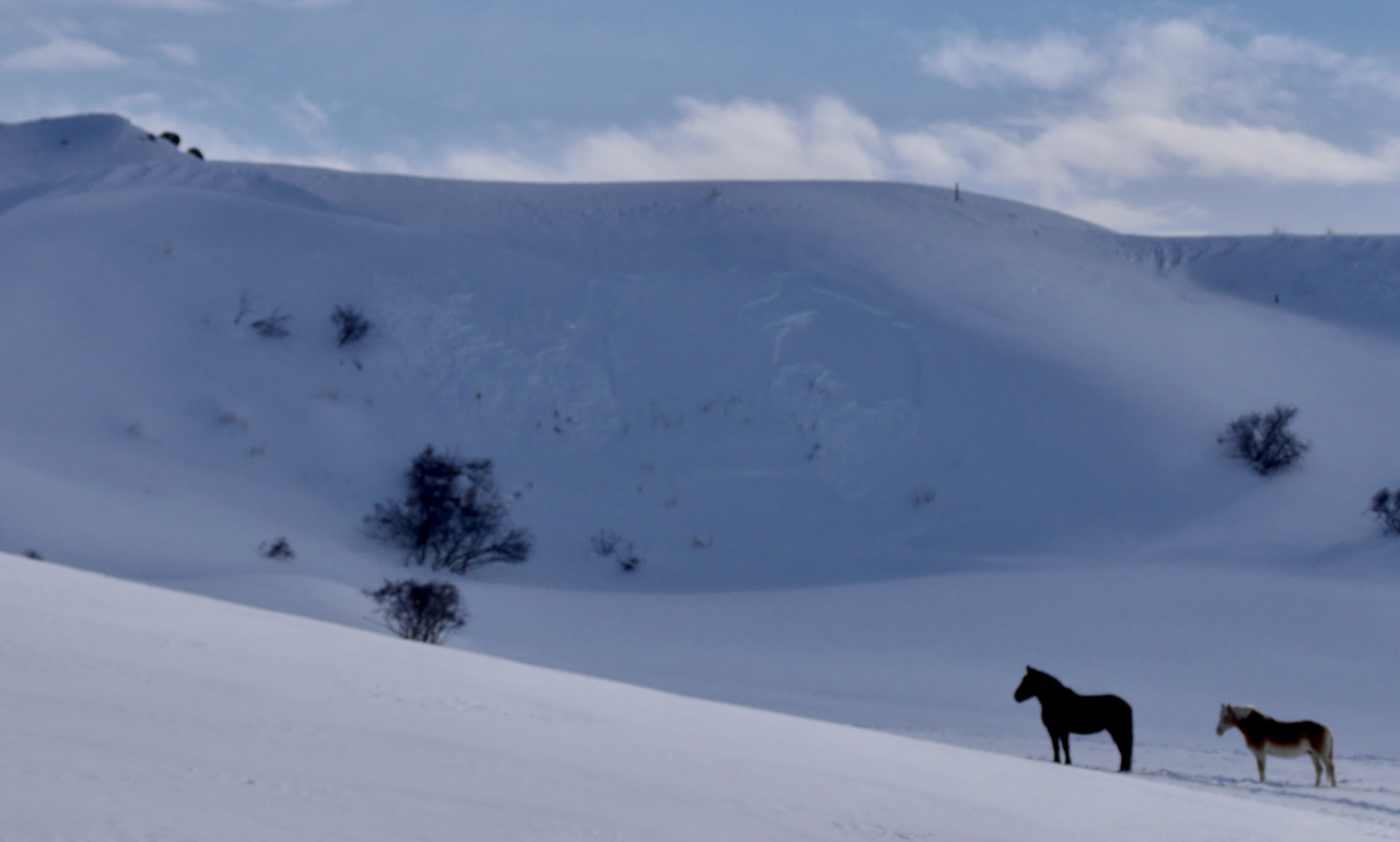
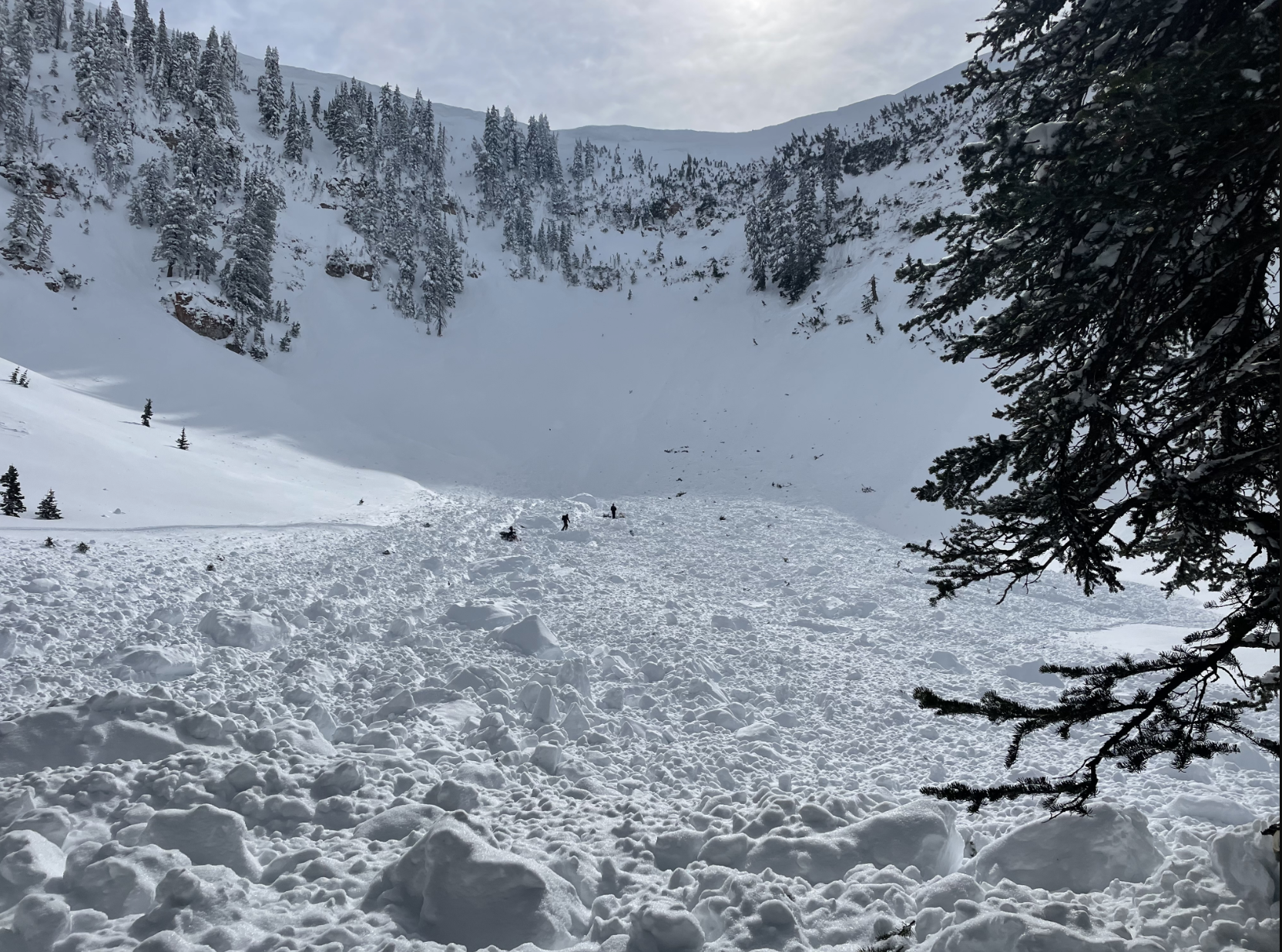
Heightened conditions exist at all elevations today, the danger is MODERATE and avalanches are possible on backcountry slopes steeper than 30°. Potential avalanches could be larger and are more likely on drifted upper elevation slopes. Avalanches failing on a buried persistent weak layer are possible, even on sunny slopes and in drifted terrain at lower elevations where avalanche problems are uncommon.
  • Evaluate snow and terrain carefully.
Low
Moderate
Considerable
High
Extreme
Learn how to read the forecast here
Special Announcements
To help you safely enjoy the backcountry, the UAC team is constantly evaluating and implementing new programs and technologies. Donate to the Spring Campaign to help our team implement innovative tools and better provide you with the information you rely on.
Weather and Snow
Last week people remotely triggered a few large avalanches on drifted slopes. Huge cornices formed with the recent storms, and heavy snow and drifting this weekend increased the load and thickened wind slabs overloading backcountry slopes, some with poor snow structure and buried persistent weak layers. Today, after several hours with moderate winds, the snow is becoming more stable and the danger is gradually diminishing. People could trigger still trigger soft slab avalanches of storm snow, large cornice falls, or 1 to 4' thick slab avalanches of wind drifted snow failing on a buried persistent weak layer. Excellent snow cover at low elevations means that slopes are smooth and primed, and even small avalanches could surprise unsuspecting people at lower elevations who do not normally face avalanche risk.
The cold temperatures are keeping the snow nice and soft, and we've been finding fantastic powder riding in the meadows and on lower angled slopes.

The 8400' Tony Grove Snotel reports around two feet of new snow from the weekend storm, with 2.2" SWE . It's 8° F this morning, and there is 133 inches of total snow. The wind is currently blowing from the southeast 5 to 10 mph at the 9700' CSI Logan Peak weather station.
Here is the NWS point forecast for high elevations in the Central Bear River Range:
Today: A 20 percent chance of snow after 11am. Mostly cloudy, with a high near 21. Wind chill values as low as -7. East southeast wind around 9 mph becoming west in the morning.
Tonight: A 30 percent chance of snow after 5am. Mostly cloudy, with a low around 7. Wind chill values as low as -7. West southwest wind 7 to 9 mph becoming southeast in the evening. New snow accumulation of less than a half inch possible.
Wednesday: Snow, mainly after 8am. The snow could be heavy at times. High near 23. Wind chill values as low as 1. East southeast wind around 10 mph becoming west southwest in the afternoon. Chance of precipitation is 80%. New snow accumulation of 2 to 4 inches possible.

Unsettled and cold weather will continue through the week, and it looks like another productive storm is on tap for the weekend, starting Friday.
Recent Avalanches
  • This weekend, there were many small natural avalanches of storm snow and wind drifted snow at all elevations. Yesterday, I spotted a few small natural wind slab avalanches at lower elevations in the Cache foothills.
  • Last week was quite active in the Logan Zone, with a few close calls and new avalanches reported almost every day.
  • For a list of avalanches in the Logan Zone go HERE
  • Find a list of all recent observations & avalanches from across Utah HERE.
Avalanches of wind drifted snow are fairly common at lower elevations these days.
Ad
Avalanche Problem #1
Wind Drifted Snow
Type
Location
Likelihood
Size
Description
Moderate westerly winds yesterday and overnight limited drifting to exposed terrain and wind slabs formed close to ridge lines and high in avalanche starting zones. Harder, buried wind slabs that formed over the weekend might be hidden by a few inches of powder. Avalanches of wind drifted snow, 1 to 4 feet thick, are possible in windy terrain at all elevations, but will be larger and more likely for people to trigger on upper elevation slopes facing northwest through southeast.
  • Avoid corniced slopes and stiffer drifts on steep slopes near ridges and in and around terrain features like cliff bands, sub-ridges, mid-slope break-overs, and gully walls.
  • Wind slabs consist of stiffer drifted snow.
  • The overhanging cornices on the high peaks and ridges have become huge and unstable with recent storms, so stay well away and out from under them.
  • Some wind slab avalanches could fail on a sugary persistent weak layer, and some might be triggered remotely.
Avalanche Problem #2
Persistent Weak Layer
Type
Location
Likelihood
Size
Description
The Persistent Weak Layer problem is widely scattered across terrain, where thin layers of sugary faceted snow exist only in some areas, but on most aspects. At lower elevations in the Logan Zone layers of sugary faceted snow are more widespread in areas with shallower snow cover (<4') and more prevalent on northerly facing slopes. Thin layers of weak snow also often form above or between sun crusts, and some recent avalanches have failed on sunny east and southeast facing slopes.
  • Avalanches failing on a persistent weak layer could be triggered remotely or from a distance.
Additional Information
Stay well clear of the freshly swollen cornices, which are likely to break further back than you might expect and could trigger avalanches on slopes below.
A cornice broke further back than expected , and it took a sled for a nasty ride. Luckily the rider was able to jump off the sled before it went over the edge and was swept into a large avalanche and buried.
The cornice fall triggered a large avalanche below in the Cirque in Logan Dry Canyon, which damaged and completely buried the sled.
General Announcements
  • Please submit your observations from the backcountry HERE.
  • For a list of avalanche classes from the Utah Avalanche Center go HERE
  • For information on where you can ride your sled or snowbike, check out this map of the winter travel plan for the Logan and Ogden Ranger Districts HERE, and a close up of the Tony Grove and Franklin Basin Areas HERE.
This forecast is from the U.S.D.A. Forest Service, which is solely responsible for its content. This forecast describes general avalanche conditions and local variations always occur.