Join us at our 2nd Annual Blizzard Ball

Forecast for the Logan Area Mountains

Toby Weed
Issued by Toby Weed on
Thursday morning, March 28, 2024
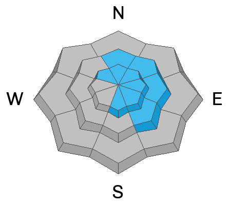
Heavy snowfall and significant drifting will elevate the avalanche danger today on many slopes in the backcountry. The danger will likely rise to CONSIDERABLE in drifted upper-elevation terrain. Natural avalanches are possible, and people are likely to trigger slab avalanches of drifted snow 1 to 2 feet thick on slopes steeper than 30°. Human-triggered soft slabs and loose avalanches of storm snow will become more likely at all elevations as new snow rapidly accumulates.

Evaluate snow and terrain carefully, make conservative decisions, and travel carefully with increased situational awareness. The best and safest riding conditions will be found in low-angled terrain off and out from under slopes steeper than 30°.
Low
Moderate
Considerable
High
Extreme
Learn how to read the forecast here
Special Announcements
Donate today to help us rebuild our website backend platform to ensure uninterrupted access to avalanche information and the ongoing security of the website and the data stored on the site.
Weather and Snow
Heavy snowfall and drifting by strong winds will likely create dangerous avalanche conditions on slopes facing northwest through southeast at upper elevations today. Yesterday, we found wind-affected snow in exposed upper-elevation terrain near Naomi Peak, with ongoing drifting and drifts already up to around two feet deep in places. Shallow powder riding was pretty good in more sheltered terrain, and today's expected shot of new snow will probably improve conditions further. Periods of rapid accumulation and drifting snow will elevate the avalanche danger during the day today. You'll find safer and better riding conditions in the meadows and on lower angled slopes, less than about 30° in slope steepness.

The Tony Grove Lake Snotel at 8400' reports 29° F, with 99 inches of total snow containing 120% of normal snow water equivalent. At 6:00 on Logan Peak, winds are blowing from the south-southwest above 30 mph, with gusts of 55 mph, and it's 23° F at 9700' in elevation.
At our new Paris Peak weather station at 9500', it's 22 °F, and the wind is blowing from the south-southwest at 20 mph, with gusts of 41 mph. It's 26° F and pretty windy at the generally sheltered new Card Canyon weather station at 8800', now with 86 inches of total snow on the ground.

Today will be stormy, with heavy snow at times at all elevations in the mountains. High temperatures at 8500' will be near 31° F, but will drop to around 25° F during the day. It will be breezy with winds blowing from the southwest 25 to 30 mph this morning, veering from the west and northwest in the afternoon. Expect periods of heavy snow, especially between noon and 3:00 PM, with 9 to 13 inches of accumulation possible on upper elevation slopes and 5 to 9 inches at lower elevations in Logan Canyon.
There will be a break tomorrow, with mostly cloudy conditions. More snow is expected over the weekend, with several inches in the forecast for Saturday and several more again on Sunday.
Recent Avalanches
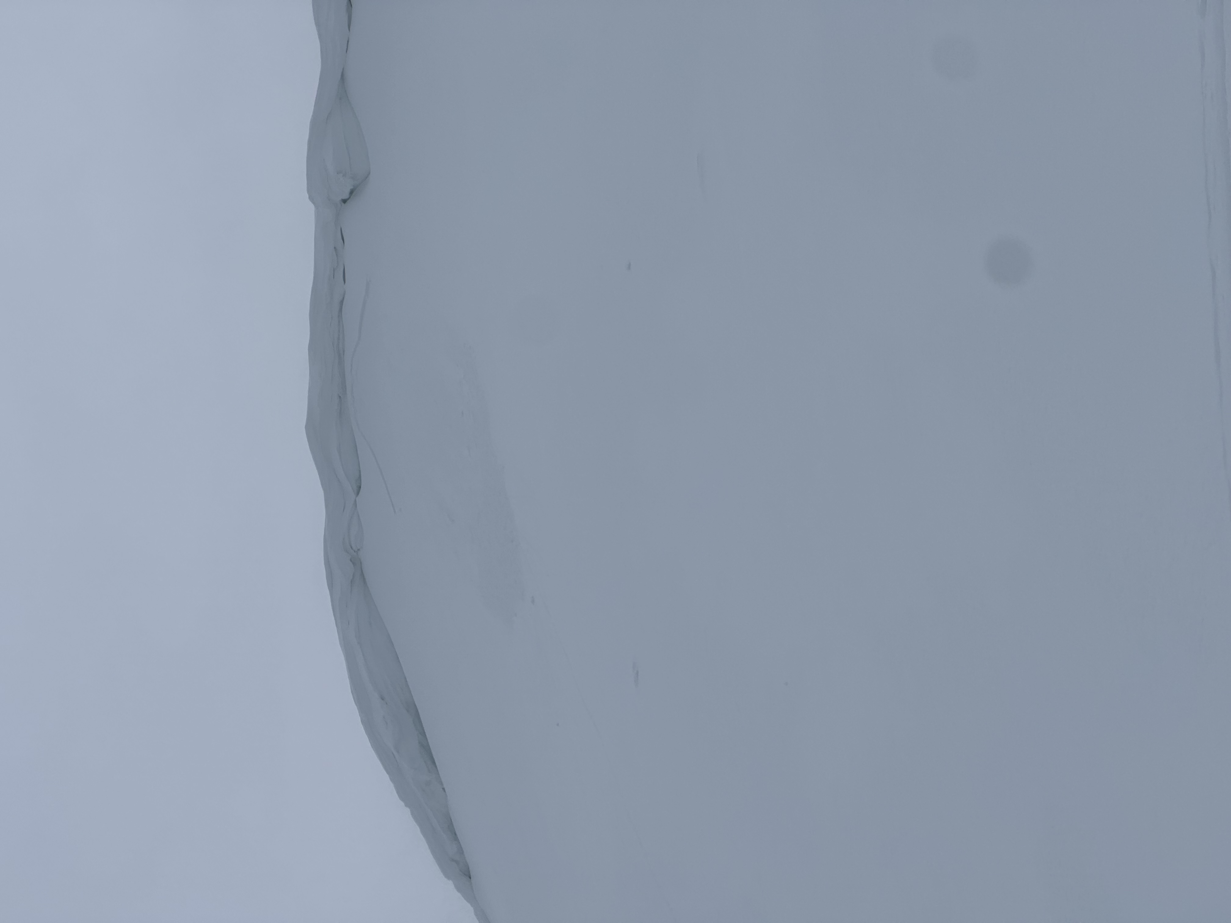
Yesterday, a snowmobiler remotely triggered a small wind slab avalanche from quite a distance on Cornice Ridge in the Central Bear River Range. Riders also triggered a few other small wind slabs in drifted upper-elevation terrain.

Check out all local observations and avalanches HERE.
Ad
Avalanche Problem #1
Wind Drifted Snow
Type
Location
Likelihood
Size
Description
Expect rising avalanche danger due to heavy snowfall and strong winds today. People will likely trigger slab avalanches of drifted snow, especially in easterly-facing upper-elevation terrain on slopes steeper than 30°. Avalanches could fail on the interface on top of last week's melt-freeze crust or a density change within the newer snow.
  • Avoid travel on slopes capped by large cornices on the lee side of major ridges.
  • Watch for stiffer drifted snow and growing wind slabs in and around terrain features like sub ridges, gully walls, mid-slope rollovers, scoops, and cliff bands.
  • In drifted terrain, watch for cracking and other obvious signs of instability, like recent avalanches on similar slopes.
Avalanche Problem #2
New Snow
Type
Location
Likelihood
Size
Description
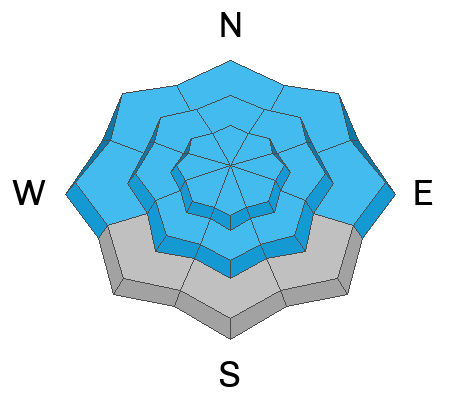
Heightened storm snow avalanche conditions may develop at all elevations due to significant or heavy deposits of new snow. Avalanches are most likely during periods of particularly rapid accumulation. Natural and human-triggered avalanches are possible on backcountry slopes steeper than 30°.
  • Natural avalanches could occur during periods of particularly heavy snowfall and may threaten people below steep slopes.
  • In steep, even sheltered terrain, you could trigger soft slabs or fast-moving sluffs of new snow.
  • Although generally manageable, shallow soft wind slab or loose avalanches in steep terrain could dangerously carry you into trees or other terrain traps below. Pay attention to and avoid being on steep slopes with potential terrain traps below, like trees, gullies, sinks, or cliff bands.
Additional Information
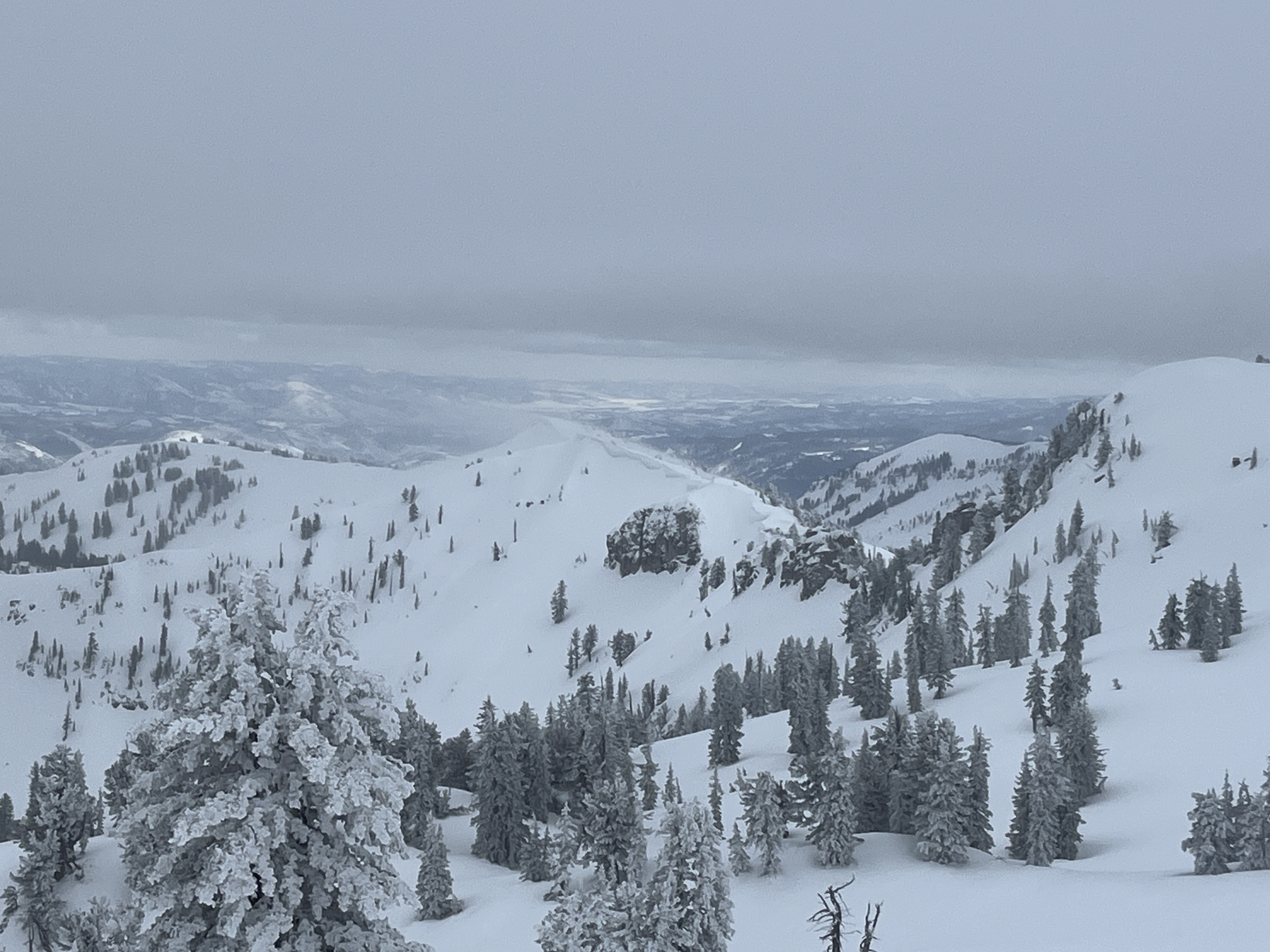
A plume of drifting snow was apparent with a brief clearing yesterday afternoon, blowing off Cornice Ridge and Castle Rock south of Naomi Peak.
General Announcements
-National Forest Winter Recreation Travel Maps show where it's open to ride: UWCNF Logan, Ogden LRD Tony Grove, Franklin Basin CTNF Montpelier
-Listen to your very own Logan Zone avalanche forecasters on the UAC Podcast HERE.
-Read Toby's blog about wind, drifting, and avalanches HERE.
-Sign up for forecast region-specific text message alerts. You will receive messages about changing avalanche conditions, watches, and warnings...HERE.
-For all questions on forecasts, education, Know Before You Go, events, online purchases, or fundraising, call 801-365-5522.
-To report an avalanche or submit an observation from the backcountry, go HERE.
-Come practice companion rescue at the Franklin Basin TH Beacon Training Park. It's free and open to everyone. For easy user instructions, go HERE.
-We will issue regular daily updates of our forecast through April 14.
-We will update this forecast tomorrow by 7:30 AM.
This forecast is from the U.S.D.A. Forest Service, which is solely responsible for its content. This forecast describes general avalanche conditions, and local variations always occur.