If you rely on the UAC forecasts each day you get out, consider making a donation during our
Spring Awareness Campaign to help us continue providing the avalanche forecasts and education you rely on.
The UAC encourages everyone to follow direction from federal, state, city and county officicals. The following is from Joe Dougherty, spokesman for the
Utah Division of Emergency Management:
Though outdoor recreation is still permitted under the governor’s Stay Safe/Stay Home directive, we recommend that people maintain a distance of at least 6 feet.
Be extra cautious to avoid injuries outdoors. We are working with our hospital systems to conserve as much personal protective equipment as possible in case of hospitalizations.
Most outdoor injuries can be prevented. Know the conditions and know your limits so you don’t end up in a hospital.
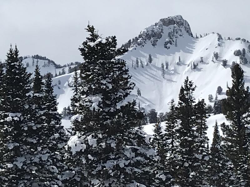
It's 20°F at the 8400' Tony Grove Snotel, and 3 inches of light new snow fell overnight. This week's storm brought a bit under two feet of snow with 2" Snow Water Equivalent. There is now 99 inches of total snow with 111% of normal SWE. It's 14°F at the 9700' CSI Logan Peak weather station, and west-northwest winds are currently blowing about 17 mph.
Powder conditions stayed good in north facing terrain yesterday, and you might still be able to find areas with nice snow today. Clouds and cool weather will help preserve conditions and should keep a lid on wet avalanche activity.
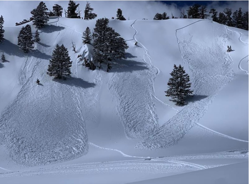
We observed a fair amount of natural loose wet sluffing of the storm snow in steep sunny terrain yesterday.
Snow showers are likely in the mountains this afternoon, with 1 to 3 inches of accumulation possible. 8500' high temperatures of around 31°F and 11 to 13 mph west winds are expected. It will be mostly cloudy in the mountains tonight, with low temperatures expected to be around 17°F and west-southwest wind 7 to 11 mph. Snow showers are likely tomorrow, it will be partly cloudy with high temperatures near 37°F, and west-southwest winds will blow 8 to 11 mph.
Despite large numbers of riders venturing onto steep slopes yesterday, only one small triggered soft slab avalanche was reported. This in Christmas Tree Bowl near Naomi Peak, on a very steep east facing slope at about 9600'.
Several human-triggered avalanches were reported Thursday in the Central Bear River Range. Most were 12-16 inches deep, 50-100 feet wide and ran between 300-500 vertical feet. These were soft wind slab avalanches of new snow on east facing high elevation slopes, failing on the storm/older snow interface (with graupel) and running on a crust from last week's warm weather. Also, a skier triggered a soft slab of moist new snow on a very steep north facing mid elevation slope in Providence Canyon.
In some areas the new snow stabilized quickly while on east facing slopes the new snow was still sensitive and reactive Thursday morning in the Central Bear River Range.